You can help expand this article with text translated from the corresponding article in Portuguese. (March 2024)Click [show] for important translation instructions.
|
Campo Grande | |
|---|---|
| Campo Grande | |
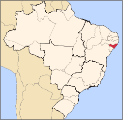
 Campo Grande Location in Brazil | |
| Coordinates: 9°57′28″S36°47′31″W / 9.95778°S 36.79194°W | |
| Country | |
| State | Alagoas |
| Mesoregion | Agreste Alagoano |
| Microregion | Arapiraca |
| Founded | November 30, 1961 |
| Government | |
| • Mayor | Téo Higino |
| Area | |
• Total | 170.144 km2 (65.693 sq mi) |
| Population (2020 est [1] ) | |
• Total | 9,567 |
| • Density | 53.98/km2 (139.8/sq mi) |
| Demonym | Campo-grandense [2] |
| Time zone | UTC−3 (BRT) |
Campo Grande is a municipality located in the Brazilian state of Alagoas. It is situated in the Agreste Alagoano mesoregion and belongs to the Arapiraca microregion. [3]