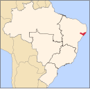
Cajueiro

Last updated • a couple of secsFrom Wikipedia, The Free Encyclopedia

Cajueiro
Entrada-de-cajueiro-20.jpg
Entrance to Cajueiro
Cajueiro bandeira.png
Brasao de armas de Cajueiro.png
Cajueiro Alagoas.png
Location of Cajueiro in Alagoas
Relief Map of Brazil.jpg
Red pog.svg
Cajueiro
South America laea relief location map.jpg
Red pog.svg
Cajueiro
Coordinates: 9°23′48″S36°9′13″W / 9.39667°S 36.15361°W / -9.39667; -36.15361
CountryFlag of Brazil.svg  Brazil
Region Northeast
State Bandeira de Alagoas.svg  Alagoas
Founded22 May 1958 [1]
Government
   Mayor Lucila Regia Albuquerque Toledo (PODE) (2021-2024) [2] [3]
  Vice MayorAntonio Jorge de Melo Junior (PROS) (2021-2024) [2] [3]
Area
  Total94.357 km2 (36.431 sq mi)
Elevation
90 m (300 ft)
Population
 (2022)
  Total16,024 [4]
  Density169.82/km2 (439.8/sq mi)
Demonym Cajueirense (Brazilian Portuguese) [4]
Time zone UTC-03:00 (Brasília Time)
Postal code
57770-000 [5]
HDI (2010)0.562 – medium [4]
Website cajueiro.al.gov.br
The Access Road to Cajueiro (Alagoas) Municipal. Cajueiro (Alagoas) acesso.jpg
The Access Road to Cajueiro (Alagoas) Municipal.

Cajueiro is a municipality located in the western of the Brazilian state of Alagoas. Its population is 21,331 (2020) [6] and its area is 124 km². [7] Its name comes from the Portuguese for the cashew tree — in the 19th century, a village began to form around such a tree, near the banks of the Paraíba river.

See also

Related Research Articles

<span class="mw-page-title-main">Belém, Alagoas</span> Place in Northeast, Brazil

Belém is a municipality located in the center of the Brazilian state of Alagoas. Its population is 4,284 (2020) and its area is 48 km2.

<span class="mw-page-title-main">Cacimbinhas</span> Municipality in Alagoas, Brazil

Cacimbinhas is a municipality in the western of the Brazilian state of Alagoas. Its population is 10,889 (2020) and its area is 273 km2.

<span class="mw-page-title-main">Canapi</span> Municipality in Alagoa, Brazil

Carié is a municipality located in the Brazilian state of Alagoas. Its population is 17,719 (2020) and its area is 572 km².

<span class="mw-page-title-main">Craíbas</span> Municipality in Alagoas, Brazil

Craíbas is a municipality located in the western of the Brazilian state of Alagoas. Its population is 24,309 (2020) and its area is 275 km².

<span class="mw-page-title-main">Estrela de Alagoas</span> Municipality in Alagoas, Brazil

Estrela de Alagoas is a municipality located in the western of the Brazilian state of Alagoas. Its population is 18,255 (2020) and its area is 264 km².

<span class="mw-page-title-main">Feira Grande</span> Municipality in Alagoas, Brazil

Feira Grande is a municipality located in the western region of the Brazilian state of Alagoas. Its population is 22,178 (2020) and its area is 156 square kilometres (60 sq mi).

<span class="mw-page-title-main">Girau do Ponciano</span> Municipality in Alagoas, Brazil

Girau do Ponciano is a municipality located in the west of the Brazilian state of Alagoas. Its population is 41,237 (2020) and its area is 502 km².

<span class="mw-page-title-main">Japaratinga</span> Municipality in Alagoas, Brazil

Japaratinga is a municipality located in the Brazilian state of Alagoas. Its population is 8,403 (2020) and its area is 86 km².

<span class="mw-page-title-main">Lagoa da Canoa</span> Municipality in Alagoas, Brazil

Lagoa da Canoa is a municipality located in the Brazilian state of Alagoas. Its population is 17,771 (2020) and its area is 103 km².

<span class="mw-page-title-main">Paripueira</span> Municipality in Alagoas, Brazil

Paripueira is a municipality located in the Brazilian state of Alagoas. Its population is 13,332 (2020) and its area is 93 km2.

<span class="mw-page-title-main">Passo de Camaragibe</span> Municipality of Brazil

Passo de Camaragibe is a municipality located in the northern coast of the Brazilian state of Alagoas. Its population is 15,258 (2020) and its area is 187 km2.

<span class="mw-page-title-main">Paulo Jacinto</span> Municipality of Brazil

Paulo Jacinto is a municipality located in the center of the Brazilian state of Alagoas. Its population is 7,560 (2020) and its area is 108 km².

<span class="mw-page-title-main">Pilar, Alagoas</span> Municipality located in Alagoas, Brazil

Pilar is a municipality located in the Brazilian state of Alagoas. Its population was 35,212 (2020) and its area is 249 km². On March 28, 1876, Pilar carried out the last official execution of Brazil when it hanged the slave Francisco.
<span class="mw-page-title-main">Rio Largo</span> Municipality in Alagoas, Brazil

Rio Largo is a municipality located in the Brazilian state of Alagoas. Its population was 75,394 (2020) and its area is 309 km².

<span class="mw-page-title-main">São Brás, Alagoas</span> Municipality of Brazil

São Brás is a municipality located in the Brazilian state of Alagoas. Its population was 6,969 (2020) and its area is 140 km².

<span class="mw-page-title-main">São Miguel dos Milagres</span> Municipality of Brazil

São Miguel dos Milagres is a municipality located in the northern coast of the Brazilian state of Alagoas. Its population was 8,013 (2020) and its area is 65 km².

<span class="mw-page-title-main">São Sebastião, Alagoas</span> Municipality in Alagoas

São Sebastião is a municipality located in the Brazilian state of Alagoas. Its population was 34,290 (2020) and its area is 306 km2.

<span class="mw-page-title-main">Satuba</span> Municipality of Brazil

Satuba is a municipality located in the Brazilian state of Alagoas. Its population was 13,936 (2020) and its area is 43 km2.
<span class="mw-page-title-main">Senador Rui Palmeira</span> Municipality in Alagoas, Brazil

Senador Rui Palmeira is a municipality located in the western of the Brazilian state of Alagoas. Its population was 13,921 (2020) and its area is 360 km².
<span class="mw-page-title-main">Taquarana</span> Municipality in Alagoas, Brazil

Taquarana is a municipality located in the center of the Brazilian state of Alagoas. Its population was 20,072 (2020) and its area is 166 km2.

References

  1. "História". Instituto Brasileiro de Geografia e Estatística. Instituto Brasileiro de Geografia e Estatística. Retrieved 13 October 2024.
  2. 1 2 "Representantes". Prefeitura de Cajueiro. Prefeitura de Cajueiro. Retrieved 13 October 2024.
  3. 1 2 "Prefeita e vereadores de Cajueiro tomam posse; veja lista de eleitos". globo.com. globo.com. Retrieved 13 October 2024.
  4. 1 2 3 "Cajueiro". Instituto Brasileiro de Geografia e Estatística. Instituto Brasileiro de Geografia e Estatística. Retrieved 13 October 2024.
  5. "Código Postal Cajueiro/AL - Brasil". Código Postal. Código Postal. Retrieved 13 October 2024.
  6. IBGE 2020
  7. IBGE - "Archived copy". Archived from the original on 11 June 2008. Retrieved 11 June 2008.{{cite web}}: CS1 maint: archived copy as title (link)