Igaci

Last updated
Igaci
Igaci.png
Municipal location within the State of Alagoas
Brazil location map.svg
Red pog.svg
Igaci
Location in Brazil
Coordinates: 9°32′13″S36°38′01″W / 9.53694°S 36.63361°W / -9.53694; -36.63361
CountryBrazil
State Alagoas
MunicipalityIgaci
Government
  MayorOliveiro Torres Pianco [1]
Area
  Total334.346 km2 (129.092 sq mi)
Elevation
[2]
250 m (820 ft)
Population
 (2020) [1]
  Total25,613
  Density77/km2 (200/sq mi)
Demonym igaciense
Time zone UTC−3 (BRT)
Website www.igaci.al.gov.br/site

Igaci is a municipality in the Brazilian state of Alagoas. It has an area of 334.346 square kilometres (129.091 sq mi). The climate is tropical savanna climate. As of 2020 the estimated population was 25,613. [3]

Contents

Geography

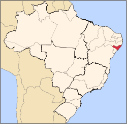
Igaci is in the state of Alagoas, Brazil. [2] It has an area of 334.346 square kilometres (129.092 sq mi) as of 2020. [1] The elevation above sea level is about 250 metres (820 ft). [2] It is located in the Palmeira dos Índios micro-region. It is 161 km from Maceió. [4]

Climate

The Köppen climate type is As : Tropical savanna climate. [5] The climate is hot and humid. Winter normally lasts from May to August. [4] The average annual temperature is 25 °C (77 °F). [6] The warmest month is December, when the average temperature is 28 °C (82 °F), and the coldest is July, with 20 °C (68 °F). [6] The average annual rainfall is 972 millimetres (38.3 in). The wettest month is July, with 158 millimetres (6.2 in) of precipitation on average, and the driest is January, with 21 millimetres (0.83 in) of precipitation. [7]

Igaci, AL
Climate chart (explanation)
J
F
M
A
M
J
J
A
S
O
N
D
 
 
21
 
 
36
22
 
 
33
 
 
33
21
 
 
39
 
 
33
21
 
 
102
 
 
30
21
 
 
142
 
 
27
20
 
 
117
 
 
24
18
 
 
158
 
 
23
17
 
 
109
 
 
24
16
 
 
66
 
 
28
18
 
 
111
 
 
34
20
 
 
31
 
 
36
21
 
 
45
 
 
39
22
Average max. and min. temperatures in °C
Precipitation totals in mm
Source: [6]
Imperial conversion
JFMAMJJASOND
 
 
0.8
 
 
97
72
 
 
1.3
 
 
91
70
 
 
1.5
 
 
91
70
 
 
4
 
 
86
70
 
 
5.6
 
 
81
68
 
 
4.6
 
 
75
64
 
 
6.2
 
 
73
63
 
 
4.3
 
 
75
61
 
 
2.6
 
 
82
64
 
 
4.4
 
 
93
68
 
 
1.2
 
 
97
70
 
 
1.8
 
 
102
72
Average max. and min. temperatures in °F
Precipitation totals in inches

History

The settlement that is now the municipality of Igaci was founded by João de Lima Acioli of Portugal in the mid-19th century. The original name was Olho D'Água do Acioli, or Acioli's Waterholes, due to the many pools in the region. The abundant water attracted many families from areas that suffered from droughts, particularly in 1877, when there was a severe drought in Alagoas. The first urban settlement of the municipality was founded soon after. Early settlers in the town were Serapião Sampaio, Santos Silva, captain Bartolomeu de Souza Vergueiro, Justino Luiz, the Torres and Tomas de Albuquerque families and Carlos Pontes who later became an important figure in Brazilian literature and national politics. [4]

Olho D'Água do Acioli was named a town and judicial district of Palmeira dos Índios by State law No. 428 of 15 June 1904. The town became more important when the Grewestern railway reached it, now operated by the Rede Ferroviária Federal do Nordeste. At this time its name was changed to Igaci, the indigenous word for waterhole. Many cotton gins began operation to process the local harvest, although as of 2017 only one remained. Law No. 2087 of 27 December 1857 established Igaci as a separate municipality from Palmeira dos Índios effective 12 January 1959. It has a single district, Igaci. [4]

Demographics

The population in the 2010 census was 25,188. [8] The estimated population as of 2020 was 25,613. [1] Population density as of 2010 was 75.31 inhabitants per square kilometre (195.1/sq mi). [1] As of 2010, 94.3% of the population had attended school between the ages of 6 and 14. Also as of 2010, the municipal Human Development Index was 0.564. This compares to 0.241 in 1991 and 0.366 in 2000. [1]

On the 2010 census religion was reported as Catholic by 23,131 people, Evangelical by 1,156 people and Animism by 0 people. [8]

The municipality has two main festivities: Political Emancipation Day and the festival of the patron saint Nossa Senhora da Saúde. [4]

Economy

In 2017, the average monthly salary was 1.8 minimum wages. Employed people were 5.0% of the total population. Households with monthly income of up to half a minimum wage per person represent 54.3% of the population. [8] Recent estimates of GDP per capita: [1]

1,000
2,000
3,000
4,000
5,000
6,000
7,000
8,000
2010
2011
2012
2013
2014
2015
2016
2017

Health and sanitation

6.2% of households have adequate sanitation, 94.3% of urban households are on public roads with afforestation and 9.4% of urban households are on public roads with adequate urbanization (presence of manhole, sidewalk, pavement and curb). [8] Annual hospitalizations due to diarrhea are 1.4 per 1,000 inhabitants. [8] Deaths per 1,000 live births: [1]

Municipal finances

Recent figures for committed municipal expenditure: [1]

10,000,000
20,000,000
30,000,000
40,000,000
50,000,000
60,000,000
70,000,000
2009
2013
2014
2015
2016
2017

Recent figures for realized municipal revenue: [1]

10,000,000
20,000,000
30,000,000
40,000,000
50,000,000
60,000,000
70,000,000
2005
2006
2008
2009
2013
2014
2015
2016
2017

Related Research Articles

<span class="mw-page-title-main">Lajedo, Pernambuco</span> Municipality in Northeast, Brazil

Lajedo is a municipality and a city in the state of Pernambuco in Brazil. The population is 40,589 in an area of 189.10 km². The city area is 3.5 km².

<span class="mw-page-title-main">Piranhas, Alagoas</span> Municipality in Alagoas, Brazil

Piranhas is a historic municipality near the western limit of the State of Alagoas, in the Northeast Region of Brazil.

<span class="mw-page-title-main">Arapiraca</span> Brazilian municipality in the state of Alagoas

Arapiraca is a Brazilian municipality in the state of Alagoas, Northeast Region of the country. It is located in Agreste in Alagoas and belongs to the Metropolitan Region of Agreste, being located about 125 km (78 mi) west of state capital. It occupies an area of just over 345 km2 (133 sq mi), being 59 km2 (23 sq mi) in urban area, and its population in 2021 was 234,309 inhabitants. Being the second municipality with the largest population in Alagoas and the ninth in the interior of the Northeast.

<span class="mw-page-title-main">Engenheiro Beltrão</span> Municipality in Paraná, Brazil

Engenheiro Beltrão is a municipality in the Brazilian state of Paraná. It is about 64 kilometres (40 mi) southwest of the city of Maringá. It was founded in 1954 It has an area of 467.470 square kilometres (180.491 sq mi). It has a Humid subtropical climate. As of 2020 the estimated population was 13,981.

<span class="mw-page-title-main">Alexânia</span> Municipality in Central-West, Brazil

Alexânia is a municipality in central Goiás state, Brazil. Alexânia is known for its alleged extraterrestrial sightings in the late sixties and early seventies. The Areias River passes through the municipality.

<span class="mw-page-title-main">Cacoal</span> Municipality in Rondônia, Brazil

Cacoal is a municipality in the Brazilian state of Rondônia. It has an area of 3,792.892 square kilometres (1,464.444 sq mi). It has a Tropical savanna climate. As of 2020 the estimated population was 85,893. It is the fourth-largest city in Rondônia state.

<span class="mw-page-title-main">Mairiporã</span> Municipality in Southeast, Brazil

Mairiporã is a Brazilian municipality in São Paulo state. It is part of the São Paulo metropolitan area. The population is 101,937 in an area of 321 km².

<span class="mw-page-title-main">Olho d'Água das Flores</span> Municipality in Alagoas, Brazil

Olho d'Água das Flores is a municipality located in the western of the Brazilian state of Alagoas. Its population is 21,738 (2020) and its area is 183 km².

<span class="mw-page-title-main">Olho d'Água do Casado</span> Municipality in Northeast, Brazil

Olho d'Água do Casado is a municipality located in the western of the Brazilian state of Alagoas. Its population is 9,441 (2020) and its area is 323 square kilometres (125 sq mi).

<span class="mw-page-title-main">Olho d'Água Grande</span> Place

Olho d'Água Grande is a municipality located in the Brazilian state of Alagoas. Its population is 5,128 (2020) and its area is 119 km².

<span class="mw-page-title-main">Palmeira dos Índios</span> Municipality in Alagoas, Brazil

Palmeira dos Índios is a municipality located in the western of the Brazilian state of Alagoas. As of 2010, it has a population of around 70,000.

<span class="mw-page-title-main">Cacaulândia</span> Municipality in Rondônia, Brazil

Cacaulândia is a municipality in the Brazilian state of Rondônia. It has an area of 1,961.778 square kilometres (757.447 sq mi). It has a Tropical savanna climate. As of 2019 the estimated population was 6230.

<span class="mw-page-title-main">Olhos-d'Água</span> Human settlement in Brazil

Olhos-d'Água is a Brazilian municipality located in the north of the state of Minas Gerais. Its population as of 2020 was 6,171 people living in a total area of 2,086 km². The city belongs to the mesoregion of North of Minas and to the microregion of Bocaiúva. It became a municipality in 1997.

<span class="mw-page-title-main">Guaíra, São Paulo</span> Municipality in Southeast, Brazil

Guaíra is a municipality in São Paulo state in Brazil. The population is 41,040 in an area of 1258 km2.

<span class="mw-page-title-main">Bocaiúva</span> Town in Brazil

Bocaiuva is a Brazilian municipality located in the northwest of the state of Minas Gerais. Its population as of 2020 was 50,256 people living in a total area of 3,232 km2. The city belongs to the mesoregion of North of Minas and to the microregion of Bocaiuva. It became a municipality in 1890.

Várzea Alegre is a municipality in the state of Ceará in the Northeast region of Brazil. Its area is 835.706 km2, including the Calabaça (pumpkin), Canindezinho, Ibicatu, Naraniú and Lagoa Verde districts.

<span class="mw-page-title-main">Cocalinho</span> Municipality in Center-West, Brazil

Cocalinho is a municipality in the Brazilian state of Mato Grosso. It has an area of 16,516.319 square kilometres (6,376.986 sq mi). It has a tropical savanna climate. As of 2020 the estimated population was 5,681.

<span class="mw-page-title-main">Cruzeiro do Sul, Paraná</span> Municipality in Paraná, Brazil

Cruzeiro do Sul is a municipality in the Brazilian state of Paraná. It has an area of 259.103 square kilometres (100.040 sq mi). It has a Humid subtropical climate. As of 2020 the estimated population was 4,449.

<span class="mw-page-title-main">Saudade do Iguaçu</span> Municipality in Paraná, Brazil

Saudade do Iguaçu is a municipality in the Brazilian state of Paraná. It has an area of 152.085 square kilometres (58.720 sq mi). It has a humid subtropical climate. As of 2020 the estimated population was 5,539. The municipality contains the Salto Santiago Hydroelectric Power Plant on the Iguazu River.

<span class="mw-page-title-main">Sulina, Paraná</span> Municipality in Paraná, Brazil

Sulina is a municipality in the Brazilian state of Paraná. It has an area of 170.759 square kilometres (65.930 sq mi). It has a humid subtropical climate. As of 2020 the estimated population was 2,930.

References

  1. 1 2 3 4 5 6 7 8 9 10 IBGE.
  2. 1 2 3 Geonames.
  3. IBGE 2020
  4. 1 2 3 4 5 História : IBGE.
  5. mindat.
  6. 1 2 3 NASAearth.
  7. NASArain.
  8. 1 2 3 4 5 IBGEpan.

Sources