Savant Lake is an unincorporated place and community in Unorganized Thunder Bay District in northwestern Ontario, Canada.

Hudson is an unincorporated place and community in the municipality of Sioux Lookout, Kenora District in northwestern Ontario, Canada. It is located on Lost Lake on the English River in the Nelson River drainage basin.
Rice Lake is an unincorporated place and railway point in geographic Rice Township in Unorganized Kenora District in northwestern Ontario, Canada, 2.5 kilometres (1.6 mi) east of the border with the province of Manitoba.
Flindt Landing railway station is located at Flindt Landing in Unorganized Thunder Bay District in northwestern Ontario, Canada. The station is on the Canadian National Railway transcontinental main line between Savant Lake to the west and Harvey to the east; it is used by Via Rail and served by transcontinental Canadian trains.
Richan railway station is located in the community of Richan in Unorganized Kenora District in northwestern Ontario, Canada. The station is on the Canadian National Railway transcontinental main line, between Amesdale to the west and Millidge to the east, has a passing track, and is in use by Via Rail as a stop for transcontinental Canadian trains.

Red Lake Road railway station is located in the community of Red Lake Road in Unorganized Kenora District in Northwestern Ontario, Canada. The station is on the Canadian National Railway transcontinental main line, between Quibell to the west and Lash to the east, has a passing track, and is in use by Via Rail as a stop for transcontinental Canadian trains. Highway 105 passes to the east of the stop.
Farlane railway station is located in the community of Farlane in Unorganized Kenora District in northwestern Ontario, Canada. The station is on the Canadian National Railway transcontinental main line and is in use by Via Rail as a stop for transcontinental Canadian trains.
Ottermere railway station is in the community of Ottermere in Unorganized Kenora District in northwestern Ontario, Canada. The station is on the Canadian National Railway transcontinental main line, between Malachi to the west and Wade to the east, and is used by Via Rail as a stop for transcontinental Canadian trains.
Malachi railway station is located in the community of Malachi in Unorganized Kenora District in northwestern Ontario, Canada. The station is on the Canadian National Railway transcontinental main line, between Copelands Landing to the west and Ottermere to the east, has a passing track, and is used by Via Rail as a stop for transcontinental Canadian trains.
Rice Lake railway station is located at the unincorporated place of Rice Lake in Unorganized Kenora District in northwestern Ontario, Canada. The station is on the Canadian National Railway transcontinental main line, between the Manitoba border, just 2.5 kilometres (1.6 mi) to the west, and White to the east, and is used by Via Rail as a stop for transcontinental Canadian trains.
Flindt Landing is an unincorporated place and railway point in Unorganized Thunder Bay District in northwestern Ontario, Canada.
McIntosh is an unincorporated place on Canyon Lake on the Canyon River in Unorganized Kenora District in northwestern Ontario, Canada. It lies on the Canadian National Railway transcontinental main line, between Canyon to the west and Quibell to the east, and is passed but not served by Via Rail transcontinental Canadian trains. The community can be accessed by road using the continuation of Ontario Highway 647 that arrives from the southeast from the community of Vermilion Bay, on Ontario Highway 17, via Blue Lake Provincial Park.
Girdwood is a railway point and unincorporated place in geographic Atkinson Township in the Unorganized North Part of Algoma District in northeastern Ontario, Canada. It lies on the Canadian Pacific Railway transcontinental main line between the settlements of Amyot on the line 13.5 kilometres (8.4 mi) to the west northwest and Ryerson on the line 4 kilometres (2 mi) to the northeast. Via Rail provides services to Girdwood railway station with the Sudbury – White River train once daily in each direction. Girdwood is adjacent to Tripoli Creek, a tributary of the Magpie River.
Malachi is an unincorporated place and community in Unorganized Kenora District in northwestern Ontario, Canada. It is also the name of the surrounding geographic township. The community is almost exclusively situated on the shores of Malachi Lake.
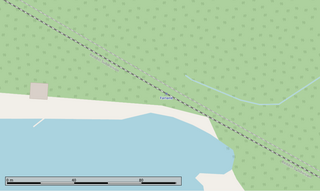
Ottermere is an unincorporated place and community in Unorganized Kenora District in northwestern Ontario, Canada.
Favel is an unincorporated place on Favel Lake on the Canyon River in Unorganized Kenora District in northwestern Ontario, Canada.
Canyon is an unincorporated place on Canyon Lake on the Canyon River in Unorganized Kenora District in northwestern Ontario, Canada.
The Canyon River is a river in the Hudson Bay drainage basin in Unorganized Kenora District in northwestern Ontario, Canada. it is a tributary of the Wabigoon River.
Superior Junction is a community in the town of Sioux Lookout, Kenora District in northwestern Ontario, Canada. It is on the Marchington River downstream of Botsford Lake and upstream of the river's mouth at Abram Lake on the English River.

The Groundhog River is a river in Cochrane District and Sudbury District in Northeastern Ontario, Canada. The river is in the James Bay drainage basin and is a left tributary of the Mattagami River.
