
Adelaide Airport, also known as Adelaide International Airport, is the principal airport of Adelaide, South Australia and the fifth-busiest airport in Australia, servicing 8.5 million passengers in the financial year ending 30 June 2019. Located adjacent to West Beach, it is approximately 6 km (3.7 mi) west of the city centre. It has been operated privately by Adelaide Airport Limited under a long-term lease from the Commonwealth Government since 29 May 1998.
The Australian Antarctic Division (AAD) is a division of the Department of Climate Change, Energy, the Environment and Water. The Division undertakes science programs and research projects to contribute to an understanding of Antarctica and the Southern Ocean. It conducts and supports collaborative research programs with other Australian and international organisations, such as the Bureau of Meteorology and Geoscience Australia, as well as administering and maintaining a presence in Australian Antarctic and sub-Antarctic territories.

Footscray is an inner-city suburb in Melbourne, Victoria, Australia, 5 km (3.1 mi) west of Melbourne's Central Business District, located within the City of Maribyrnong local government area. Footscray recorded a population of 17,131 at the 2021 census.

Gold Coast Airport is an international Australian airport located at the southern end of the Gold Coast and approximately 90 km (56 mi) south of Brisbane, within the South East Queensland agglomeration. The entrance to the airport is situated in the suburb of Bilinga near Coolangatta. The runway itself cuts through the state borders of Queensland and New South Wales. During summer, these states are in two different time zones. The Gold Coast Airport operates on Queensland Time.

Collins Street is a major street in the central business district of Melbourne, Victoria, Australia. It was laid out in the first survey of Melbourne, the original 1837 Hoddle Grid, and soon became the most desired address in the city. Collins Street was named after Lieutenant-Governor of Tasmania David Collins who led a group of settlers in establishing a short-lived settlement at Sorrento in 1803.
A lighter is a type of flat-bottomed barge used to transfer goods and passengers to and from moored ships. Lighters were traditionally unpowered and were moved and steered using long oars called "sweeps" and the motive power of water currents. They were operated by skilled workers called lightermen and were a characteristic sight in London's docks until about the 1960s, when technological changes made this form of lightering largely redundant. Unpowered lighters continue to be moved by powered tugs, however, and lighters may also now themselves be powered. The term is also used in the Lighter Aboard Ship (LASH) system.

The Port of Melbourne is the largest port for containerised and general cargo in Australia. It is located in Melbourne, Victoria, and covers an area at the mouth of the Yarra River, downstream of Bolte Bridge, which is at the head of Port Phillip, as well as several piers on the bay itself. Since 1 July 2003, the Port of Melbourne has been managed by the Port of Melbourne Corporation, a statutory corporation created by the State of Victoria.

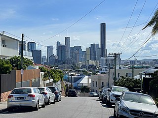
The Sydney central business district (CBD) is the historical and main commercial centre of Sydney. The CBD is Sydney's city centre, or Sydney City, and the two terms are used interchangeably. Colloquially, the CBD or city centre is often referred to simply as "Town" or "the City". The Sydney city centre extends southwards for about 3 km (2 mi) from Sydney Cove, the point of first European settlement in which the Sydney region was initially established.
Teneriffe is an inner suburb of Brisbane, Queensland, Australia, 2.5 kilometres (1.6 mi) north-east of the CBD. In the 2016 census, Teneriffe had a population of 5,335 people.
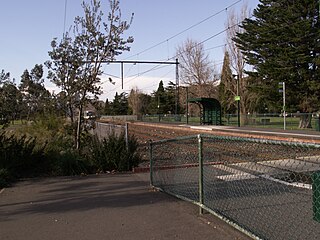
Graham Street is light rail station and former railway station on the former Port Melbourne railway line, in the inner Melbourne suburb of Port Melbourne, Victoria, Australia. Located to the north of Graham Street, between Evans Street and Station Street, the station has been demolished since 1987, and is now served by route 109 trams, stopping at a pair of low level platforms.

A ute, originally an abbreviation for "utility" or "coupé utility", is a term used in Australia and New Zealand to describe vehicles with a tonneau behind the passenger compartment, that can be driven with a regular driver's license.

Streets is an Australian ice-cream brand owned by the British multinational company Unilever. Some products are made in China and shipped to Australia and New Zealand. It is part of Unilever's ice cream brand Heartbrand. The company is in a long-term contract with dairy company Dairy Farmers.

Australian National Line (ANL) was a coastal shipping line established by the Government of Australia in 1956. It was sold in 1998 by the Howard government to CMA CGM.

The Port of Geelong is located on the shores of Corio Bay at Geelong, Victoria, Australia. The port is the sixth-largest in Australia by tonnage.

Melbourne is the capital of the Australian state of Victoria, and the second-most populous city in Australia. Its name generally refers to a 9,993 km2 (3,858 sq mi) metropolitan area known as Greater Melbourne, comprising an urban agglomeration of 31 local municipalities, although the name is also used specifically for the local municipality of City of Melbourne based around its central business area. The metropolis occupies much of the northern and eastern coastlines of Port Phillip Bay and spreads into the Mornington Peninsula, part of West Gippsland, as well as the hinterlands towards the Yarra Valley, the Dandenong and Macedon Ranges. It has a population over 5 million, mostly residing to the east side of the city centre, and its inhabitants are commonly referred to as "Melburnians".

Fremantle Harbour is Western Australia's largest and busiest general cargo port and an important historical site. The inner harbour handles a large volume of sea containers, vehicle imports and livestock exports, cruise shipping and naval visits, and operates 24 hours a day. It is located adjacent to the city of Fremantle, in the Perth metropolitan region.
Pionair Australia is a passenger and cargo airline based at Bankstown Airport in Sydney.

