| Ophir New South Wales | |
|---|---|
| Coordinates | 33°7′42.3″S149°14′34.3″E / 33.128417°S 149.242861°E |
| Population | 128 (SAL 2021) [1] |
| LGA(s) | Cabonne Shire Council |
Ophir is the name of a locality in New South Wales, Australia in Cabonne Shire.
| Ophir New South Wales | |
|---|---|
| Coordinates | 33°7′42.3″S149°14′34.3″E / 33.128417°S 149.242861°E |
| Population | 128 (SAL 2021) [1] |
| LGA(s) | Cabonne Shire Council |
Ophir is the name of a locality in New South Wales, Australia in Cabonne Shire.

Ophir is located near the Macquarie River northeast of the city of Orange. Ophir is the place where gold was first discovered in New South Wales in 1851, leading to the Australian gold rushes. In popular literature it has been stated that William Tom Jr, John Lister and Edward Hargraves found payable gold in February 1851 at the Ophir gold diggings, located at the confluence of Summer Hill Creek and Lewis Ponds Creek ( 33°10′7.68″S149°14′19.68″E / 33.1688000°S 149.2388000°E ). Hargraves was awarded £10,500 (worth $1,125,434 in 2004 values) by the NSW Government.
William Tom's father (Parson Tom) [2] named the area 'Ophir', after a region in the Old Testament noted for its fine gold. [3]
There was a gold rush to the area in 1851 and 1852. The village of Ophir was laid out in 1851 by Major Sir Thomas Livingstone Mitchell, its first lots were sold in 1852. Reef gold was discovered in 1868 by Joseph Christopherson. [4]
Although Hargraves was honoured and rewarded, it may have been William Tipple Smith mineralogist, who first discovered gold at what would be later named Ophir, in 1848. On 27 February 1852 William Tipple Smith wrote to geologist Sir Roderick Murchison in England saying the spot now called Ophir was the very spot where he had found nugget gold in 1848. Smith's claims and correspondence are exhaustively studied in a 1986 book "A Fool's Gold?" by Lynette Ramsay Silver, in the foreword of which geology Professor David Branagan of Sydney University concurs and states "It is good to see him deservedly remembered in the pages of this book". [5] William Tipple Smith was one of the owners of the Fitzroy Iron Works at Mittagong and, during a visit in February 1849, Governor Charles Augustus Fitz Roy was presented with a steel knife "mounted with colonial gold". [6]
Some remnants of old alluvial, reef, and deep lead mines, are located within the Ophir Reserve, which includes the former site of the town. [7] The town's cemetery also remains. [8] There is an obelisk that commemorates the discovery of payable gold, in 1851, giving credit to Edward Hargraves, John Lister, James Tom, and William Tom. [9]
All that remains of William Tipple Smith is one small gold sample and a previously unmarked grave (number 4929, section 4, Rookwood Cemetery) that was only recently provided with a headstone recognising him as the discoverer of the first payable gold in Australia. [10]
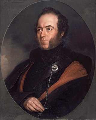
Sir Thomas Livingstone Mitchell, often called Major Mitchell, was a Scottish surveyor and explorer of Southeastern Australia. He was born in Scotland and served in the British Army during the Peninsular War. In 1827 he took up an appointment as Assistant Surveyor General of New South Wales. The following year he became Surveyor General and remained in this position until his death. Mitchell was knighted in 1839 for his contribution to the surveying of Australia.
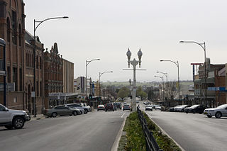
Bathurst is a city in the Central Tablelands of New South Wales, Australia. Bathurst is about 200 kilometres (120 mi) west-northwest of Sydney and is the seat of the Bathurst Regional Council. Founded in 1815, Bathurst is the oldest inland settlement in Australia and had a population of 37,396 in 2021.

The Victorian gold rush was a period in the history of Victoria, Australia, approximately between 1851 and the late 1860s. It led to a period of extreme prosperity for the Australian colony and an influx of population growth and financial capital for Melbourne, which was dubbed "Marvellous Melbourne" as a result of the procurement of wealth.
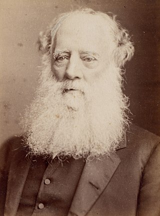
William Branwhite Clarke, FRS was an English geologist and clergyman, active in Australia.
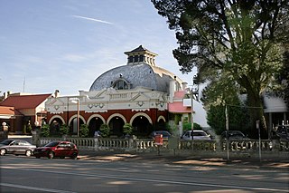
The Hydro Majestic Hotel is located in Medlow Bath, New South Wales, Australia. The hotel is located on a clifftop overlooking the Megalong Valley on the western side of the Great Western Highway.
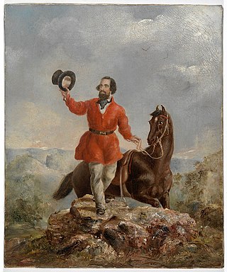
Edward Hammond Hargraves was a gold prospector who claimed to have found gold in Australia in 1851, starting an Australian gold rush.

Sir William à Beckett was a British barrister and the first Chief Justice of the Supreme Court of Victoria.

Abercrombie River, a perennial river that is part of the Murray–Darling basin, is located in the central west of New South Wales, Australia.

Hill End is a former gold mining town in New South Wales, Australia. The town is located in the Bathurst Regional Council local Government area.

Sofala is a village in New South Wales, Australia, 255 kilometres (158 mi) north-west of Sydney, within Bathurst Regional Council. It is located beside the Turon River. Sofala is just off the Bathurst-Ilford Road, with only local traffic through the town itself. At the 2006 census, Sofala had a population of 208.
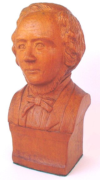
Thomas Hiscock (1812–1855) was an English blacksmith and prospector who settled in Australia in the 1840s. He is best-remembered today for helping to spark the Victorian Gold Rush with his discovery of gold outside the town of Buninyong, near Ballarat.

Gundaroo is a small village in the Southern Tablelands of New South Wales, Australia and in Yass Valley Council. It is situated to the east of the Yass River, about 16 kilometres (10 mi) north of Sutton, about 15 kilometres (9 mi) west of the Lake George range. At the 2016 census, Gundaroo "state suburb" had a population of 1,146. At the 2006 census, its "urban centre/locality" had a population of 331.
1851 in Australia was a watershed year. It saw the start of the Australian gold rushes with significant gold discoveries in both New South Wales in February and Victoria in July. As a result of the Gold Rushes, the European population of Victoria increased from 97,489 in 1851 to 538,628 in 1861 and the population of NSW increased from 197,265 in 1851 to 350,860 in 1861. Victoria became a self-governing colony. Sentiment in the eastern Australian colonies moved decisively against penal transportation leading to the end of transportation to Tasmania in 1853. Melbourne's major suburb/satellite city in the Dandenong Ranges, Belgrave was first settled, making it the oldest town in the Dandenong Ranges.
The following lists events that happened during 1823 in Australia.

Tuena is a town in the Southern Tablelands of New South Wales, Australia, in Upper Lachlan Shire. It is located on Tuena Creek, tributary of the Abercrombie River, 269 km (167 mi) west of the state capital, Sydney. At the 2016 census, Tuena and the surrounding area had a population of 59.

During the Australian gold rushes, starting in 1851, significant numbers of workers moved from elsewhere in Australia and overseas to where gold had been discovered. Gold had been found several times before, but the colonial government of New South Wales had suppressed the news out of the fear that it would reduce the workforce and destabilise the economy.

New South Wales experienced the first gold rush in Australia, a period generally accepted to lie between 1851 and 1880. This period in the history of New South Wales resulted in a rapid growth in the population and significant boost to the economy of the colony of New South Wales. The California Gold Rush three years prior signaled the impacts on society that gold fever would produce, both positive and negative. The New South Wales colonial government concealed the early discoveries, but various factors changed the policy.

Hargraves is a village in Central West New South Wales, Australia. It is 306 kilometres (190 mi) north west of the state capital of Sydney and 39 kilometres (24 mi) southwest of the town of Mudgee, New South Wales, Australia. At the 2011 census, Hargraves had a population of 338.
Hargraves House, Noraville is a heritage-listed house at 3 Elizabeth Drive, Noraville in the Central Coast local government area of New South Wales, Australia. It was designed by Edward Hammond Hargraves and built from 1856 to 1859 by Mr Fletcher. It is also known as Hargraves House and Norahville. It was added to the New South Wales State Heritage Register on 2 April 1999.

Amusu Theatre is a heritage-listed cinema and theatre at 17 Derowie Street, Manildra, in the Central West region of New South Wales, Australia. It was designed by Allan Tom and built in 1936 by Jim Fullerton. It is also known as Amusu Cinema. The property is owned by Cabonne Council. It was added to the New South Wales State Heritage Register on 26 November 1999.
{{cite book}}: CS1 maint: multiple names: authors list (link) CS1 maint: numeric names: authors list (link)