Geography
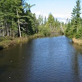
With a length of 2.8 kilometres (1.7 mi) and a maximum width of 1.9 kilometres (1.2 mi), Carillon Lake has five islands. Deformed in nature, this lake has three parts:
- western part: with a length of 0.8 kilometres (0.50 mi), this part is separated from the central part by two facing peninsulas and by an island (length: 0.35 kilometres (0.22 mi)) between the two peninsulas; thus, two small straits allow pleasure craft to connect the central part of the lake;
- central part: of a length: 1.8 kilometres (1.1 mi), this part comprises three islands and is attached to a peninsula attached to the south shore, stretching over 0.8 kilometres (0.50 mi) north and separating the eastern and central part of the lake;
- eastern part: the eastern part has a length of 1.9 kilometres (1.2 mi) in the north–south direction.
Lac Carillon is located 0.4 kilometres (0.25 mi) southwest of Montauban Lake. The mouth of Carillon Lake is located at the bottom of a small bay on the southeast shore of the lake at:
Comprising 70 kilometres (43.50 mi), the Portneuf Regional Natural Park includes in particular the Long lakes, Montauban, Carillon, Sept Îles, Lac en Coeur, "À l'Anguille" and some other more secondary bodies of water. This park is popular for recreational and tourist activities: hiking trails, cross-country skiing, boat launching ramp ...
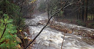
From the mouth of Carillon Lake, the current flows over:

Notre-Dame-de-Montauban is a municipality in the Mauricie region in Canada. This municipality is located at the northern edge of regional county municipality of Mékinac Regional County Municipality and the administrative region of Mauricie. It includes the population centres of Notre-Dame-des-Anges and Montauban-les-Mines. Both communities are located along route 367, about 7 kilometres (4.3 mi) apart.

The Batiscan River is located in La Mauricie administrative region, in the Quebec province, Canada. This river flows 196 kilometres (122 mi) from Lake Édouard in Mauricie south and west to empty into the St. Lawrence River at Batiscan, Quebec, northeast of Trois-Rivières, Quebec. It passes through the regional county municipalities (RCM) of La Tuque, Portneuf, Mékinac and Les Chenaux.
The Charest River takes its source in Charest Lake, in the sector Montauban-les-Mines, in the extreme East of the municipality of Notre-Dame-de-Montauban, located in the Mekinac Regional County Municipality, in the administrative region of Mauricie in the province of Quebec, Canada. In the upper part, Charest River also drains the surrounding lakes: lake of the Mine, lake Perron, lake Perreault and lake End.
The Island of the Cross is located in the middle of the Batiscan River, at the northern edge of the eastern part of the Portneuf Wildlife Reserve, in the area designated "Miguick-Île à la Croix", the unincorporated Lac-Lapeyrère, Quebec territory, Portneuf Regional County Municipality, in the administrative area of the Capitale-Nationale, in the province of Quebec, Canada.
Lake Charest (Mékinac) is located in the area Montauban-les-Mines, in the municipality of Notre-Dame-de-Montauban, in the Mékinac Regional County Municipality (RCM), in the extreme east of the administrative region of Mauricie, in Québec, Canada.
The Noire River flows in the municipality of rivière-à-Pierre, Saint-Alban and Saint-Casimir, in the Portneuf Regional County Municipality, in the administrative region of Capitale-Nationale, in Quebec, in Canada.
Lake Montauban is crossed by Noire River, in the municipality of Saint-Alban, in the Portneuf Regional County Municipality, in the administrative region of the Capitale-Nationale, in the Quebec, in Canada.
The Blanche River is a stream flowing in the municipalities of Saint-Ubalde, Saint-Thuribe, Saint-Alban and Saint-Casimir, in the Portneuf Regional County Municipality, in the administrative region from Capitale-Nationale, to Quebec, to Canada.
The Weller River is a tributary left bank of the Blanche River whose confluence is found east of the village of Saint-Ubalde, in the Portneuf Regional County Municipality, in the administrative region of Capitale-Nationale, in the province of Quebec in Canada.
The Talayarde North East River is a tributary of the Talayarde River flowing in the administrative region of Capitale-Nationale, at Quebec, in Canada. The course of the river crosses the municipality of Saint-Gabriel-de-Valcartier and the city of Saint-Raymond, in the Portneuf Regional County Municipality).

Portneuf Regional Natural Park is a Quebec regional park (Canada) spanning five municipalities in the northwestern part of the Portneuf Regional County Municipality: Saint-Ubalde, Saint-Alban, Saint-Casimir, Portneuf and Rivière-à-Pierre. This park is administered on the basis of a social economy enterprise with the mission of showing visitors around an exceptional territory and contributing to its preservation and enhancement.
Lac Sept Îles is a freshwater body straddling the municipalities of Saint-Ubalde and Saint-Alban, in the Portneuf Regional County Municipality, in the administrative region of Capitale-Nationale, in province of Quebec, in Canada.
The lac Long is crossed by the Noire River, entirely in the municipality of Saint-Alban, in the MRC of Portneuf Regional County Municipality, in the administrative region of Capitale-Nationale, in province, Canada.
The lac Clair is part of the hydrographic side of the Noire River, in the municipalities of Sainte-Christine-d'Auvergne and Saint-Alban, in the MRC of Portneuf Regional County Municipality, in the administrative region of Capitale-Nationale, in province of Quebec, Canada.
The lac Émeraude is located in the northern part of the municipality of Saint-Ubalde, in the MRC of Portneuf Regional County Municipality, in the administrative region of the Capitale-Nationale, in the province of Quebec, in Canada.
The Lac Blanc is located in the northern part of the municipality of Saint-Ubalde, in the MRC of Portneuf Regional County Municipality, in the administrative region of the Capitale-Nationale, in the province of Quebec, in Canada.
The Rivière des Pins is a freshwater stream, in Quebec, in Canada. This river crosses the municipalities of:
The Rivière des Sept Îles is a tributary of the Portneuf River, flowing in the municipalities of Saint-Raymond and Saint-Basile, in the regional county municipality (MRC) of Portneuf Regional County Municipality, in the administrative region of Capitale-Nationale, in Quebec, in Canada.
The Gosford River is a tributary of the Sept Îles Lake which is the head of the Portneuf River, flowing in the municipality of Portneuf, in the Portneuf Regional County Municipality, in the administrative region of Capitale-Nationale, in the province of Quebec, in Canada.
The Rivière Portneuf is a tributary of the north shore of the Saint-Laurent river, crossing the municipalities of Saint-Raymond, Pont-Rouge, Sant-Basile and Portneuf, in the Portneuf Regional County Municipality, in the administrative region of the Capitale-Nationale, in the province of Quebec, in Canada.
