
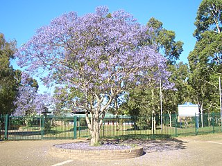
Girraween is a suburb of Sydney, in the state of New South Wales, Australia. Girraween is located 30 km west of the Sydney central business district, in the local government area of Cumberland Council and is part of the Greater Western Sydney region.
Holsworthy is a suburb in south-western Sydney, in the state of New South Wales, Australia 31 kilometres south-west of the Sydney central business district, in the local government area of the City of Liverpool.

Summer Hill is a suburb of Sydney, in the state of New South Wales, Australia. Summer Hill is located 7 kilometres west of the Sydney central business district, in the local government area of the Inner West Council.

Wentworthville is a suburb in Sydney, in the state of New South Wales, Australia. Wentworthville is located 27 kilometres west of the Sydney central business district and is part of the Greater Western Sydney region. Wentworthville is split between the local government areas of the City of Parramatta and the Cumberland Council. Wentworthville is colloquially known as 'Wenty'.

Villawood, a suburb of local government areas City of Canterbury-Bankstown and City of Fairfield, is 27 kilometres west of the Sydney central business district, in the state of New South Wales, Australia.

Lalor Park is a suburb of Sydney, in the state of New South Wales, Australia. Lalor Park is located 35 kilometres west of the Sydney central business district in the local government area of the City of Blacktown. Lalor Park is part of the Greater Western Sydney region. Lalor Park is commonly abbreviated as 'L.P'.
Kemps Creek is a suburb of Sydney, in the state of New South Wales, Australia. It is approximately 39 kilometres (24 mi) west of the Sydney central business district, in the local government areas of the City of Penrith and City of Liverpool. It is part of the Greater Western Sydney region.

Bonnyrigg is a suburb of Sydney, in the state of New South Wales, Australia 36 kilometres west of the Sydney central business district, in the local government area of the City of Fairfield. It is part of the Greater Western Sydney region.
Bonnyrigg Heights is a suburb of Sydney, in New South Wales, Australia. Its name originates from Bonnyrigg, Midlothian, Scotland. Bonnyrigg Heights is located on the traditional indigenous lands of the Dharug Nation.
Busby is a suburb of Sydney, in the state of New South Wales, Australia. Busby is located 37 kilometres south-west of the Sydney central business district, in the local government area of the City of Liverpool. Neighbouring suburbs include Miller, Heckenberg, Hinchinbrook, Green Valley and Bonnyrigg.
Canley Heights is a suburb of Sydney, in the state of New South Wales, Australia 31 kilometres west of the Sydney central business district, in the local government area of the City of Fairfield and is part of the South-western Sydney region.
Edmondson Park is a suburb in the South West of Sydney, in the state of New South Wales, Australia. Edmondson Park is located 46 kilometres from the Sydney central business district, in the local government area of the City of Liverpool.
Greenfield Park is a suburb of Sydney, in the state of New South Wales, Australia. Greenfield Park is located 36 kilometres west of the Sydney central business district in the local government area of the City of Fairfield. The suburb has one of the most highest proportion of Assyrian people in the Sydney area and Australia per se.

Cecil Hills is a suburb of Sydney, in the state of New South Wales, Australia. Cecil Hills is located 38 kilometres west of the Sydney central business district, in the local government area of the City of Liverpool and is part of the Greater Western Sydney region.

Hinchinbrook is a suburb of Sydney, in the state of New South Wales, Australia. Hinchinbrook is located 35 kilometres south-west of the Sydney central business district, in the local government area of the City of Liverpool. It is bordered by Hoxton Park and Green Valley.

Horningsea Park is a suburb of Sydney, in the state of New South Wales, Australia. Horningsea Park is located 39 kilometres south-west of the Sydney central business district, in the local government area of the City of Liverpool and is part of the Greater Western Sydney region.

Leppington is a suburb of Sydney, in the state of New South Wales, Australia. Leppington is located 52 kilometres south-west of the Sydney central business district, in the local government areas of the City of Liverpool and Camden Council.
Middleton Grange is a suburb of Sydney, in the state of New South Wales, Australia. Middleton Grange is located 40 kilometres west of the Sydney central business district, in the local government area of the City of Liverpool and is part of the Greater Western Sydney region.
Gregory Hills is a suburb of Sydney in the state of New South Wales, Australia in Camden Council. The suburb was assigned on 1 August 2008. The suburb was named from the topography of the local area and from the original St Gregory's Chapel on the Marist Brothers land.
Elizabeth Hills is a suburb of western Sydney, in the state of New South Wales, Australia. It is located 39 kilometres south-west of the Sydney central business district, in the local government area of Liverpool. Elizabeth Hills was gazetted as a suburb on 18 December 2009. Like the neighbouring suburb of Len Waters Estate, Elizabeth Hills had previously been part of the suburb of Cecil Hills.
