Lurnea, New South Wales

Last updated

Lurnea
Sydney,  New South Wales
LurneaNSWplaza.jpg
Lurnea Plaza
Lurnea, New South Wales
Map
Population9,311 (2016 census) [1]
Postcode(s) 2170
Location35 km (22 mi) west of Sydney
LGA(s) City of Liverpool
State electorate(s) Holsworthy
Federal division(s) Werriwa
Suburbs around Lurnea:
Cartwright Liverpool Liverpool
Prestons Lurnea Liverpool
Prestons Casula Casula

Lurnea is a suburb of Sydney, in the state of New South Wales, Australia. It is 35 kilometres south-west of the Sydney central business district, in the local government area of the City of Liverpool.

Contents

History

Lurnea was originally home to the Cabrogal people who spoke the Darug language. Following British settlement of the area in the 1800s, it was given the colloquial name Hillview as the suburb had nice views of the surrounding Liverpool area, and this name persisted until after World War I when the land was converted into a soldier settlement which provided the soldiers with enough room for a house and a small farm. It was renamed Lurnea which means "a resting place". Lurnea Post Office opened on 15 February 1921. A street was also named after the old name of the suburb – Hillview Parade. [2] In the 1970s the area was redeveloped again into a residential suburb for a small number of veterans from the Vietnam War. It also became home to several Vietnamese refugee families of the aforementioned war. [3]

Transport

Hoxton Park Road runs along the northern edge of Lurnea providing access to Liverpool as well as suburbs to the west of Lurnea such as Hoxton Park. It also has relatively easy access to the M5 South Western Motorway to the city and the Westlink M7 to the northwest of Sydney. Lurnea is well serviced by Interline Bus Services bus routes with five services passing through the suburb and another three along Hoxton Park Road on the northern edge. [4]

Education

There are three schools situated in the suburb:

Population

Lurnea's population at the 2016 Australian census was 9,311, with 49.8% of people were born in Australia. The most common countries of birth were Iraq 8.0%, Lebanon 6.0%, Vietnam 2.8%, Fiji 2.4% and New Zealand 1.9%. 36.0% of people only spoke English at home. Other languages spoken at home included Arabic 28.0%, Vietnamese 3.7%, Hindi 2.7%, Spanish 2.2% and Serbian 2.0%. The most common responses for religion in Lurnea (State Suburbs) were Islam 25.0%, Catholic 20.9%, Not stated 10.7%, No Religion, so described 9.5% and Anglican 7.5%. In Lurnea (State Suburbs), Christianity was the largest religious group reported overall (47.8%) (this figure excludes not stated responses). The median household income of $1068 per week is slightly higher than the national average ($1027) while the rent and mortgage repayments are also slightly higher than average. [1]

Related Research Articles

<span class="mw-page-title-main">Liverpool, New South Wales</span> Suburb of City of Liverpool, New South Wales, Australia

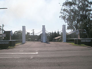
Liverpool is a suburb of Greater Western Sydney, in the state of New South Wales, Australia. It is located approximately 31 kilometres (19 mi) south-west of the Sydney CBD. Liverpool is the administrative seat of the local government area of the City of Liverpool and is situated in the Cumberland Plain.

Casula is a suburb of Sydney, in the state of New South Wales, Australia. It is 34 kilometres south-west of the Sydney central business district, in the local government area of the City of Liverpool.

<span class="mw-page-title-main">Ashcroft, New South Wales</span> Suburb of Sydney, New South Wales, Australia

Ashcroft is a suburb of Sydney, in the state of New South Wales, Australia 35 kilometres south-west of the Sydney central business district, in the local government area of the City of Liverpool.

Austral is a suburb of Sydney, in the state of New South Wales, Australia. It is 42 kilometres south-west of the Sydney central business district, in the local government area of the City of Liverpool.

<span class="mw-page-title-main">Yennora</span> Suburb of Sydney, New South Wales, Australia

Yennora is a suburb of Sydney in the state of New South Wales, Australia, 29 kilometres west of the Sydney central business district. The residential part of the suburb is primarily in the local government area of the City of Fairfield, although the industrial area in west is a part of Cumberland Council. It is part of the Greater Western Sydney region.

<span class="mw-page-title-main">West Hoxton, New South Wales</span> Suburb of Sydney, New South Wales, Australia

West Hoxton is a suburb of Sydney, in the state of New South Wales, Australia. West Hoxton is located 40 kilometres west of the Sydney central business district, in the local government area of the City of Liverpool and is part of the Greater Western Sydney region.

Rossmore is a suburb of Sydney, in the state of New South Wales, Australia.

<span class="mw-page-title-main">Prestons, New South Wales</span> Suburb of Sydney, New South Wales, Australia

Prestons is a suburb of Sydney, in the state of New South Wales, Australia 37 kilometres south-west of the Sydney central business district, in the local government area of the City of Liverpool.

<span class="mw-page-title-main">Miller, New South Wales</span> Suburb of Sydney, New South Wales, Australia

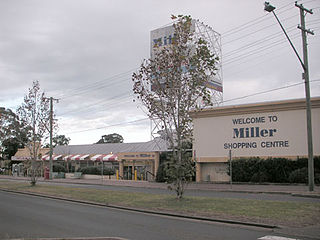
Miller is a suburb of Sydney in the state of New South Wales, Australia 38 kilometres south-west of the Sydney central business district, in the local government area of the City of Liverpool. Neighbouring suburbs include Hoxton Park, Hinchinbrook, Cartwright, Prestons, Sadleir and Busby.

<span class="mw-page-title-main">Ingleburn, New South Wales</span> Suburb of Sydney, New South Wales, Australia

Ingleburn is a suburb of Sydney, in the state of New South Wales, Australia 40 kilometres south-west of the Sydney central business district, in the local government area of City of Campbelltown. It is part of the Macarthur region. Ingleburn is located approximately halfway between the two commercial centres of Liverpool and Campbelltown.

<span class="mw-page-title-main">East Hills, New South Wales</span> Suburb of Sydney, New South Wales, Australia

East Hills, a suburb of local government area City of Canterbury-Bankstown, is located 26 kilometres south-west of the Sydney central business district, in the state of New South Wales, Australia, and is a part of the South-western Sydney region, near larger areas like Liverpool, Revesby, and Bankstown.

<span class="mw-page-title-main">Bonnyrigg, New South Wales</span> Suburb of Sydney, New South Wales, Australia

Bonnyrigg is a suburb of Sydney, in the state of New South Wales, Australia 36 kilometres west of the Sydney central business district, in the local government area of the City of Fairfield. It is part of the Greater Western Sydney region.

Bringelly is a suburb of Sydney, in the state of New South Wales, Australia. It is located on the Northern Road between Penrith and Camden. It has a public school. Bringelly is also the name of a local hill.

<span class="mw-page-title-main">Cartwright, New South Wales</span> Suburb of Sydney, New South Wales, Australia

Cartwright is a suburb in south-western Sydney, in the state of New South Wales, Australia 38 kilometres south-west of the Sydney central business district, in the local government area of the City of Liverpool.

Edmondson Park is a suburb in the South West of Sydney, in the state of New South Wales, Australia. Edmondson Park is located 32 kilometres from the Sydney central business district, in the local government area of the City of Liverpool.

<span class="mw-page-title-main">Greenfield Park, New South Wales</span> Suburb of Sydney, New South Wales, Australia

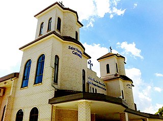
Greenfield Park is a suburb of Sydney, in the state of New South Wales, Australia. Greenfield Park is located 36 kilometres west of the Sydney central business district in the local government area of the City of Fairfield. The suburb has one of the most highest proportion of Assyrian people in the Sydney area and Australia per se.

<span class="mw-page-title-main">Hoxton Park, New South Wales</span> Suburb of Sydney, New South Wales, Australia

Hoxton Park is a suburb of Sydney, in the state of New South Wales, Australia. Hoxton Park is located 38 kilometres west of the Sydney central business district, in the local government area of the City of Liverpool and is part of the Greater Western Sydney region.

<span class="mw-page-title-main">Colyton, New South Wales</span> Suburb of Sydney, New South Wales, Australia

Colyton is a suburb of Sydney, in the state of New South Wales, Australia 43 kilometres west of the Sydney central business district, in the local government area of the City of Penrith. It is part of the Greater Western Sydney region.

<span class="mw-page-title-main">Hinchinbrook, New South Wales</span> Suburb of Sydney, New South Wales, Australia

Hinchinbrook is a suburb of Sydney, in the state of New South Wales, Australia. Hinchinbrook is located 35 kilometres south-west of the Sydney central business district, in the local government area of the City of Liverpool. It is bordered by Hoxton Park and Green Valley.

<span class="mw-page-title-main">Horningsea Park, New South Wales</span> Suburb of Sydney, New South Wales, Australia

Horningsea Park is a suburb of Sydney, in the state of New South Wales, Australia. Horningsea Park is located 39 kilometres south-west of the Sydney central business district, in the local government area of the City of Liverpool and is part of the Greater Western Sydney region.

References

  1. 1 2 Australian Bureau of Statistics (27 June 2017). "Lurnea (State Suburb)". 2016 Census QuickStats. Retrieved 19 March 2018. OOjs UI icon edit-ltr-progressive.svg
  2. Phoenix Auctions History. "Post Office List". Phoenix Auctions. Retrieved 12 February 2021.
  3. The Book of Sydney Suburbs, Compiled by Frances Pollon, Angus & Robertson Publishers, 1990, Published in Australia ISBN   0-207-14495-8, page 159
  4. "Interline Network Map" (PDF). Interline Bus Services. Retrieved 12 February 2021.

Coordinates: 33°56′06″S150°53′44″E / 33.93492°S 150.89557°E / -33.93492; 150.89557