
The Oxley Wild Rivers National Park is a protected national park that is located in the Northern Tablelands region of New South Wales, Australia in the Port Macquarie-Hastings City Council and Walcha Shire councils. The 145,223-hectare (358,850-acre) park is situated 445 kilometres (277 mi) north of Sydney and is named in memory of the Australian explorer John Oxley, who passed through the area in 1818 and is one of the largest national parks in New South Wales.

The Snowy Mountains scheme or Snowy scheme is a hydroelectricity and irrigation complex in south-east Australia. The Scheme consists of sixteen major dams; seven power stations; one pumping station; and 225 kilometres (140 mi) of tunnels, pipelines and aqueducts that were constructed between 1949 and 1974. The Scheme was completed under the supervision of Chief Engineer, Sir William Hudson. It is the largest engineering project undertaken in Australia.

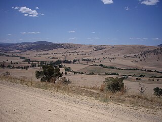
Armidale is a city in the Northern Tablelands, New South Wales, Australia. Armidale had a population of 24,504 as at June 2018. It is the administrative centre for the Northern Tablelands region. It is approximately halfway between Sydney and Brisbane at the junction of the New England Highway and Waterfall Way. Armidale traditional owners are Anaiwan people. Many Gumbaynggirr people have settled in Armidale since colonisation.

Uralla is a town on the Northern Tablelands, New South Wales, Australia. The town is located at the intersection of the New England Highway and Thunderbolts Way, 465 kilometres (289 mi) north of Sydney and about 23 kilometres (14 mi) south west of the city of Armidale. At the 2016 census, the township of Uralla had a population of 2,388 people,.

Inverell is a large town in northern New South Wales, Australia, situated on the Macintyre River, close to the Queensland border. It is also the centre of Inverell Shire. Inverell is located on the Gwydir Highway on the western slopes of the Northern Tablelands. It has a temperate climate. In the 2016 census, the population of Inverell was 11,660 and the Inverell Shire population was 16,483.

Tocumwal is a town in the southern Riverina region of New South Wales, Australia, in the Berrigan Shire local government area, near the Victorian border. The town is situated on the banks of the Murray River, 270 kilometres (170 mi) north of the city of Melbourne. The Newell Highway and Murray Valley Highway join at the Murray River, and form part of the main road route National Highway A39 between Brisbane and Melbourne. At the 2006 census, Tocumwal had a population of 1,860.

Mullumbimby is an Australian town in the Byron Shire in the Northern Rivers region of New South Wales. It promotes itself as "The Biggest Little Town in Australia". The town lies at the foot of Mount Chincogan in the Brunswick Valley about 9 kilometres by road from the coast. At the 2016 census, Mullumbimby and the surrounding area had a population of 3,596 people. Locals refer to the town either as "Mullum" or "Bimby".

Leeton Shire is a local government area in the Riverina region of New South Wales, Australia. The Shire is located adjacent to the Murrumbidgee River and falls within the Murrumbidgee Irrigation Area.

Ben Lomond is a village on the Northern Tablelands in the New England region of New South Wales, Australia. The village is situated 6 km off the New England Highway between Armidale and Glen Innes. It was located in the Guyra Shire local government area until that council was amalgamated into the Armidale Regional Council on 12 May 2016, with parts of the surrounding district in Glen Innes Severn Shire and Inverell Shire. It is primarily a farming area, with most of the residents involved in sheep, cattle and grain farming.

Walcha Shire is a local government area located in the New England region of New South Wales, Australia. The Shire is situated adjacent to the junction of the Oxley Highway and Thunderbolts Way and is 20 kilometres (12 mi) east of the Main North railway line passing through Walcha Road. The shire was formed on 1 June 1955 through the amalgamation of Apsley Shire and the Municipality of Walcha.

Dorrigo, a small town on the Waterfall Way, is located on the Northern Tablelands, in northern New South Wales, Australia. The town is part of Bellingen local government area.
Tooma River, a perennial stream that has had some of its flow diverted as a result of the Snowy Mountains Scheme, is part of the Murray catchment within the Murray–Darling basin and is located in the Australian Alpine region of New South Wales and Victoria, Australia.

Hillgrove is a Northern Tablelands village with population of about 95. The village is located approximately 30 km east of Armidale and is 5 kilometres south of the Waterfall Way. Hillgrove is part of the Armidale Regional Council local government area and is in Sandon County. This historic goldmining town is situated at elevation of 1,000 metres on a granite plateau above Bakers Creek and near the Oxley Wild Rivers National Park.

Bronte Park is a locality on the Marlborough Highway at the southern edge of the Cradle Mountain-Lake St Clair National Park in Tasmania, Australia. It is located just north of the Lyell Highway and approximately halfway in between Hobart and Queenstown, and is also almost exactly in the geographic centre of the island.

Black Mountain is a village situated between Armidale and Guyra, located on the Northern Tablelands in the New England region of New South Wales, Australia. Situated within Armidale Regional Council, as at the 2016 census, Black Mountain had a population of 310.

Gara River, a perennial river that is a tributary of the Macleay River, is located in the Northern Tablelands region of New South Wales, Australia.
The Commissioners Waters, a watercourse that is part of the Macleay River catchment, is located in the Northern Tablelands region of New South Wales, Australia.

The Armidale Region is a local government area in the New England and Northern Tablelands regions of New South Wales, Australia. This area was formed in 2016 from the merger of the Armidale Dumaresq Shire with the surrounding Guyra Shire.

Jeogla is a locality in the Armidale Regional Council region of New South Wales, Australia. It contains much of Cunnawarra National Park and the Georges Creek Nature Reserve. It had a population of 40 people as of the 2016 census.

Gara River Hydro-Electric Scheme is a heritage-listed former hydroelectic power station located at Castle Doyle, Armidale Regional Council, New South Wales, Australia. It was designed by Richard Threlfall and built from 1893 to 1895 by Crompton Power Company. The property is owned by the State Government's Office of Environment and Heritage. It was added to the New South Wales State Heritage Register on 2 April 1999.
