Castle Hill Peak

Last updated
Castle Hill Peak
Castle Hill Peak.jpg
Northwest aspect
Highest point
Elevation 1,998 m (6,555 ft) [1] [2]
Prominence 1,148 m (3,766 ft) [2]
Isolation 4.95 km (3.08 mi) [2]
Coordinates 43°15′28″S171°46′11″E / 43.25778°S 171.76972°E / -43.25778; 171.76972 [2]
Geography
New Zealand (relief map).png
Red triangle with thick white border.svg
Castle Hill Peak
Location in New Zealand
Castle Hill Peak
Interactive map of Castle Hill Peak
Location South Island
Country New Zealand
Region Canterbury
Protected area Korowai / Torlesse Tussocklands Park
Parent range Southern Alps
Torlesse Range
Topo map NZMS260 L34 [3]

Castle Hill Peak is a 1,998-metre-elevation (6,555-foot) mountain in the Canterbury Region of New Zealand.

Contents

Description

Castle Hill Peak is the highest summit of the Torlesse Range which is a subrange of the Southern Alps. [3] [4] It is situated 70 kilometres (43 mi) west-northwest of the city of Christchurch and set on the boundary of Korowai / Torlesse Tussocklands Park. [5] It is the second-highest peak in the Selwyn District of the Canterbury Region of South Island. [6] Precipitation runoff from the mountain drains west to the Porter River, north to the Broken River and east into the Kowai River, all of which are part of the Waimakariri River drainage basin. [2] Topographic relief is significant as the summit rises 1,300 metres (4,265 feet) above Ghost Creek in two kilometres. Climbing to the summit is a popular destination that can be accomplished by starting at Porters Pass and following an unmarked, well-worn trail towards Foggy Peak, then following the long, high, connecting ridge to Castle Hill Peak, 12 km (round-trip) from the pass. [5] [7] The nearest higher peak is Mount Enys, six km west in the Craigieburn Range. [2]

Climate

Based on the Köppen climate classification, Castle Hill Peak is located in a marine west coast (Cfb) climate zone. [8] Prevailing westerly winds blow moist air from the Tasman Sea onto the mountains, where the air is forced upward by the mountains (orographic lift), causing moisture to drop in the form of rain or snow. The months of December through February offer the most favourable weather for viewing or climbing this peak. [9] Climate data for Castle Hill Village which is six kilometres northwest of Castle Hill Peak:

Climate data for Castle Hill Village (averages 2006–2020, records 2006–present), 726m
MonthJanFebMarAprMayJunJulAugSepOctNovDecYear
Record high °C (°F)33.6
(92.5)
32.8
(91.0)
30.1
(86.2)
23.7
(74.7)
20.7
(69.3)
16.8
(62.2)
15.6
(60.1)
19.3
(66.7)
21.5
(70.7)
26.5
(79.7)
29.7
(85.5)
29.9
(85.8)
33.6
(92.5)
Mean maximum °C (°F)29.6
(85.3)
29.2
(84.6)
26.0
(78.8)
21.8
(71.2)
17.7
(63.9)
14.6
(58.3)
13.3
(55.9)
15.3
(59.5)
19.3
(66.7)
22.6
(72.7)
25.8
(78.4)
27.6
(81.7)
31.1
(88.0)
Mean daily maximum °C (°F)22.2
(72.0)
22.0
(71.6)
19.4
(66.9)
15.1
(59.2)
11.6
(52.9)
8.1
(46.6)
7.8
(46.0)
9.9
(49.8)
12.8
(55.0)
15.1
(59.2)
17.8
(64.0)
20.0
(68.0)
15.2
(59.4)
Daily mean °C (°F)14.7
(58.5)
14.2
(57.6)
11.9
(53.4)
8.4
(47.1)
5.5
(41.9)
2.4
(36.3)
2.1
(35.8)
3.7
(38.7)
6.1
(43.0)
8.1
(46.6)
10.6
(51.1)
12.8
(55.0)
8.4
(47.1)
Mean daily minimum °C (°F)7.8
(46.0)
7.4
(45.3)
5.7
(42.3)
3.1
(37.6)
0.9
(33.6)
−1.8
(28.8)
−2.2
(28.0)
−1.1
(30.0)
0.4
(32.7)
1.9
(35.4)
4.1
(39.4)
6.5
(43.7)
2.7
(36.9)
Mean minimum °C (°F)1.8
(35.2)
1.6
(34.9)
−0.7
(30.7)
−2.8
(27.0)
−5.0
(23.0)
−7.4
(18.7)
−7.8
(18.0)
−7.0
(19.4)
−5.5
(22.1)
−3.2
(26.2)
−2.0
(28.4)
0.7
(33.3)
−9.0
(15.8)
Record low °C (°F)−1.4
(29.5)
−1.2
(29.8)
−2.9
(26.8)
−5.1
(22.8)
−6.8
(19.8)
−11.0
(12.2)
−10.6
(12.9)
−9.8
(14.4)
−6.9
(19.6)
−5.9
(21.4)
−3.9
(25.0)
−1.7
(28.9)
−11.0
(12.2)
Average rainfall mm (inches)57.3
(2.26)
56.7
(2.23)
41.5
(1.63)
67.3
(2.65)
75.8
(2.98)
67.5
(2.66)
77.1
(3.04)
71.8
(2.83)
71.7
(2.82)
94.8
(3.73)
75.2
(2.96)
72.4
(2.85)
829.1
(32.64)
Source: Weather Summary Reports – Castle Hill Village [10]

See also

Related Research Articles

<span class="mw-page-title-main">Port Hills</span> Range of hills of Canterbury, New Zealand

The Port Hills are a range of hills in Canterbury Region of New Zealand, so named because they lie between the city of Christchurch and its port at Lyttelton. They are an eroded remnant of the Lyttelton volcano, which erupted millions of years ago.

<span class="mw-page-title-main">Mount Hutt</span> Mountain and ski field in the South Island of New Zealand

Mount Hutt rises to the west of the Canterbury Plains in the South Island of New Zealand, above the braided upper reaches of the Rakaia River, and 80 kilometres west of Christchurch. Its summit is 2190 metres above sea level.

<span class="mw-page-title-main">Arthur's Pass National Park</span> National park in New Zealand

Arthur's Pass National Park is located in the South Island of New Zealand and covers 1,185 km2 of mostly mountainous terrain. Adjacent to it lies Craigieburn Forest Park. The park is administered by the Department of Conservation.

<span class="mw-page-title-main">Craigieburn, New Zealand</span> Settlement in Canterbury, New Zealand

Craigieburn is the name of a settlement and several geographic features in northwest Canterbury, in New Zealand's South Island.

<span class="mw-page-title-main">Springfield, New Zealand</span> Settlement in Canterbury, New Zealand

Springfield, called Kowai Pass until 1880, is a small town in the Selwyn District of Canterbury, in the South Island, of New Zealand. Springfield is situated in the foothills of the Southern Alps as the most westerly town of the Canterbury Plains. Springfield is 65 kilometres (40 mi) west of Christchurch on State Highway 73, 9.7 kilometres (6.0 mi) northwest of Sheffield and 22.7 kilometres (14.1 mi) from Darfield. It is located close to Porters Ski Area, Mount Cheeseman, Broken River, Temple Basin and Craigieburn ski fields. Springfield has a long association with the Midland railway line.
<span class="mw-page-title-main">Conservation parks of New Zealand</span>

Conservation park is a type of specially protected land status held by the Crown in New Zealand for conservation purposes. The status is established under the Conservation Act 1987 and the parks are administered by the Department of Conservation (DoC).

<span class="mw-page-title-main">Kakanui Range</span> Mountain range in New Zealand

The Kakanui Range is a range of high hills located inland from Oamaru in the South Island of New Zealand. The range forms a boundary between the valley of the Waitaki River to the north and the high plateau known as the Maniototo and the upper watershed of the Taieri River to the southwest.

<span class="mw-page-title-main">Lake Lyndon</span> Lake in Canterbury, New Zealand

Lake Lyndon is a small lake in the Canterbury region of New Zealand's South Island. It is located near Porters Pass on State Highway 73 after Springfield heading into the Southern Alps. The lake regularly freezes in winter due to its elevation and location on the outer border of the Southern Alps.
<span class="mw-page-title-main">Porters Pass</span> Mountain pass in the Canterbury region of New Zealand

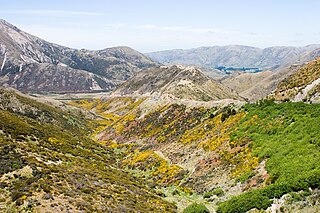
Porters Pass is a mountain pass in the Canterbury region of New Zealand's South Island.

<span class="mw-page-title-main">Mount Dobson</span> Ski field in the South Island of New Zealand

Mount Dobson is the common name for Dobson Peak as a result of being used for the name of a ski resort near Fairlie in South Canterbury, South Island of New Zealand. There is an official Mount Dobson being 702 m (2,303 ft) high at the northern end of the South Island in Marlborough District between Blenheim and Picton, and an unofficial Mount Dobson in the Southern Alps at 2,265 m (7,431 ft) only a short distance due west. Accordingly confusion could arise.

<span class="mw-page-title-main">Porters Ski Area</span> Ski field in Canterbury, New Zealand

Porters, is a commercial ski resort just over an hour's drive (98 km) west from Christchurch, in the South Island of New Zealand. Originally functioning as a club skifield, it has one beginner magic carpet, one platter tow, one chairlift and three t-bars. The difficulty of the slopes is distributed as 15% beginner, 35% intermediate and 50% advanced. Modern grooming equipment is used, and snowmaking facilities operate along the main pistes along the chairlift.

<span class="mw-page-title-main">Craigieburn Forest Park</span> Forest park in New Zealand

Craigieburn Forest Park is a protected area in the South Island of New Zealand, adjacent to Arthur's Pass National Park to the north.
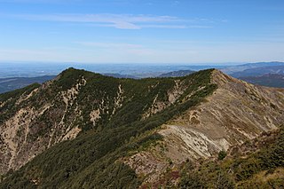
<span class="mw-page-title-main">Castle Hill Village</span> Settlement in Canterbury, New Zealand

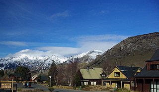
Castle Hill Village is an alpine village in Canterbury, New Zealand that was established in 1982.

<span class="mw-page-title-main">Geology of the Canterbury Region</span>

Canterbury in New Zealand is the portion of the South Island to the east of the Southern Alps / Kā Tiritiri o te Moana, from the Waiau Uwha River in the north, to the Waitaki River in the south.

<span class="mw-page-title-main">Charles Torlesse</span> New Zealand surveyor (1825–1866)

Charles Obins Torlesse was a prominent surveyor for the Canterbury Association in Canterbury, New Zealand.

<span class="mw-page-title-main">Korowai / Torlesse Tussocklands Park</span>

Korowai / Torlesse Tussocklands Park is a protected area in Canterbury, New Zealand. Covering around 21,000 hectares, it is located on both sides of State Highway 73, from east of Porters Pass to south of Castle Hill Village.

<span class="mw-page-title-main">Two Thumb Range</span> Mountain range in New Zealand

The Two Thumb Range is a range of mountains in the Canterbury Region of New Zealand's South Island. It is located to the east of Lake Tekapo and has several peaks which rise to around 2,500 metres (8,200 ft). The southern end of the range contains one of Canterbury's main skifields, Mount Dobson.

Hunters Hills is a range of mountains in South Canterbury, New Zealand.

<span class="mw-page-title-main">Mount Eglinton</span> Mountain in New Zealand

Mount Eglinton is an 1,854-metre-elevation (6,083-foot) mountain summit in the Fiordland Region of New Zealand.

<span class="mw-page-title-main">Alma (mountain)</span> Mountain in New Zealand

Alma is a 2,510-metre-elevation (8,235-foot) mountain in the Canterbury Region of New Zealand.

References

  1. Castle Hill Peak, Canterbury, NZTopoMap, Retrieved 2024-12-14.
  2. 1 2 3 4 5 6 "Castle Hill Peak, New Zealand". Peakbagger.com. Retrieved 2024-12-14.
  3. 1 2 Castle Hill Peak, New Zealand Gazetteer, Retrieved 2024-12-14.
  4. Torlesse Range, Canterbury, NZTopoMap, Retrieved 2024-12-14.
  5. 1 2 Korowai/Torlesse Tussocklands Park, Department of Conservation, Retrieved 2024-12-14.
  6. "Castle Hill Peak, Peakvisor.com" . Retrieved 2024-12-14.
  7. Lonely Planet Best Day Walks New Zealand 1, Craig McLachlan, Lonely Planet, 2021, ISBN   9781838693282.
  8. Christchurch Climate (New Zealand), climate-data.org, Retrieved 2024-12-13.
  9. The Best Time to Visit the South Island, nzpocketguide.com, Retrieved 2024-12-13.
  10. "Castle Hill Village". CastleHill.net.NZ. Retrieved 4 April 2021.