
The administrative units of Pakistan comprise four provinces, one federal territory, and two disputed territories: the provinces of Punjab, Sindh, Khyber Pakhtunkhwa, and Balochistan; the Islamabad Capital Territory; and the administrative territories of Azad Jammu and Kashmir and Gilgit–Baltistan. As part of the Kashmir conflict with neighbouring India, Pakistan has also claimed sovereignty over the Indian-controlled territories of Jammu and Kashmir and Ladakh since the First Kashmir War of 1947–1948, but has never exercised administrative authority over either region. All of Pakistan's provinces and territories are subdivided into divisions, which are further subdivided into districts, and then tehsils, which are again further subdivided into union councils.

Nowshera is the capital city of Nowshera District in the Khyber Pakhtunkhwa province of Pakistan. It is the 78th largest city in Pakistan and ninth largest city in the province of Khyber Pakhtunkhwa.

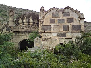
Orakzai District is a district in the Kohat Division of the Khyber Pakhtunkhwa province of Pakistan. Before 1973, it was part of FR Kohat. Up until 2018, it was an agency within the erstwhile Federally Administered Tribal Areas. However, with the merger of the FATA with Khyber Pakhtunkhwa, it attained the status of a district.
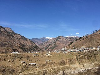
Allai is a tehsil of Allai District in Pakistan's Khyber-Pakhtunkhwa province. It is home to the Allai Valley and district headquarters. Prince Muhammad Nawaz Khan Swati is the current "Chief of Allai Valley".

Khyber District is a district in the Peshawar Division of the Khyber Pakhtunkhwa province of Pakistan. Until 2018, it was an agency of the erstwhile Federally Administered Tribal Areas. With the merger of FATA with Khyber Pakhtunkhwa in 2018, it became a district. It ranges from the Tirah valley down to Peshawar. It borders Nangarhar Province to the west, Orakzai District to the south, Kurram District to southwest, Peshawar to the east and Mohmand District to the north.

Mohmand District is a district in Peshawar Division of Khyber Pakhtunkhwa province in Pakistan. Until 2018, it was an agency of Federally Administered Tribal Areas, with merger of FATA with Khyber Pakhtunkhwa, it became a district. It was created as an agency in 1951. Mohmand is bordered by Bajaur District to the north, Khyber District to the south, Malakand and Charsadda districts to the east and Peshawar district to the southeast.
Kohat Division is one of the seven divisions in the Khyber Pakhtunkhwa province of Pakistan. It consists of five districts: Hangu, Karak, Kohat, Kurram, and Orakzai. According to the 2017 Census of Pakistan, the division had a population of 3,211,458, making it the third-least populous division in the province. Its area is 12,377 km2 (4,779 sq mi). Thus, it is also the fourth-largest division by area in the province. Kohat is the division's largest city and its namesake. Kohat city has a population of 220,000. The division borders Bannu Division to the south and west, Peshawar Division to the north and east, the province of Punjab to the east, and Afghanistan to the northwest.

Bannu Division is one of seven divisions in Pakistan's Khyber Pakhtunkhwa province. It consists of three districts: Bannu, Lakki Marwat, and North Waziristan. According to the 2017 Pakistani Census, the division had a population of 2,656,801, making it the least populous division in the province, but it spans 9,975 km2 (3,851 sq mi) of area, and this makes it the third-smallest division by area in the province. Lakki Marwat is the largest city of Bannu Division, with around 60,000 people, while the division's namesake and second-largest city is Bannu, with just under 50,000 people. The division borders Dera Ismail Khan Division to the south and west, Kohat Division to the north and east, and the province of Punjab, Pakistan to its east.
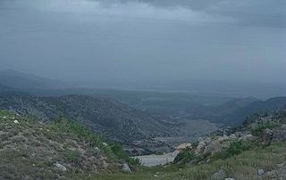
Kurram District is a district in the Kohat Division of the Khyber Pakhtunkhwa province of Pakistan.The name Kurram comes from the river Kuramá in Pashto which itself derives from the Sanskrit word Krumuḥ.

Bara Tehsil is a subdivision located in Khyber District, Khyber Pakhtunkhwa, Pakistan.
Alpuri is a tehsil located in Shangla District, Khyber Pakhtunkhwa, Pakistan. The population is 506,718 according to the 2017 census.
Wari is a tehsil located in Central Dir District, Khyber Pakhtunkhwa, Pakistan.

Charbagh is an administrative subdivision (tehsil) of Swat District in the Khyber Pakhtunkhwa province of Pakistan.
Lower Kurram Tehsil is a subdivision located in Kurram District, Khyber Pakhtunkhwa, Pakistan. The population is 136,719 according to the 2017 census.

Upper Kurram Tehsil is a subdivision located in Kurram District, Khyber Pakhtunkhwa, Pakistan. The population is 253,478 according to the 2017 census.
Kandia is a tehsil located in the Upper Kohistan District of Khyber Pakhtunkhwa, Pakistan. It consists of five union councils: Karang, Thoti, Kareen, Jashoi and Gabrial. The population is 84,055 according to the 2017 census.
Karak is a tehsil located in Karak District, Khyber Pakhtunkhwa, Pakistan. The population is 155,642 according to the 2017 census.
Behrain is a tehsil located in Swat District, Khyber Pakhtunkhwa, Pakistan. The population is 61,787, according to the 2017 census.
Utmankhel Tehsil is a subdivision located in Bajaur District, Khyber Pakhtunkhwa, Pakistan. The population is 107,356 according to the 2017 census.

