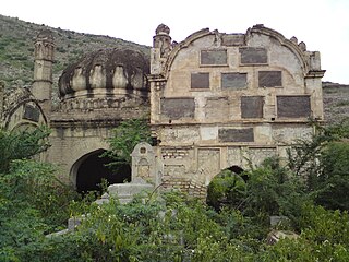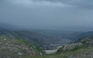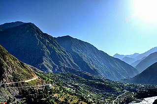
North Waziristan District is a district of Khyber Pakhtunkhwa province in Pakistan. It is the northern part of Waziristan, a mountainous region of northwest Pakistan, bordering Afghanistan and covering 4,707 square kilometres (1,817 sq mi). The capital city of North Waziristan is Miranshah.

Orakzai District is a district in the Kohat Division of the Khyber Pakhtunkhwa province of Pakistan. Before 1973, it was part of FR Kohat. Up until 2018, it was an agency within the erstwhile Federally Administered Tribal Areas. However, with the merger of the FATA with Khyber Pakhtunkhwa, it attained the status of a district.

Khyber District is a district in the Peshawar Division of the Khyber Pakhtunkhwa province of Pakistan. Until 2018, it was an agency of the erstwhile Federally Administered Tribal Areas. With the merger of FATA with Khyber Pakhtunkhwa in 2018, it became a district. It ranges from the Tirah valley down to Peshawar. It borders Nangarhar Province to the west, Orakzai District to the south, Kurram District to southwest, Peshawar to the east and Mohmand District to the north.

Mohmand District is a district in Peshawar Division of Khyber Pakhtunkhwa province in Pakistan. Until 2018, it was an agency of Federally Administered Tribal Areas, with merger of FATA with Khyber Pakhtunkhwa, it became a district. It was created as an agency in 1951. Mohmand is bordered by Bajaur District to the north, Khyber District to the south, Malakand and Charsadda districts to the east and Peshawar district to the southeast.

Kohat Division is one of the seven divisions in the Khyber Pakhtunkhwa province of Pakistan. It consists of five districts: Hangu, Karak, Kohat, Kurram, and Orakzai. According to the 2017 Census of Pakistan, the division had a population of 3,211,458, making it the third-least populous division in the province. Its area is 12,377 km2 (4,779 sq mi). Thus, it is also the fourth-largest division by area in the province. Kohat is the division's largest city and its namesake. Kohat city has a population of 220,000. The division borders Bannu Division to the south and west, Peshawar Division to the north and east, the province of Punjab to the east, and Afghanistan to the northwest.

Bannu Division is one of seven divisions in Pakistan's Khyber Pakhtunkhwa province. It consists of three districts: Bannu, Lakki Marwat, and North Waziristan. According to the 2017 Pakistani Census, the division had a population of 2,656,801, making it the least populous division in the province, but it spans 9,975 km2 (3,851 sq mi) of area, and this makes it the third-smallest division by area in the province. Lakki Marwat is the largest city of Bannu Division, with around 60,000 people, while the division's namesake and second-largest city is Bannu, with just under 50,000 people. The division borders Dera Ismail Khan Division to the south and west, Kohat Division to the north and east, and the province of Punjab, Pakistan to its east.

Kurram District is a district in the Kohat Division of the Khyber Pakhtunkhwa province of Pakistan.The name Kurram comes from the river Kuramá in Pashto which itself derives from the Sanskrit word Krumuḥ.

Bara Tehsil is a subdivision located in Khyber District, Khyber Pakhtunkhwa, Pakistan.

Datakhel or Datta Khel is a town in North Waziristan district of Khyber Pakhtunkhwa, Pakistan.
Adenzai is a tehsil located in Lower Dir District, Khyber Pakhtunkhwa Pakistan, which includes the town of Chakdara.The name adenzai is derived from Yousafzai subclan adenzai.Adenzai is subtribe of Yousafzai pashtoon. It is listed among:
- Adenzai Tehsil
- Balambat Tehsil
- Khall Tehsil
- Lal Qilla Tehsil
- Munda Tehsil
- Samar Bagh Tehsil
- Timergara Tehsil

Charbagh is an administrative subdivision (tehsil) of Swat District in the Khyber Pakhtunkhwa province of Pakistan.

Lower Kohistan District is a district in the Hazara Division of the Khyber Pakhtunkhwa province of Pakistan. The district headquarters of Lower Kohistan is Pattan.

Upper Kohistan District is a district in the Hazara Division of the Khyber Pakhtunkhwa province of Pakistan.
Birmil Tehsil is a subdivision located in Lower South Waziristan District district, Khyber Pakhtunkhwa, Pakistan. The population is 104,304 according to the 2017 census. The Tehsil has a diverse collection of vegetation.
Upper Orakzai Tehsil is a subdivision located in Orakzai District, Khyber Pakhtunkhwa, Pakistan. The population is 63,872 according to the 2017 census.
Central Kurram Tehsil is a subdivision located in Kurram District, Khyber Pakhtunkhwa, Pakistan. The population is 229,356 according to the 2017 census.

Upper Kurram Tehsil is a subdivision located in Kurram District, Khyber Pakhtunkhwa, Pakistan. The population is 253,478 according to the 2017 census.
Ghozgarhy, or Ghoz Ghari, is an area of Upper Kurram, Kurram Agency, Federally Administered Tribal Areas, Pakistan. The population is 7,349 according to the 2017 census.
Tank is a tehsil located in Tank District, Khyber Pakhtunkhwa, Pakistan.


