Interstate 5 (I-5) is the main Interstate Highway on the West Coast of the United States, running largely parallel to the Pacific coast of the contiguous U.S. from Mexico to Canada. It travels through the states of California, Oregon, and Washington, serving several large cities on the U.S. West Coast, including San Diego, Los Angeles, Sacramento, Portland, and Seattle. It is currently the only continuous Interstate highway to touch both the Mexican border and the Canadian border. Upon crossing the Mexican border at its southern terminus, Interstate 5 continues to Tijuana, Baja California as Mexico Federal Highway 1. Upon crossing the Canadian border at its northern terminus, it continues to Vancouver as British Columbia Highway 99.

Marin County is a county located in the San Francisco Bay Area of the U.S. state of California. As of the 2010 census, the population was 252,409. Its county seat is San Rafael. Marin County is included in the San Francisco-Oakland-Hayward, CA Metropolitan Statistical Area across the Golden Gate Bridge from San Francisco.

The Central Valley is a flat valley that dominates the geographical center of the U.S. state of California. It is 40 to 60 miles wide and stretches approximately 450 miles (720 km) from north-northwest to south-southeast, inland from and parallel to the Pacific Ocean coast. It covers approximately 18,000 square miles (47,000 km2), about 11% of California's total land area. The valley is bounded by the Sierra Nevada to the east and the Coast Ranges to the west.
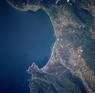
Monterey Bay is a bay of the Pacific Ocean located on the coast of the U.S. state of California. The bay is south of the major cities of San Francisco and San Jose. The county-seat city of Santa Cruz is located at the north end of the bay. The city of Monterey is on the Monterey Peninsula at the south end. The Monterey Bay Area is a local colloquialism sometimes used to describe the whole of the Central Coast communities of Santa Cruz and Monterey counties.

Bay Point, formerly West Pittsburg, is a census-designated place located in the East Bay region of the San Francisco Bay Area in Contra Costa County, California. Bay Point is just west of Pittsburg, California, and northeast of Concord, California, on the southern shore of Suisun Bay. The population of Bay Point was 21,349 as of 2010. The Pittsburg/Bay Point Station of the Bay Area Rapid Transit (BART) rail system is located adjacent to Bay Point in Pittsburg. The community is traversed by a freeway, State Route 4, the California Delta Highway. Being unincorporated, Bay Point does not have its own police department. The community is policed by the California Highway Patrol and the Contra Costa County Sheriff's Office. The ZIP code is 94565, and the area code is 925.
Redding, officially the City of Redding, is the county seat of Shasta County, California, in the northern part of the state. It lies along the Sacramento River, 162 miles north of Sacramento, and 120 miles (190 km) south of California's northern border, shared with the state of Oregon. Interstate 5 bisects the entire city, from the south to north before it approaches Shasta Lake, which is located 15 miles (24 km) to the north. The 2010 population was 89,861. Redding is the largest city in the Shasta Cascade region, and it is the sixth-largest city in the Sacramento Valley, behind Sacramento, Elk Grove, Roseville, Vacaville and Chico.

Northern California is the northern portion of the U.S. state of California. Spanning the state's northernmost 48 counties its main population centers include the San Francisco Bay Area, the Greater Sacramento area, and the Metropolitan Fresno area. Northern California also contains redwood forests, along with the Sierra Nevada, including Yosemite Valley and part of Lake Tahoe, Mount Shasta, and most of the Central Valley, one of the world's most productive agricultural regions.

Point Loma Nazarene University (PLNU) is a Christian liberal arts college. Its main campus is located on the Point Loma oceanfront in San Diego, California, United States. It was founded in 1902 as a Bible college by the Church of the Nazarene.

Point Conception is a headland along the Pacific coast of the U.S. state of California, located in southwestern Santa Barbara County. It is the point where the Santa Barbara Channel meets the Pacific Ocean, and as the corner between the mostly north-south trending portion of coast to the north and the east-west trending part of the coast near Santa Barbara, it makes a natural division between Southern and Central California, and is commonly used as such in regional weather forecasts. The Point Conception Lighthouse is at its tip.
Fleming Point is a rocky promontory in the U.S. state of California. It is situated in Albany, on the eastern shore of San Francisco Bay. Albany Bulb is an extension of the point, having been formed in the 1960s from construction debris.

Patrick's Point State Park is 25 miles (40 km) north of Eureka, California in the heart of California's coast redwood country. The State Park was named for Patrick Beegan, an Irish immigrant who originally called it Patrick's Ranch.
Point of Timber is a former settlement in Contra Costa County, California. It was located on Indian Slough 2 miles (3.2 km) north of Byron, and about 2.5 miles east of Union Cemetery in Brentwood. It was originally named Point of Timber Landing. The landing was built by Josiah Wills, who organized the deepening of Indian Slough, connecting the landing to the Old River. Point of Timber got its name from the mile wide strip of open Oak woodland that ran from just east of the house of John Marsh along the course of Arroyo del Sur to the edge of the marshes bordering Indian Slough and Old River.

Burnt Wagons is a former settlement in Inyo County, California. It was located in Death Valley 7 miles (11 km) northwest of Death Valley Junction. The name recalls the emigrants of 1849 who abandoned and burnt their wagons at the site. The site is now registered as California Historical Landmark #441. The monument's plaque reads:
BURNED WAGONS POINT Near this monument, the Jayhawker group of Death Valley Forty-Niners, gold seekers from Middle West, who entered Death Valley in 1849 seeking short route to the mines of central California, burned their wagons, dried the meat of some oxen and, with surviving animals, struggled westward on foot.
STATE REGISTERED LANDMARK NO.441
Marker placed by California Centennials Commission.
Base furnished by Death Valley '49ers, Inc.
Dedicated December 3rd, 1949
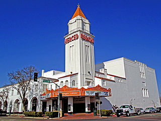
Ortigalito is a former settlement in Merced County, California. It was located 20 miles (32 km) southwest of Central Point.
Gerstle Cove State Marine Reserve (SMR) is a marine protected area that lies onshore from Salt Point State Park, within the Salt Point State Marine Conservation Area, in Sonoma County on California’s north central coast. The marine protected area covers 0.1 square miles. Gerstle Cove SMR prohibits the take of all living resources.

Duxbury Reef State Marine Conservation Area (SMCA) is a marine protected area located about 1 mile (2 km) west of Bolinas in Marin County on California’s north central coast. This marine protected area covers 0.66 square miles (1.7 km2). Duxbury Reef SMCA prohibits the take of all living marine resources, except the recreational take of finfish from shore only and the recreational take of abalone.

Salt Point State Marine Conservation Area (SMCA) is a marine protected area that lies onshore from Fisk Mill Cove and south along Salt Point State Park in Sonoma County on California’s north central coast. The marine protected area covers 3.12 square miles. Salt Point SMCA prohibits the take of all living marine resources, except the recreational take of abalone and finfish.

Estero de Limantour State Marine Reserve (SMR) and Drakes Estero State Marine Conservation Area (SMCA) are two adjoining marine protected areas along the Point Reyes National Seashore in Marin County on California’s north central coast. These marine protected areas cover a combined 4.04 square miles (10.5 km2), with 1.49 square miles (3.9 km2) in the SMR and 2.55 square miles (6.6 km2) in the SMCA. Drakes Estero SMCA prohibits the take of all living marine resources from Drakes Estero except the recreational take of clams and formerly the commercial aquaculture of shellfish pursuant to a disputed state water bottom lease and permit, which has been the subject of ongoing legal proceedings since 2012, when the lease was allowed to expire.

Point Sur State Marine Reserve (SMR) and Point Sur State Marine Conservation Area (SMCA) are two adjoining marine protected areas that lie offshore of Point Sur, part of the Big Sur area on California’s central coast. The combined area of these marine protected areas is 19.68 square miles (51.0 km2). The SMR protects all marine life within its boundaries. Fishing and take of all living marine resources is prohibited. Within the SMCA fishing and take of all living marine resources is prohibited except the commercial and recreational take of salmon and albacore.

Cisco is an unincorporated community in Placer County, California. Cisco is located on the Union Pacific Railroad, 0.5 miles (0.8 km) south-southwest of Cisco Grove. It lies at an elevation of 5938 feet.