Edendale, Merced County, California

Last updated
Edendale
Former settlement
USA California location map.svg
Red pog.svg
Edendale
Location in California
Coordinates: 37°26′55″N120°30′14″W / 37.44861°N 120.50389°W / 37.44861; -120.50389 Coordinates: 37°26′55″N120°30′14″W / 37.44861°N 120.50389°W / 37.44861; -120.50389
Country United States
State California
County Merced County
Elevation [1] 266 ft (81 m)

Edendale is a former settlement in Merced County, California. [1] It was located on the Yosemite Valley Railroad 9 miles (14 km) northeast of Atwater, [2] at an elevation of 266 feet (81 m). [1] Edendale still appeared on USGS maps as of 1917. [1]
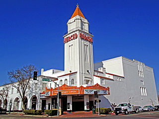
Merced County, California County in California, United States

Merced County, is a county located in the northern San Joaquin Valley section of the Central Valley, in the U.S. state of California.

California State of the United States of America

California is a state in the Pacific Region of the United States. With 39.6 million residents, California is the most populous U.S. state and the third-largest by area. The state capital is Sacramento. The Greater Los Angeles Area and the San Francisco Bay Area are the nation's second and fifth most populous urban regions, with 18.7 million and 9.7 million residents respectively. Los Angeles is California's most populous city, and the country's second most populous, after New York City. California also has the nation's most populous county, Los Angeles County, and its largest county by area, San Bernardino County. The City and County of San Francisco is both the country's second-most densely populated major city after New York City and the fifth-most densely populated county, behind only four of the five New York City boroughs.
Yosemite Valley Railroad

The Yosemite Valley Railroad (YVRR) was a short-line railroad operating from 1907 to 1945 in the state of California, mostly following the Merced River from Merced to Yosemite National Park, carrying a mixture of passenger and freight traffic. Contrary to the name of the railroad, rail service did not extend to Yosemite Valley itself, but rather ended at the park boundary as the construction of railroads is prohibited in the National Parks. Passengers would disembark at the park boundary in El Portal, CA and take a stage coach, and starting in 1913 a motor coach, to Yosemite Valley itself. With closure of the Yosemite Sugar Pine Lumber Company in 1942 and the sale of the Yosemite Portland Cement Company to the Henry J. Kaiser Company and subsequent suspension of all operations in 1944 led to a loss of most of the freight track on the railroad. This in addition to the increased competition for passengers from use along the Yosemite All-Year Highway, both commercial and private, and the substantial decrease of recreational passenger traffic because of World War II led to the downfall of the railroad. The railroad asked the Interstate Commerce Commission for permission to abandon operations on October 25, 1944. The last regularly scheduled train ran on August 24, 1945.

Related Research Articles

Edendale may refer to:

Edendale, California may refer to:

Merced Falls, California Unincorporated community in California, United States

Merced Falls is an unincorporated community in Merced County, California. It is located on the north bank of the Merced River 6 miles (9.7 km) east of Snelling, at an elevation of 348 feet . Merced Falls was named for a set of rapids on the Merced River.

Eden Landing is a former settlement in Alameda County, California. Eden Landing was located west-southwest of Mount Eden. Its site is now located within the corporate limits of Hayward. Eden Landing was established in 1854 by farmers who were dissatisfied with the freight charges at Allen's Landing, which was a quarter of a mile west. The place was bought by Richard Barron in 1855, and renamed Barrons Landing. Henry Louis Petermann and Mary F. Petermann operated their salt works here. Stokes Landing was located east of Eden Landing on Alameda Creek.

Briceburg, California Unincorporated community in California, United States

Briceburg is an unincorporated community in Mariposa County, California. It is located on the Merced River near the confluence with Bear Creek, 5 miles (8 km) north-northwest of Midpines, at an elevation of 1138 feet. It is accessed via a bridge over the Merced River that connects Highway 140 with Briceburg Road.

Arena, California Unincorporated community in California, United States

Arena is an unincorporated community in Merced County, California. It is located on the Southern Pacific Railroad 4 miles (6.4 km) west-northwest of Atwater, at an elevation of 141 feet.

Arundel, California Former settlement in California, United States

Arundel is a former settlement in Merced County, California. It was located on the Southern Pacific Railroad 7 miles (11 km) north of Atwater, at an elevation of 161 feet. Arundel still appeared on USGS maps as of 1917.

Bear Creek, Merced County, California census-designated place in California, United States

Bear Creek is a census-designated place in Merced County, California. It is located 3.5 miles (5.6 km) east of Merced, at an elevation of 190 feet. The population was 290 at the 2010 census.

Bellevue, California Former settlement in California, United States

Bellevue is a former settlement in Merced County, California. It was located on the Yosemite Valley Railroad 4 miles (6.4 km) north of Merced, at an elevation of 177 feet. Bellevue still appeared on USGS maps as of 1917.

Burchell, California Former settlement in California, United States

Burchell is a former settlement in Merced County, California. It was located on the Atchison, Topeka and Santa Fe Railroad 2.5 miles (4 km)southeast of Planada, at an elevation of 236 feet. It still appeared on USGS maps as of 1918.

Cuba, Merced County, California Former settlement in California, United States

Cuba is a former settlement in Merced County, California. It was located on the Atchison, Topeka and Santa Fe Railroad 2.25 miles (3.6 km) east-northeast of Atwater, at an elevation of 167 feet. Cuba still appeared on USGS maps as of 1918.

Fergus, California Unincorporated community in California, United States

Fergus is an unincorporated community in Merced County, California. It is located on the Southern Pacific Railroad 4.5 miles (7.2 km) east-southeast of Atwater, at an elevation of 157 feet.

Fluhr, Merced County, California Unincorporated community in California, United States

Fluhr is an unincorporated community in Merced County, California. It is located on the Atchison, Topeka and Santa Fe Railroad 2 miles (3.2 km) east-northeast of Atwater, at an elevation of 174 feet.

Kadota, California Unincorporated community in California, United States

Kadota is an unincorporated community in Merced County, California, USA. It is located on the Atchison, Topeka and Santa Fe Railroad 4 miles (6.4 km) east of Merced, at an elevation of 194 feet.

Lingard, California Unincorporated community in California, United States

Lingard is an unincorporated community in Merced County, California. It is located on the Southern Pacific Railroad 8 miles (13 km) west of Le Grand, at an elevation of 194 feet.

Nairn, California Former settlement in California, United States

Nairn is a former settlement in Merced County, California. It was located on the Southern Pacific Railroad 6 miles (9.7 km) east-northeast of Atwater, at an elevation of 187 feet. Nairn still appeared on USGS maps as of 1917.

The Grove, California Unincorporated community in California, United States

The Grove is an unincorporated community in Merced County, California. It is located 3.5 miles (5.6 km) north of Atwater, at an elevation of 197 feet.

Chester was a settlement in Merced County, California. It was located 17 miles (27 km) southwest of Merced.

Brickville is a former settlement in Merced County, California. It was located 2 miles (3.2 km) west of Merced.

References

  1. 1 2 3 4 U.S. Geological Survey Geographic Names Information System: Edendale, Merced County, California
  2. Durham, David L. (1998). California's Geographic Names: A Gazetteer of Historic and Modern Names of the State. Clovis, Calif.: Word Dancer Press. p. 769. ISBN   1-884995-14-4.