Fluhr, Merced County, California

Last updated
Fluhr
Unincorporated community
California Locator Map with US.PNG
Red pog.svg
Fluhr
Location in California
Usa edcp location map.svg
Red pog.svg
Fluhr
Fluhr (the US)
Coordinates: 37°21′46″N120°34′40″W / 37.36278°N 120.57778°W / 37.36278; -120.57778 Coordinates: 37°21′46″N120°34′40″W / 37.36278°N 120.57778°W / 37.36278; -120.57778
Country United States
State California
County Merced County
Elevation [1] 174 ft (53 m)

Fluhr is an unincorporated community in Merced County, California. [1] It is located on the Atchison, Topeka and Santa Fe Railroad 2 miles (3.2 km) east-northeast of Atwater, [2] at an elevation of 174 feet (53 m). [1]

Unincorporated area Region of land not governed by own local government

In law, an unincorporated area is a region of land that is not governed by a local municipal corporation; similarly an unincorporated community is a settlement that is not governed by its own local municipal corporation, but rather is administered as part of larger administrative divisions, such as a township, parish, borough, county, city, canton, state, province or country. Occasionally, municipalities dissolve or disincorporate, which may happen if they become fiscally insolvent, and services become the responsibility of a higher administration. Widespread unincorporated communities and areas are a distinguishing feature of the United States and Canada. In most other countries of the world, there are either no unincorporated areas at all, or these are very rare; typically remote, outlying, sparsely populated or uninhabited areas.
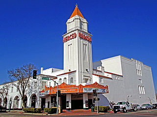
Merced County, California County in California, United States

Merced County, is a county located in the northern San Joaquin Valley section of the Central Valley, in the U.S. state of California.

California State of the United States of America

California is a state in the Pacific Region of the United States. With 39.6 million residents, California is the most populous U.S. state and the third-largest by area. The state capital is Sacramento. The Greater Los Angeles Area and the San Francisco Bay Area are the nation's second and fifth most populous urban regions, with 18.7 million and 9.7 million residents respectively. Los Angeles is California's most populous city, and the country's second most populous, after New York City. California also has the nation's most populous county, Los Angeles County, and its largest county by area, San Bernardino County. The City and County of San Francisco is both the country's second-most densely populated major city after New York City and the fifth-most densely populated county, behind only four of the five New York City boroughs.

Related Research Articles

Merced, California City and county seat in California, United States

Merced is a city in, and the county seat of, Merced County, California, United States, in the San Joaquin Valley. As of 2014, the city had a population of 81,743. Incorporated on April 1, 1889, Merced is a charter city that operates under a council-manager government. It is named after the Merced River, which flows nearby.

El Nido, Merced County, California Census designated place in California, United States

El Nido is a census-designated place in Merced County, California. It is located 15 miles (24 km) west-southwest of Le Grand, at an elevation of 141 feet, and a population of 160 The population was 330 at the 2010 census.

Cressey, California Census designated place in California, United States

Cressey is a census-designated place in Merced County, California. It is located 6 miles (9.7 km) north-northwest of Atwater, at an elevation of 167 feet. The population was 394 at the 2010 census.

Merced Falls, California Unincorporated community in California, United States

Merced Falls is an unincorporated community in Merced County, California. It is located on the north bank of the Merced River 6 miles (9.7 km) east of Snelling, at an elevation of 348 feet . Merced Falls was named for a set of rapids on the Merced River.

Fluhr may refer to:

Fluhr, Kern County, California Former settlement in California, United States

Fluhr is a former settlement in Kern County, California. It was located on the Atchison, Topeka and Santa Fe Railroad 2 miles (3.2 km) north-northwest of Edwards, at an elevation of 2372 feet. Fluhr still appeared on maps as of 1942.

Briceburg, California Unincorporated community in California, United States

Briceburg is an unincorporated community in Mariposa County, California. It is located on the Merced River near the confluence with Bear Creek, 5 miles (8 km) north-northwest of Midpines, at an elevation of 1138 feet. It is accessed via a bridge over the Merced River that connects Highway 140 with Briceburg Road.

Bear Creek, Merced County, California census-designated place in California, United States

Bear Creek is a census-designated place in Merced County, California. It is located 3.5 miles (5.6 km) east of Merced, at an elevation of 190 feet. The population was 290 at the 2010 census.

Bellevue, California Former settlement in California, United States

Bellevue is a former settlement in Merced County, California. It was located on the Yosemite Valley Railroad 4 miles (6.4 km) north of Merced, at an elevation of 177 feet. Bellevue still appeared on USGS maps as of 1917.

Brito, California Unincorporated community in California, United States

Brito is an unincorporated community in Merced County, California. It is located on the Southern Pacific Railroad 4.5 miles (7.2 km) west of Dos Palos, at an elevation of 108 feet.

Buhach, California Unincorporated community in California, United States

Buhach is an unincorporated community in Merced County, California. It is located 2 miles (3.2 km) east-southeast of Atwater, at an elevation of 157 feet.

Burchell, California Former settlement in California, United States

Burchell is a former settlement in Merced County, California. It was located on the Atchison, Topeka and Santa Fe Railroad 2.5 miles (4 km)southeast of Planada, at an elevation of 236 feet. It still appeared on USGS maps as of 1918.

Calpack, California Unincorporated community in California, United States

Calpack is an unincorporated community in Merced County, California. It is located 2 miles (3.2 km) west of Planada, at an elevation of 213 feet. The community was named for the California Packing Corporation. It has a population of 50.

Cuba, Merced County, California Former settlement in California, United States

Cuba is a former settlement in Merced County, California. It was located on the Atchison, Topeka and Santa Fe Railroad 2.25 miles (3.6 km) east-northeast of Atwater, at an elevation of 167 feet. Cuba still appeared on USGS maps as of 1918.

Edendale, Merced County, California Former settlement in California, United States

Edendale is a former settlement in Merced County, California. It was located on the Yosemite Valley Railroad 9 miles (14 km) northeast of Atwater, at an elevation of 266 feet. Edendale still appeared on USGS maps as of 1917.

Fergus, California Unincorporated community in California, United States

Fergus is an unincorporated community in Merced County, California. It is located on the Southern Pacific Railroad 4.5 miles (7.2 km) east-southeast of Atwater, at an elevation of 157 feet.

Kadota, California Unincorporated community in California, United States

Kadota is an unincorporated community in Merced County, California, USA. It is located on the Atchison, Topeka and Santa Fe Railroad 4 miles (6.4 km) east of Merced, at an elevation of 194 feet.

Trent, California Unincorporated community in California, United States

Trent is an unincorporated community in Merced County, California. It is located on the Southern Pacific Railroad 2 miles (3.2 km) northwest of Los Banos, at an elevation of 121 feet.

Brickville is a former settlement in Merced County, California. It was located 2 miles (3.2 km) west of Merced.

References

  1. 1 2 3 U.S. Geological Survey Geographic Names Information System: Fluhr, Merced County, California
  2. Durham, David L. (1998). California's Geographic Names: A Gazetteer of Historic and Modern Names of the State. Clovis, Calif.: Word Dancer Press. p. 773. ISBN   1-884995-14-4.