Castle Gardens, California

Last updated
Castle Gardens
Unincorporated community
California Locator Map with US.PNG
Red pog.svg
Castle Gardens
Location in California
Usa edcp location map.svg
Red pog.svg
Castle Gardens
Castle Gardens (the US)
Coordinates: 37°21′24″N120°34′51″W / 37.35667°N 120.58083°W / 37.35667; -120.58083 Coordinates: 37°21′24″N120°34′51″W / 37.35667°N 120.58083°W / 37.35667; -120.58083
Country United States
State California
County Merced County
Elevation [1] 167 ft (51 m)

Castle Gardens is an unincorporated community in Merced County, California. [1] It is located 1.5 miles (2.4 km) east-northeast of Atwater, [2] at an elevation of 167 feet (51 m). [1]

Unincorporated area Region of land not governed by own local government

In law, an unincorporated area is a region of land that is not governed by a local municipal corporation; similarly an unincorporated community is a settlement that is not governed by its own local municipal corporation, but rather is administered as part of larger administrative divisions, such as a township, parish, borough, county, city, canton, state, province or country. Occasionally, municipalities dissolve or disincorporate, which may happen if they become fiscally insolvent, and services become the responsibility of a higher administration. Widespread unincorporated communities and areas are a distinguishing feature of the United States and Canada. In most other countries of the world, there are either no unincorporated areas at all, or these are very rare; typically remote, outlying, sparsely populated or uninhabited areas.
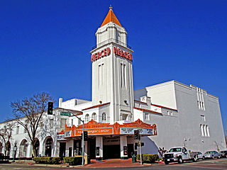
Merced County, California County in California, United States

Merced County, is a county located in the northern San Joaquin Valley section of the Central Valley, in the U.S. state of California.

California State of the United States of America

California is a state in the Pacific Region of the United States. With 39.6 million residents, California is the most populous U.S. state and the third-largest by area. The state capital is Sacramento. The Greater Los Angeles Area and the San Francisco Bay Area are the nation's second and fifth most populous urban regions, with 18.7 million and 8.8 million residents respectively. Los Angeles is California's most populous city, and the country's second most populous, after New York City. California also has the nation's most populous county, Los Angeles County, and its largest county by area, San Bernardino County. The City and County of San Francisco is both the country's second-most densely populated major city after New York City and the fifth-most densely populated county, behind only four of the five New York City boroughs.

Castle Gardens is near Castle Air Force Base. [2]

Related Research Articles

Glamis, California Unincorporated community in California, United States

Glamis is an unincorporated community in Imperial County, California. It is located 22 miles (35 km) northeast of Holtville, at an elevation of 335 feet.

Garden Valley, Yuba County, California Former settlement in California, United States

Garden Valley is a former settlement in Yuba County, California. It was located 3.25 miles (5.2 km) west-southwest of Camptonville, at an elevation of 1909 feet. It was inundated by Bullards Bar Reservoir.

Rose Garden is a former settlement in Yolo County, California. It was located on the railroad half a mile northwest of Mikon.

Garden Valley, El Dorado County, California Unincorporated community in California, United States

Garden Valley is an unincorporated community in El Dorado County, California. It is located on Johntown Creek 6.25 miles (10 km) north-northwest of Chili Bar, at an elevation of 1949 feet.

Kelsey, California Unincorporated community in California, United States

Kelsey is an unincorporated community in El Dorado County, California. It is located 2 miles (3.2 km) north of Chili Bar, at an elevation of 1923 feet.

Volcanoville, California Unincorporated community in California, United States

Volcanoville is an unincorporated community in El Dorado County, California. It is located 6 miles (9.7 km) north-northeast of Georgetown, at an elevation of 2992 feet.

Old Fig Garden, California census-designated place in California, United States

Old Fig Garden is a census-designated place in Fresno County, California. It lies at an elevation of 312 feet. The city of Fresno, through annexations, has entirely circled Fig Garden. Old Fig Garden's population was 5,365 at the 2010 census.

Figarden, California Unincorporated community in California, United States

Figarden is an unincorporated community in Fresno County, California. It is located 6 miles (9.7 km) northwest of downtown Fresno, at an elevation of 315 feet.

Sailors Flat is a former settlement and mining camp in El Dorado County, California. It was located 2 miles (3.2 km) southeast of Garden Valley.

Aerial Acres, California Unincorporated community in California, United States

Aerial Acres is a fly-in unincorporated community in Kern County, California. It is located 5.5 miles (9 km) east-southeast of Castle Butte, at an elevation of 2,428 feet (740 m). It was noted as "a desert town at Clay Mine Road and Sequoia in Peerless Valley, California.

North Muroc, California Former settlement in California, United States

North Muroc is a former settlement in Kern County, California. It was located 8 miles (13 km) south-southeast of Castle Butte, at an elevation of 2290 feet. North Muroc still appeared on maps as of 1947.

Winter Garden is a former settlement in Kern County, California. It was located south of Alameda. It flourished during 1888 and 1889.

Castle Rock Springs, California Unincorporated community in California, United States

Castle Rock Springs is an unincorporated community in Lake County, California. It is located 3 miles (4.8 km) south of Whispering Pines, at an elevation of 2349 feet.

Pole Garden, California Unincorporated community in California, United States

Pole Garden is an unincorporated community in Lake County, California. It is located near the Colusa County line 14 miles (23 km) north of Clearlake Oaks, at an elevation of 3435 feet.

River Garden, California Former settlement in California, United States

River Garden is a former settlement in Mendocino County, California. It was located on the railroad and on the South Fork of the Eel River 3.5 miles (5.6 km) south-southeast of Spyrock, at an elevation of 797 feet. It still appeared on maps as of 1952.

Gracey is a former settlement in Merced County, California. It was located near the site of present-day Castle Gardens.

Castle Hill, California census-designated place in California, United States

Castle Hill is a census-designated place in Contra Costa County, California. Castle Hill sits at an elevation of 302 feet (92 m). The 2010 United States census reported Castle Hill's population was 1,299.

Massack, California Unincorporated community in California, United States

Massack is an unincorporated community in Plumas County, California. It lies at an elevation of 3642 feet. Massack is located on the Western Pacific Railroad, 3.5 miles (5.6 km) northwest of Spring Garden. California State Route 89 runs through Massack.

Castle Garden, Indiana Unincorporated community in Indiana, United States

Castle Garden is an unincorporated community in Ohio Township, Warrick County, in the U.S. state of Indiana.

References

  1. 1 2 3 U.S. Geological Survey Geographic Names Information System: Castle Gardens, California
  2. 1 2 Durham, David L. (1998). California's Geographic Names: A Gazetteer of Historic and Modern Names of the State. Clovis, Calif.: Word Dancer Press. p. 755. ISBN   1-884995-14-4.