Palo Alto is a charter city located in the northwest corner of Santa Clara County, California, United States, in the San Francisco Bay Area. Palo Alto means tall stick in Spanish; the city is named after a coastal redwood tree called El Palo Alto.

Palos Verdes Estates is a city in Los Angeles County, California, United States, situated on the Palos Verdes Peninsula. The city was master-planned by the noted American landscape architect and planner Frederick Law Olmsted Jr. The city is located along the Southern California coastline of the Pacific Ocean.

Rancho Palos Verdes is a city in Los Angeles County, California atop the Palos Verdes Hills and bluffs of the Palos Verdes Peninsula. A suburb of Los Angeles, it is known for expensive homes amidst large tracts of open space with expansive views of the Pacific Ocean. Rancho Palos Verdes is translated as "Ranch of Green Sticks", probably referring to the willows in the northeastern part of Bixby Slough shown on earlier maps.

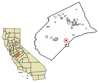
South Dos Palos is a census-designated place (CDP) in Merced County, California, United States. South Dos Palos is located 2 miles (3.2 km) southwest of Dos Palos, at an elevation of 118 feet. The population was 1,620 at the 2010 census, up from 1,385 at the 2000 census.

Blythe is a city in Riverside County, California, United States, in the Palo Verde Valley of the Lower Colorado River Valley region, an agricultural area and part of the Colorado Desert along the Colorado River, approximately 224 miles (360 km) east of Los Angeles and 150 miles (240 km) west of Phoenix. Blythe was named after Thomas H. Blythe, a San Francisco financier, who established primary water rights to the Colorado River in the region in 1877. The city was incorporated on July 21, 1916. The population was 20,817 at the 2010 census.

East Palo Alto is a city in San Mateo County, California, United States. As of the 2010 census, the population of East Palo Alto was 28,155. It is situated on the San Francisco Peninsula, roughly halfway between the cities of San Francisco and San Jose. To the north and east is the San Francisco Bay, to the west is the city of Menlo Park, and to the south the city of Palo Alto. Despite being called "East" Palo Alto, the city is directly north of Palo Alto. While often incorrectly assumed to be part of the city of Palo Alto, East Palo Alto has always been a separate entity since its founding as an unincorporated community until its incorporation in July 1983. It is also in San Mateo County, while Palo Alto is in Santa Clara County. The two cities are separated only by San Francisquito Creek and, largely, the Bayshore Freeway. The revitalization projects in 2000, and high income high-tech professionals moving into new developments, including employees from Google and Facebook, have begun to eliminate the cultural and economic differences between the two cities. East Palo Alto and Palo Alto share both telephone area codes and postal ZIP codes.

Palo Cedro (Cedarwood) is a census-designated place (CDP) in Shasta County, California, United States. The population was 1,269 at the 2010 census, up from 1,247 at the 2000 census. It is 8 miles (13 km) east of Redding, California. The communities of Bella Vista, Millville, Shingletown, Oak Run, Whitmore, and Round Mountain lie within a 15-mile (24 km) radius.

The Palos Verdes Peninsula is a landform and a geographic sub-region of the Los Angeles metropolitan area, within southwestern Los Angeles County in the U.S. state of California. Located in the South Bay region, the peninsula contains a group of affluent cities in the Palos Verdes Hills, including Palos Verdes Estates, Rancho Palos Verdes, Rolling Hills and Rolling Hills Estates. The South Bay city of Torrance borders the peninsula on the north, the Pacific Ocean is on the west and south, and the Port of Los Angeles is east. The population of the Palos Verdes Peninsula is 42,364.
Susie Frankeberger is a television news reporter who worked for CBS affiliate KGPE, Channel 47, in Fresno, California, from 1998 to 2008.
The Palo Alto Unified School District is a public school district located near Stanford University in Palo Alto, California. It consists of twelve primary schools, three middle schools, two high schools, and an adult school.
Stanley Craig "Stan" Holmes was a college and minor league baseball outfielder who is most notable for winning the College World Series MVP award in 1981.

Brito is an unincorporated community in Merced County, California. It is located on the Southern Pacific Railroad 4.5 miles (7.2 km) west of Dos Palos, at an elevation of 108 feet.
Dos Palos Y is a census-designated place in Merced County, California. It is located 11.5 miles (19 km) east of Los Banos, 4.8 miles north of Dos Palos, the intersection of California Highways 33 and 152, at an elevation of 112 feet. The population was 323 at the 2010 census.

Santa Rita Park is an unincorporated community in Merced County, California. It is located 2.25 miles (4 km) east of Dos Palos Y, at an elevation of 118 feet.
Elgin is a former settlement in Merced County, California. It was located 3.5 miles (5.6 km) southwest of Dos Palos.
Agatha is a former settlement in Merced County, California. It was located 7 miles (11 km) east-southeast of Los Banos between Los Banos and South Dos Palos.

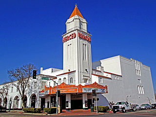
Merced College is a public community college in Merced, California.

The Palo Verde Valley is located in the Lower Colorado River Valley, next to the eastern border of Southern California with Arizona, United States. It is located on the Colorado Desert within the Sonoran Desert south of the Parker Valley. Most of the valley is in Riverside County, with the southern remainder in Imperial County. La Paz County borders to the east on the Colorado River.