Cerro Mesa Ahumada

Last updated
Cerro Mesa Ahumada
Cerro Mesa Ahumada (3).JPG
Cerro Mesa Ahumada
Highest point
Elevation 2,600 m (8,500 ft)
Coordinates 19°54′4″N99°11′11″W / 19.90111°N 99.18639°W / 19.90111; -99.18639 Coordinates: 19°54′4″N99°11′11″W / 19.90111°N 99.18639°W / 19.90111; -99.18639
Naming
English translationMesa Ahumada Hill
Language of name Spanish
Geography
Mexico Estado de Mexico location map.svg
Red triangle with thick white border.svg
Cerro Mesa Ahumada
Mexico relief location map.jpg
Red triangle with thick white border.svg
Cerro Mesa Ahumada
Cerro Mesa Ahumada (Mexico)

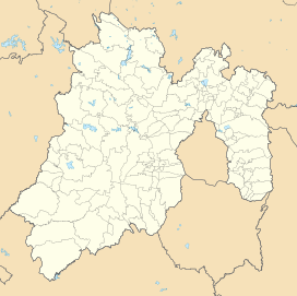
Cerro Mesa Ahumada (Mesa Ahumada Hill), also known as Cerro Colorado, is a hill located in the northern region of the State of Mexico (Estado de Mexico or Edomex). It is located between the municipalities of Tequixquiac and Apaxco. [1]

Contents

This hill has a maximum elevation of 2,600 metres (8,500 ft) above sea level [2] and is located at a southern pass leading out of the Mezquital Valley.

Geology

This hill once had natural springs running down but has since then dried up. The land is mainly composed of volcanic rock, and the soil is classified as durisol, phaeozem, and vertisol. [3]

Archaeological Site

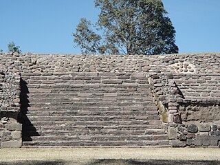
Archaeological site named Los Mogotes. Los Mogotes, Ceero Mesa Ahumada.jpg
Archaeological site named Los Mogotes.
Petroglyphs on the rocks. Petroglifo en Cerro Mesa Ahumada.JPG
Petroglyphs on the rocks.

On the high mesa, there is an archaeological site named Los Mogotes. [4] It was occupied by Otomian-Nahua tribes. A few simple pre-Hispanic basements still exists on the northwest side of the mesa, along with some petroglyphs on the rocks. [5]

Los Mogotes was discovered in 1984 by the locals. When archaeologists from INAH visited this area, it was located on the hillside of Cerro Mesa Ahumada at approximately 2,250 metres (7,380 ft) above sea level. [6]

Los Mogotes has 8 basements and a small platform, corresponding to the so-called Coyotlatelco and Mazapa of the late classic or epiclassical period (800-1000 a.C).

This site was possibly built for military activities for lookouts by the Chichimeca people with astronomical observations, funeral activities, and housing. The location has suffered from looting, but archaeologists found valuable items such as obsidian, stone utensils, human bones, and mud bow. [7]

The eastern hillsides have petroglyphs, anthropomorphic figures of men and women, the engraving of Tōnatiuh or Tonalli, a Nahui Ollin, and concentric cross symbols that probably represent stars or locations. [8]

The surroundings of the mesa were probably used by many nomadic groups, soldiers, and merchants, to observe the valleys. So it was an important location to defend and keep watch.

In Tequixquiac (altepetl) many clashes occurred with Otomis, Aztecs, Tlaxcaltecs, Texcoco, and Otumba people. This site on the mesa was necessary for watching out for people and warriors. [9]

Flora & Fauna

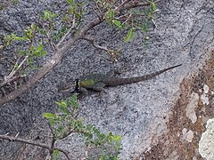
Cerro Mesa Ahumada is in the Central Mexican Plateau, where there is a diversity in plants and animals due to the region's temperate and semi-arid climate. [10] [11]

The native plants and trees in this area include:

Native Plants: Century Plant, Cholla, Prickly Pear, Golden Barrel Cactus, Fencepost Cactus, Bilberry Cactus, Mexican Creeping Zinnia, Creosote Bush, Pipicha, Creeping False Holly, Tule, Reed, Barrel Cactus, and Fern.

Trees: Kidneywood Tree, Mesquite, Netleaf oak (also known as Quercus Rugosa), Tepozán, Needle Bush

Fruit Trees: Tejocote, Capulin, and White Sapote.

Foreign Trees: Pirul and Eucalypt.

The fauna in Mesa Ahumada include:

Mammals: Cacomistle, Skunk, Gopher, Virginia Opossum, Rabbit, Mexican Gray Squirrel, Bat, and Mexican Hare.

Native birds: Turkey, Colibri, Turkey Vulture, Northern mockingbird, The Red Warbler, Rufous-crowned Sparrow, Lesser Roadrunner, Great Horned Owl, and Savannah Sparrow.

Reptiles: Rattlesnake, Pine Snake, Xincoyote, and Chirrionera Snake.

Amphibians: Axolotl, Frog, and Toad.

Insects: Red Ant, Bee, Firefly, etc.

A few animals have gone extinct and existed in the past. These include Coyote, Bobcat and Gray Fox.

Hillside Sports

The landscape around this hill is often used by international sports competitions such as Vuelta Sacra , a mountain bike competition.

Environmental Damage

Huehuetoca. Mesa Ahumada, Huehuetoca (1).jpg
Huehuetoca.

The landscape has degraded to a great extent, mainly due to an attempt at urban development in several parts of Ahumada hill.

A construction company, Wilk SA, [12] planned to construct housing units in several parts of Ahumada hill by invading the natural landscape. And this was possible due to negligence and corruption of the PAN and PRI, Tequixquiac, and Apaxco mayors.

Such development has deteriorated the natural environment over the years.

See also

Related Research Articles

<span class="mw-page-title-main">Cerro de la Estrella (archaeological site)</span>

Cerro de la Estrella is a Mesoamerican archaeological site located in southeastern Central Mexico's Valley of Mexico, in the Iztapalapa alcaldía of Mexico City at an elevation of 2460 meters (8070 ft) above sea level, hence its Summit is 224 m over the Valley of Mexico level. At the southeast edge of what was the Great Texcoco Lake.

<span class="mw-page-title-main">Atlacomulco</span> Municipality in State of Mexico, Mexico

Atlacomulco is one of 125 municipalities in the State of Mexico located in the northwest of the State of Mexico in central Mexico, 63 kilometres (39 mi) from the state capital of Toluca. The municipal seat is the city of Atlacomulco de Fabela. The name is derived from the Nahuatl phrase "atlacomulli" which means "where there are wells." The city, with a population of 109,384 is surrounded by rural area in which 75% of the rest of the municipality lives. The municipality has a sizable percentage of indigenous language speakers, mostly Mazahua. The Mazahua name for the area is Embaró, which means "colored rock." Agriculture is still the main economic activity, but the development of a number of industrial parks, such as Atlacomulco 2000, which allowed the seat to reach city statues by 1987. Atlacomulco is also the origin of a political organization called the "Atlacomulco Group" made up of powerful political figures who deny its existence.

<span class="mw-page-title-main">San Jose Ojos de Agua, El Salvador</span> Municipality in Chalatenango, El Salvador

San Jose Ojos de Agua is a municipality is located in the department of Chalatenango in the North of El Salvador

<span class="mw-page-title-main">Tequixquiac</span> Municipality in State of Mexico, Mexico

Tequixquiac is a municipality located in the Zumpango Region of the State of Mexico in Mexico. The municipality is located 84 kilometres (52 mi) north of Mexico City within the valley that connects the Valley of Mexico with the Mezquital Valley. The name comes from Nahuatl and means "place of tequesquite waters". The municipal seat is the town of Santiago Tequixquiac, although both the town and municipality are commonly referred to as simply "Tequixquiac".

Eduardo Luis Pareyón Moreno was a Mexican architect and archaeologist. He was a pioneer researcher in several aspects of modern Mexican archaeology. He was born in Azcapotzalco, Federal District, to a family renowned for its contributions to the humanities and sciences.

<span class="mw-page-title-main">Huehuetoca</span> Town & Municipality in State of Mexico, Mexico

Huehuetoca is a municipio (municipality) in State of Mexico, central Mexico, and also the name of its largest town and municipal seat.

<span class="mw-page-title-main">Apaxco</span> Municipality and town in Mexico, Mexico

Apaxco is a municipality located in the Zumpango Region in Mexico. The municipal territory is located at a southern pass leading out of the Mezquital Valley about 288 km (179 mi) northeast of the state capital of Toluca. The name Apaxco comes from Nahuatl.

<span class="mw-page-title-main">Teotenango</span> Pre-hispanic fortified city in the Valley of Toluca

Teotenango was an important pre-Hispanic fortified city located in the southern part of the Valley of Toluca. It was initially founded during the last stages of the Teotihuacan civilization by a group generally referred to as the “Teotenancas.” Later, the Matlatzincas conquered the city and expanded it. The city existed for about 1,000 years, being abandoned only after the Spanish Conquest of the Aztec Empire.
<span class="mw-page-title-main">El Conde</span>

El Conde is an archeological site located at Ozumba Street, El Conde, three block north the Mayo 1 Ave., in the municipality of Naucalpan, Mexico State.

<span class="mw-page-title-main">Huamelulpan (archaeological site)</span> Archaeological site in Oaxaca, Mexico

Huamelulpan is an archaeological site of the Mixtec culture, located in the town of San Martín Huamelulpan at an elevation of 2,218 metres (7,277 ft), about 96 kilometres (60 mi) north-west of the city of Oaxaca, the capital of Oaxaca state.

<span class="mw-page-title-main">Santiago Apóstol Parish (Tequixquiac)</span> Church in Santiago Tequixquiac, Mexico

Santiago Apóstol parish is the Catholic church and parish house of the people of downtown Santiago Tequixquiac, in the Diocese of Cuautitlán in Mexico It is dedicated to Saint James Apostle and includes a sanctuary where the image of Lord of the Chapel is venerated. It is located in the center of town, near Plaza Cuautémoc, by Juárez Avenue. The colonial building in the municipality of Tequixquiac is a monument of great architectural importance, remaining intact to this day.

<span class="mw-page-title-main">Tlapanaloya</span> Town in State of Mexico, Mexico

Tlapanaloya is a town in the municipality of Tequixquiac in Mexico State in Mexico. The town is bordered on the north La Heredad Ranch ranching The Homestead, south to the Tajo de Tequixquiac, east village Hueypoxtla and west by the town of Santiago Tequixquiac. The name Tlapanaloya is a Nahuatl toponymy, means Place where is broken stones, te- is stone, tlapana is to brake, loyan is place.

<span class="mw-page-title-main">Cerro de la Estrella National Park</span>

Cerro de la Estrella National Park is centered on the Cerro de la Estrella mountain which is located entirely within eastern Mexico City, in the borough of Iztapalapa.

<span class="mw-page-title-main">Hueypoxtla Municipality</span> Municipality in Mexico State, Mexico

Hueypoxtla is a municipality located in the Zumpango Region, the northeastern part of the state of Mexico in Mexico. The municipality is located at a northern pass leading out of the Valley of Mexico and Mezquital Valley. The name comes from Nahuatl meaning "place of great merchants".

<span class="mw-page-title-main">Zumpango Region</span>

Zumpango is a region, located in the north of the State of Mexico in the country of the same name. It is also known as the Region XVI Zumpango and has seen major population growth. It has a surface area of 8.305 km² and occupies 12.8% of the state's territory. The seat of Zumpango Region is Zumpango de Ocampo city.

<span class="mw-page-title-main">Santiago Tequixquiac</span> Municipal Seat in State of Mexico, Mexico

Santiago Tequixquiac or, is a town and municipal seat from municipality of Tequixquiac in the State of Mexico, in Mexico. As of 2010, the village had a total population of 22,676.

Teotlalpan was the pre-Columbian name of a region in the north of Valley of Mexico comprising what is today the Mezquital Valley in the state of Hidalgo and adjacent areas in the State of Mexico. The region was one of two regions settled by Otomí people, the other being the region around Jilotepec and Tula, Hidalgo. In the 18th century the name of the main part of the region came to be known as Mezquital.

<span class="mw-page-title-main">El Crucero, Tequixquiac</span> Town in State of Mexico, Mexico

El Crucero is a village in the Tequixquiac municipality, Mexico State in Mexico. The town is bordered on the north La Heredad Ranch, south to the town of Santiago Tequixquiac, east town of Tlapanaloya and west by the Apaxco municipality.

Harumi Fujita is a Japanese researcher of Mexican archaeology, who has specialized in pre-classical period of the northern states of Baja California and Baja California Sur. Her research has shown that fishing cultures had arisen in the area at the end of the Pleistocene period, indicating an occupation from at least 11,000 years ago. In a cave shelf known as the Babisuri Shelter, radiocarbon dating indicated the area may have been occupied 40,000 years ago.

<span class="mw-page-title-main">Sierra de Guadalupe, Mexico</span> Mountain range along Central Mexico

The Sierra de Guadalupe is a mountain range in Mexico. It is found between the borough of Gustavo A. Madero in northern Mexico City and the municipalities of Cuautitlán Izcalli, Tultitlán, Coacalco, Ecatepec and Tlalnepantla, in the State of Mexico. Its highest peak is at 3,055 meters (10,023 ft).

References

  1. Díaz, Por Jerónimo (2011-11-22). "Los habitantes de Apaxco en defensa del Cerro Colorado y del bien común • SubVersiones". SubVersiones (in Spanish). Retrieved 2021-09-23.
  2. "Reforestan el Cerro de la Mesa con especies autóctonas". www.milenio.com (in Mexican Spanish). Retrieved 2021-09-23.
  3. "Archived copy" (PDF). Archived from the original (PDF) on 2016-08-08. Retrieved 2016-05-24.{{cite web}}: CS1 maint: archived copy as title (link)
  4. Plan de desarrollo municipal, Tequixquiac Archived 2014-04-30 at the Wayback Machine Page 9, May 22, 2016.
  5. Rodríguez Peláez, Maria Elena, Monografía municipal de Tequixquiac, Historia, Instituto Mexiquense de Cultura, Toluca de Lerdo, 1999. p.p. 78.
  6. El sitio arqueológico de Tequixquiac, México. López Warrio, Luis Alberto, Ortuño Cos, Francisco and Pulido Mendez, Salvador. INAH. 1985.
  7. El sitio arqueológico de Tequixquiac, México. López Warrio, Luis Alberto, Ortuño Cos, Francisco and Pulido Mendez, Salvador. INAH. 1985. pp. 35-38.
  8. El sitio arqueológico de Tequixquiac, México. López Warrio, Luis Alberto, Ortuño Cos, Francisco and Pulido Mendez, Salvador. INAH. 1985. pp. 39-41.
  9. Rodríguez Peláez, Maria Elena, Monografía municipal de Tequixquiac, Historia, Instituto Mexiquense de Cultura, Toluca de Lerdo, 1999. p.p. 81.
  10. Montiel, Rodrigo Cruz (2014-03-03). "Paso Mexiquense". Mi Ambiente (in Spanish). Retrieved 2021-09-23.
  11. "El cerro de la "mesa ahumada"". dondeescurreelagua.blogspot.mx (in Spanish). Retrieved 2021-09-23.
  12. "Lucha". 29 May 2015.