North Bengal is a term used for the north-western part of Bangladesh and northern part of West Bengal. The Bangladesh part denotes the Rajshahi Division and Rangpur Division. Generally, it is the area lying west of Jamuna River and north of Padma River and includes the Barind Tract. The West Bengal part denotes Jalpaiguri Division and the Malda division together. The Bihar parts include the Kishanganj district. It also includes parts of Darjeeling Hills. Traditionally, the Ganga River divides Bengal into South Bengal and North Bengal, divided again into Terai and Dooars regions. Jalpesh and jatileswar are some of the most popular sacred places.

Raiganj is a city and a municipality in the Indian state of West Bengal. It is the headquarters of the Uttar Dinajpur district. The police station was set up 125 years ago and railway connectivity reached the place 115 years ago. The city houses the 111-year-old Raiganj Coronation High School and more than 50-years-old government primary Raiganj Sarala Sundari GSFP School. Raiganj got its railway connection in 1896. The train used to go to Parbatipur junction in Bangladesh from Raiganj. It is a 200-year-old town.

Dalkhola is a city and a municipality of Uttar Dinajpur district in the state of West Bengal, India.
Gangarampur is one of the cities and a municipality in Dakshin Dinajpur district in the state of West Bengal, India. Buniadpur is the headquarters of the Gangarampur subdivision. The city is located on the bank of river Punarbhaba. Gangarampur is one of the major cities connected through National Highway 512. It became the subdivision of newly formed district Dakshin Dinajpur when Paschim Dinajpur was bifurcated into Uttar and Dakshin Dinajpur in 1992.

The 12343 / 12344 Sealdah-Haldibari-Sealdah Darjeeling Superfast Mail is one of the oldest running legendary trains in India which connects Haldibari via Barddhaman, Malda Town, New Jalpaiguri, and Jalpaiguri. This is a major train for Kolkata–Siliguri route. It is also the first train to run with AC electric loco WAP-7 in Sealdah to New-Jalpaiguri stretch.

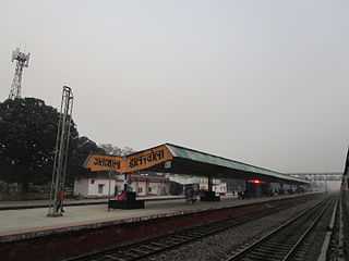
Dalkholarailway station is a railway station in Dalkhola, Uttar Dinajpur district, West Bengal, India. It is a standard II-R interlocked roadside station situated on electrified double line section at 43 metres above sea level. It also serves as a prominent rakepoint and the entry to the rest of the NFR. This station lies on Howrah–New Jalpaiguri line, Barauni–Guwahati line and Katihar-Siliguri line under Katihar railway division of Northeast Frontier Railway.

Gangarampur is a community development block that forms an administrative division in Gangarampur subdivision of Dakshin Dinajpur district in the Indian state of West Bengal.

Gour Express is an express train of the Indian Railways connecting Kolkata with the district of Malda. The train covers a distance of 349.6 km (217 mi) up to Malda with the numbers 13153/54. Previously there was an additional link service of 109 km (68 mi) which used to run with the 55421/22 Malda Town–Balurghat passenger.

The Howrah–New Jalpaiguri line is a railway line connecting Howrah with New Jalpaiguri in North Bengal in the Indian state of West Bengal. The line continues through North Bengal and western part of Assam to connect with Guwahati. The Naihati–Bandel link allows trains from another terminus Sealdah in Calcutta to use this route. The line uses a major part of the Barharwa–Azimganj–Katwa loop. Many trains use an alternative line between Howrah and New Farakka, via Bardhaman and Rampurhat. Other parts of West Bengal and Bihar are well-connected to this line. It is under the administrative jurisdiction of Eastern Railway and Northeast Frontier Railway.

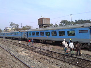
The Howrah–New Jalpaiguri Shatabdi Express is a Shatabdi class train of Indian Railways connecting Kolkata and Siliguri, West Bengal's two most important cities. It is the second fastest train after Howrah–New Jalpaiguri Vande Bharat Express in the Howrah – New Jalpaiguri section covering a distance of 561 km in a span of about 8 hours.

The 12377 / 12378 Padatik Superfast Express is a daily Superfast train which runs between Sealdah in West Bengal and New Alipurduar in West Bengal via Barddhaman, Malda Town, New Jalpaiguri, Mathabhanga & New Cooch Behar in West Bengal.

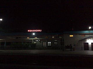
Kishanganj railway station serves Kishanganj city in Kishanganj district in the Indian state of Bihar. It is one of the important railway station, as it lies on the important railway lines, they are Howrah–New Jalpaiguri line, Katihar–Siliguri line, and Barauni–Guwahati line. The famous Gaisal train disaster occurred at Gaisal railway station near Kishanganj.
Thakurganj railway station serves Thakurganj town in Kishanganj district in the Indian state of Bihar. The Mechi flowing nearby forms the boundary between Nepal and India in the area. On the other side of the border lies Prithivinagar town of Nepal.

The 13149 / 50 Kanchan Kanya Express is an Express train belonging to Indian Railways – Eastern Railway zone that connects the cities of Kolkata and Alipurduar via Siliguri. It runs between Sealdah and Alipurduar Junction in Indian state of West Bengal. This train runs through the beautiful Dooars region of West Bengal between Siliguri Junction and Alipurduar which includes Mahananda Wildlife Sanctuary, Sevoke Railway Bridge, River Teesta, River Jaldhaka, River Torsha, Dooars-Terai tea gardens, Gorumara National Park, Buxa Tiger Reserve, Jaldapara National Park, Chapramari Wildlife Sanctuary etc.

The 13147 / 13148 Sealdah–Bamanhat Uttar Banga Express is a daily non-superfast train that runs between Sealdah & Bamanhat via Dakshineswar, Barddhaman, Bolpur, Malda Town, New Jalpaiguri, Falakata, New Cooch Behar & Dinhata. Uttar Banga Express was one of the two trains involved in the famous Sainthia train collision at Sainthia, West Bengal.

Bolpur Shantiniketan railway station is a major railway station in Birbhum district, West Bengal. Its code is BHP. It serves Bolpur City and Shantiniketan. The station consists of three platforms.

Gangarampur railway station is located in Dakshin Dinajpur district in the Indian state of West Bengal. It serves Gangarampur city and the surrounding areas. Gangarampur station was built in 2004, and the first train ran on December 30, 2004. The station is located at the south side of the town, near Gangarampur College. A few express trains, like the Gour Express, Tebhaga Express and Balurghat–Siliguri Intercity Express, Howrah Express, Malda Town passenger, Old Malda passenger, stop at Gangarampur railway station.
The 15463/64 Balurghat – Siliguri Junction Intercity Express is an Express train belonging to Indian Railways Northeast Frontier Railway zone that runs between Balurghat and Siliguri Junction in India.
The Kanchanjunga Express is an Express train belonging to Eastern Railway zone that runs between Sealdah and Silchar in India. It is currently being operated with 13175/13176 train numbers on a tri-weekly basis.

The Kanchanjunga Express is an Express train belonging to Eastern Railway zone that runs between Sealdah (Kolkata) and Agartala in India. It is currently operated with 13173/13174 train numbers on a four-days-a-week basis.


