Chandrapura

Last updated

Chandrapura
Census Town
India Jharkhand location map.svg
Red pog.svg
Chandrapura
Location in Jharkhand, India
India location map 3.png
Red pog.svg
Chandrapura
Chandrapura (India)
Coordinates: 23°45′N86°07′E / 23.75°N 86.12°E / 23.75; 86.12
CountryFlag of India.svg  India
State Jharkhand
District Bokaro
Area
  Total7.6 km2 (2.9 sq mi)
Population
 (2011)
  Total27,425
  Density3,600/km2 (9,300/sq mi)
Languages
  Official Hindi, Urdu
Time zone UTC+5:30 (IST)
PIN
828403
Telephone code06549
Vehicle registration JH
Lok Sabha constituency Giridih
Vidhan Sabha constituency Bermo
Website bokaro.nic.in
Industrial township of Chandrapura Thermal Power Station (C.T.P.S) under Damodar Valley Corporation
People of chandrapura Chandrapura 2.jpg
People of chandrapura
Guys having fun in Chandrapura Chandapura 1.jpg
Guys having fun in Chandrapura

Chandrapura is a census town in the Chandrapura CD block in the Bermo subdivision of the Bokaro district in the Indian state of Jharkhand. It is situated on the northern banks of the river Damodar. The town is well known for the Chandrapura Thermal Power Station, a thermal-coal based power generation unit of Damodar Valley Corporation (DVC) and De Nobili school which was established by Roberto de Nobili. The school is one of 16 schools supported by Damodar Valley Corporation, an Indian state-owned corporation.

Contents

Chandrapura Thermal Power Station

The Chandrapura Thermal Power Station has an installed power generation capacity of 500 MW.The power station earlier consisted of 3 units of 140MW each, constructed by General Electric (GE), now completely dismantled. At present only two units of 250 MW each, constructed by Bharat Heavy Electricals Limited (BHEL) are in working. The two new units were installed as a part of the expansion program of DVC's Power Project. BHEL had been contracted for the construction and installation of the new units. The units have been installed and have commenced production from late 2011.[ citation needed ]

The power station had the pride of being largest pulverized fuel fire power station of Asia and Unit Number I was the first reheat unit installed in India with highest steam parameters. Electrical switchyard of CTPS is a pride of DVC, being India’s biggest network. Also, the chimney of newly constructed thermal power unit holds the distinction of having highest standing tower in India and 4th highest in Asia within its township area. The power plant also provides employment to a lot of people in the surrounding regions.[ citation needed ]

The power plant was a major source of pollution for the adjoining areas owing to the coal-based generators, but things changed after electrostatic precipitators were installed in the chimneys, and large-scale afforestation was carried out, which lowered the pollution levels significantly.[ citation needed ]

Geography

Chandrapura
Cities, towns and locations in Bokaro district in North Chotanagpur Division
M: municipal town, CT: census town, R: rural/ urban centre, F: Factory, A: Coal Mining Area
Abbreviation used: TPS – Thermal Power Station
Owing to space constraints in the small map, the actual locations in a larger map may vary slightly

Location

Chandrapura is roughly situated near the East-Central part of Jharkhand at 23°45′N86°07′E / 23.75°N 86.12°E / 23.75; 86.12 and has an average elevation of 222 m (728 ft).

The town is surrounded by a group of hillocks on the North-West, West and the South. On the North, it is surrounded by the small adjoining villages of Ghatiyari, Pipradih, Narra and Taranari. The town is well connected by road and rail. Chandrapura railway station, being one of the biggest railway intersections in the nation, has five routes which provide efficient transportation all throughout India.[ citation needed ]

Area overview

Bokaro district consists of undulating uplands on the Chota Nagpur Plateau with the Damodar River cutting a valley right across. It has an average elevation of 200 to 540 metres (660 to 1,770 ft) above mean sea level. The highest hill, Lugu Pahar, rises to a height of 1,070 metres (3,510 ft). The East Bokaro Coalfield located in the Bermo-Phusro area and small intrusions of Jharia Coalfield make Bokaro a coal rich district. In 1965, one of the largest steel manufacturing units in the country, Bokaro Steel Plant, operated by Steel Authority of India Limited, was set-up at Bokaro Steel City. The Damodar Valley Corporation established its first thermal power station at Bokaro (Thermal). The 5 kilometres (3.1 mi) long, 55 metres (180 ft) high earthfill dam with composite masonry cum concrete spillway, Tenughat Dam, across the Damodar River, is operated by the Government of Jharkhand. The average annual rainfall is 1,291.2 millimetres (50.83 in). The soil is generally infertile and agriculture is mostly rain-fed. [1] [2]

Note: The map alongside presents some of the notable locations in the district. All places marked in the map are linked in the larger full screen map.

Civic administration

Police station

Chandrapura police station is located near DVC hospital. [3]

CD Bbock HQ

The headquarters of Chandrapura CD block are located at Dugda road. [4]

Demographics

According to the 2011 Census of India, Chandrapura had a total population of 27,425, of which 14,428 (52%) were males and 12,997 (47%) were females. Population in the age range 0-6 years was 3,364. The total number of literate persons in Chandrapura was 19,726 (81.98% of the population over 6 years). [5]

As of the 2001 India census, [6] Chandrapura had a population of 22,389. Males constitute 54% of the population and females 46%. Chandrapura had an average literacy rate of 71%, higher than the national average of 59.5%; with male literacy of 78% and female literacy of 62%. 13% of the population was under 6 years of age.

Chandrapura Railway Station Ctps.jpg
Chandrapura Railway Station

Infrastructure

According to the District Census Handbook 2011, Bokaro, Chandrapura covered an area of 7.6 km2. Among the civic amenities, it had 11 km roads with both open and closed drains, the protected water supply involved tapwater from treated sources, hand pumps, service reservoir. It had 5,112 domestic electric connections, 90 road lighting points. Among the medical facilities, it had 5 hospitals, 4 dispensaries, 4 health centres, 9 family welfare centres, 1 maternity and child welfare centres, 1 maternity homes, 1 nursing home, 12 medicine shops. Among the educational facilities it had 4 primary schools, 2 middle school, 2 secondary school, 3 secondary school, 1 general degree college. It had 1 non-formal educational centre (Sarva Siksha Abhiyan). Among the social, recreational and cultural facilities it had 1 stadium, 1 cinema theatre, 4 auditorium/ community halls, 1 public library, 1 reading room. An important commodity it produced was electricity. It had the branch offices of 1 nationalised bank, 1 non-agricultural credit society. [7]

Education

Educational institutions in the area include the De Nobili School, Chandrapura, which is affiliated to the I.C.S.E. The Kendriya Vidyalaya, (affiliated to the C.B.S.E) and two separate schools funded by the D.V.C (D.V.C. Middle School and the D.V.C. High School, for middle school and high school students respectively) are also in the area. Schools and coaching centres in the neighbouring cities of Dugda, Bhandaridah and Bokaro Steel City also serve the purpose of providing education to students. The Blossom School also provides primary education. The D.V.C. Inter College - a government college funded by D.V.C., provides higher education.

Related Research Articles

For the town in North Wales, see Y Bermo
For the commune of Niger see Bermo, Niger

<span class="mw-page-title-main">Dugda</span> Census Town in Jharkhand, India

Dugda is a census town in the Chandrapura CD block in the Bermo subdivision of the Bokaro district in the state of Jharkhand, India. It is a small township, constructed during the 1970s, situated under the foot of several small hills. Residents of the township are primarily employees of Dugda Coal Washery under Bharat Coking Coal Limited (BCCL).

Jaridih Bazar is a census town in the Bermo CD block in the Bermo subdivision of the Bokaro district in the Jharkhand state, India.

Tenudam-cum-Kathara is a census town in the Gomia CD block in the Bermo subdivision of the Bokaro district in the Indian state of Jharkhand.

Bokaro Thermal is a census town in Bermo CD block in the Bermo subdivision of the Bokaro district in the state of Jharkhand, India. Often colloquially referred to as 'BTPS', as the Bokaro Thermal Power Station is located in this area.

Bokaro Thermal Power Station B is located at Bokaro district in Jharkhand, 44 km from the Bokaro Steel City and is about 55 km from Dhanbad city.. The nearest railway station is Bokaro Thermal. The power plant is one of the coal based power plants of DVC.

Chandrapura is a community development block that forms an administrative division in the Bermo subdivision of the Bokaro district, Jharkhand state, India.

Tenu is a census town in the Petarwar CD block in the Bermo subdivision of the Bokaro district in the Indian state of Jharkhand. It is located at the foot of Tenughat Dam, 42 km from Bokaro Steel City, the district headquarters,

Bandh Dih is a census town in the Jaridih CD block in the Bermo subdivision of the Bokaro district of Jharkhand, India.

Kasmar is a village in the Kasmar CD block in the Bermo subdivision of the Bokaro district in the Indian state of Jharkhand.

Lalpania is a census town in the Gomia CD block in the Bermo subdivision of the Bokaro district in the Indian state of Jharkhand..

Bhandra is a census town in the Nawadih CD block in the Bermo subdivision of the Bokaro district in the Indian state of Jharkhand.

Telo is a census town in the Chandrapura CD block in the Bermo subdivision of the Bokaro district in the Indian state of Jharkhand.

Narra is a census town in Chandrapura CD block in Bermo subdivision of Bokaro district in the Indian state of Jharkhand.

Termi is a census town in the Chandrapura CD block in the Bermo subdivision of the Bokaro district in the Indian state of Jharkhand.

Bursera is a census town in the Chandrapura CD block in the Bermo subdivision of the Bokaro district in the Indian state of Jharkhand.

Tanr Balidih is a census town in the Jaridih CD block in the Bermo subdivision of the Bokaro district in the Indian state of Jharkhand.

Hasir is a census town in the Gomia CD block in the Bermo subdivision of the Bokaro district in the Indian state of Jharkhand.

<span class="mw-page-title-main">Sijua, Bokaro</span> Census Town in Jharkhand, India

Sijua is a Census town and Gram Panchayat in the Chandrapura CD Block in the Bermo subdivision of the Bokaro district in the state of Jharkhand, India. The Sijua Gram Panchayat consists of mainly SC & OBC Populations.

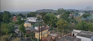
Bermo subdivision is an administrative subdivision of the Bokaro district in the North Chotanagpur division in the state of Jharkhand, India.

References

  1. "District Census Handbook Bokaro 2011" (PDF). Physical features, Mines and minerals, Indistires, p 7-8. Directorate of Census Operations. Retrieved 30 May 2021.
  2. "Tenughat Dam". india9. Retrieved 30 May 2021.
  3. "Jharkhand Police Official Website". Contact Bokaro Police. Jharkhand Police. Archived from the original on 14 February 2014. Retrieved 6 October 2017.
  4. "2011 District Census Handbook Bokaro, Series 21, Part XII B" (PDF). Map on Page 3. Directorate of Census Operations, Jharkhand. Retrieved 6 October 2017.
  5. "District Census Handbook, Bokaro, Series 21, Part XII B" (PDF). Rural PCA-C.D. blocks wise Village Primary Census Abstract, location no. 362288, page 114. Directorate of Census Operations Jharkhand. Retrieved 9 March 2021.
  6. "Census of India 2001: Data from the 2001 Census, including cities, villages and towns (Provisional)". Census Commission of India. Archived from the original on 16 June 2004. Retrieved 1 November 2008.
  7. "District Census Handbook Bokaro, Census of India 2011, Series 20, Part XII A" (PDF). Pages 384-397. Directorate of census Operations, Jharkhand. Retrieved 2 March 2021.