Chapelfields

Last updated

Chapelfields
Sir Thomas White's Rd -Chapelfields 23a08.JPG
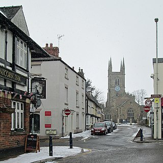
Sir Thomas White's Rd, Chapelfields
(view looking north)
OS grid reference SP319781
  London 90 mi (140 km)
Metropolitan borough
Metropolitan county
Region
Country England
Sovereign state United Kingdom
Post town COVENTRY
Postcode district CV5
Dialling code 024
UK Parliament
List of places
UK
England
West Midlands
52°24′22″N1°32′06″W / 52.406°N 1.535°W / 52.406; -1.535

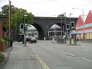
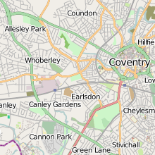
Chapelfields (also written Chapel Fields) is a suburb of Coventry, West Midlands, England. [1] It is situated about 1.5 miles to the west of Coventry City Centre; bordering Coundon to the north, Earlsdon to the south, Spon End to the east and Whoberley to the west. It is mainly residential, with a high proportion of graduates among the younger residents, and nowadays a significant element of students, particularly those studying at the University of Warwick. Houses in Chapelfields proper are mostly small to medium-sized terraced houses with gardens.

The area originally comprised just a few streets: Craven Street, Mount Street, Lord Street, Duke Street, the southern side of Allesley Old Road, and the northern side of Hearsall Lane; now a conservation area because of its links to the watchmaking industry. However, in the early 20th century the area was developed to the west and now includes streets to the west of Mount Street including Sir Thomas White's Road, Queensland Avenue, Kingsland Avenue, Abercorn Road and Maudslay Road. Although these streets now form part of the modern area known as Chapelfields, some residents and local organisations including the Chapelfields Area Residents and Traders Association (CARTA) do not consider this extended area to be part of Chapelfields.

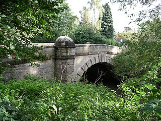
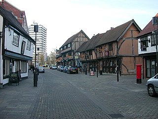
In mediaeval times there was a lazar house or leper hospital covering part of the area, which had been founded in 1168 by Hugh de Kevelioc, 5th Earl of Chester, for William D'Auney, a knight who had contracted the condition while following Kevelioc in a crusade. The modern area originates in 1847 when, as an extension of the neighbouring Spon area, building commenced to accommodate the watch-making industry for which Coventry was then famous; however, the part of Chapelfields from Sir Thomas White's Road to Maudslay Road was not developed until the early 20th century (Sir Thomas White's Road itself was built in 1908 and formed part of the tram route to Broadgate). It is a quirk of this section of Chapelfields that properties there are subject to restrictive covenants forbidding their use as "fried fish shops", which were prevalent in the area at that time. Another popular type of business in Chapelfields has always been the public house. Though fewer in number, there are still eight licensed premises in this tiny area: the Craven Arms, the Chestnut Tree, the Hearsall Inn, the Coombe Abbey Inn (closed as a pub at the end of 2015), the Craven Club (all in Craven Street), the Maudslay, the Four Provinces (Allesley Old Road, on the corner with Craven Street) and the Nursery Tavern in Lord Street. The last, locally noted as a real ale pub, presumably derives its name from Weare's Nursery, the immediate former occupier of the land upon which Chapelfields was built. Chapelfields pubs no longer extant included the New Inn and the Brewer's Arms in Craven Street, and the Sun Dial in Lord Street.

Within the Chapelfields area is All Souls Catholic Primary School.

Adjacent to the area is Hearsall Common, an open space that was deprived of official common status by the local authority in 1927. In 2007/08 this became the centre of dispute when local residents opposed the council's plans to remove part of the Chapelfields end of the common for bus lanes as part of the "PrimeLines" scheme. The six Conservative councillors for the Earlsdon and Whoberley wards have refused to support the objections and are backing one of their number, council leader Ken Taylor, in his attempts to impose this scheme which is the brainchild of the West Midlands Passenger Transport Executive. A petition was signed by 1,928 local residents opposing the scheme, whilst 29 indicated their support through a consultation with the council. The matter has not been settled at the time of writing, nor are applications by local residents to have the Common officially recognised as a village green to protect it.

Related Research Articles

<span class="mw-page-title-main">Coventry</span> City in the West Midlands, England

Coventry is a city in the West Midlands, England. It is on the River Sherbourne. Coventry has been a large settlement for centuries, although it was not founded and given its city status until the Middle Ages. The city is governed by Coventry City Council.

<span class="mw-page-title-main">Lutterworth</span> Town in Leicestershire, England

Lutterworth is a market town and civil parish in the Harborough district of Leicestershire, England. The town is located in southern Leicestershire, close to the borders with Warwickshire and Northamptonshire. It is located 6.4 miles north of Rugby, Warwickshire and 12 miles south of Leicester.

<span class="mw-page-title-main">Earlsdon</span> Human settlement in England

Earlsdon is a residential suburb and electoral ward of Coventry, England. It lies approximately one mile to the southwest of Coventry City Centre. It is the birthplace of aviation pioneer Frank Whittle.

<span class="mw-page-title-main">Coventry South (UK Parliament constituency)</span> UK Parliament constituency since 1997

Coventry South is a constituency represented in the House of Commons of the UK Parliament since 2019 by Zarah Sultana of the Labour Party.

<span class="mw-page-title-main">Small Heath</span> Human settlement in England

Small Heath is an area in south-east Birmingham, West Midlands, England situated on and around the Coventry Road about 2 miles (3 km) from the city centre.

<span class="mw-page-title-main">Walsgrave on Sowe</span> Suburban village of Coventry, West Midlands, England

Walsgrave on Sowe, or simply Walsgrave, is a suburban district situated approximately 3.5 miles (5.6 km) north-east of central Coventry, West Midlands, central England. Although it now experiences very little flooding, it was built on marshlands. However, due to urban growth, it is now an outer suburb of Coventry, south-west of the villages of Ansty and Shilton. Walsgrave on Sowe neighbours the Potters Green, Clifford Park, Woodway Park, Wyken, Henley Green and Mount Pleasant areas of Coventry, and is in the Henley ward of the city, although Walsgrave-on-Sowe was formerly in the Wyken Ward prior to ward changes made in 2003 by the Local Government Boundary Commission for England (LGBCE).

Keresley is a suburban village and civil parish in the City of Coventry, West Midlands, England, about 4.5 miles (7 km) north of Coventry city centre and 3.5 miles (6 km) southwest of Bedworth. According to the 2001 census, the parish had a population of 791 falling to 713 at the 2011 Census, although the 2018 population was estimated at 783.

<span class="mw-page-title-main">Allesley</span> Village and civil parish in Coventry, England

Allesley is a village and civil parish in the City of Coventry metropolitan borough, West Midlands, about 4 miles (5.25 km) west-northwest of Coventry city centre and 4 miles (6.5 km) east-south-east of Meriden. Located in the Arden area of historic Warwickshire, the parish population according to the 2001 census was 805, which rose to 837 at the 2011 census, and as of the 2021 census, the population was 908. Until 1998, Allesley contained the main Jaguar car assembly plant at Browns Lane.

<span class="mw-page-title-main">Eastern Green</span>

Eastern Green is a mainly residential suburb in the far west of Coventry, England, and was formerly a village in Warwickshire. Its most western area is Upper Eastern Green and the eastern area is Lower Eastern Green, though residents generally do not distinguish between the two.

<span class="mw-page-title-main">River Sherbourne</span> River in England

The River Sherbourne is a river that flows under the centre of the city of Coventry, in the West Midlands, in England.

<span class="mw-page-title-main">Spon End</span>

Spon End is a suburb of Coventry, England. It is situated west of Coventry city centre. The Butts Park Arena and a Premier Inn hotel are situated on the main road through Spon End. The Butts Park Arena, which was opened in 2004, is the home of Coventry Rugby Football club. Coventry Bears rugby league club and Coventry United and Coventry United L.F.C. football clubs are tenants of Coventry Rugby club and also play at Butts Park Arena where an all-weather pitch has been installed. Coventry Bears rugby league club were tenants until 2022.

<span class="mw-page-title-main">Whoberley</span>

Whoberley is a residential suburb of the City of Coventry in the West Midlands, England.

<span class="mw-page-title-main">Hearsall Common</span>

Hearsall Common is located in Earlsdon, Coventry in the West Midlands, central England.

<span class="mw-page-title-main">Allesley Park</span>

Allesley Park is a park near Coventry, West Midlands, England. It is also the name of the residential suburb adjacent to the park, which is approximately 2.5 miles northwest of Coventry city centre, just east of the A45 Coventry bypass.

Iden Green is a small village, near Benenden, in the county of Kent. It belongs to the civil parish of Benenden and the Tunbridge Wells Borough District of Kent, in the South East of England.

<span class="mw-page-title-main">Spon Street</span> Street in central Coventry, England

Spon Street is an historic street in central Coventry, in the West Midlands of England. The street was once part of a route that ran from Gosford to Birmingham – a route which remained intact until the 1960s. During the construction of Coventry's Inner Ring Road, built to relieve traffic on the narrow city centre streets, Spon Street was cut in half and the route severed.

<span class="mw-page-title-main">Coventry Corporation Transport</span> Operator of trams and buses in Coventry, Warwickshire

Coventry Corporation Transport was the operator of trams and motorbuses in Coventry, Warwickshire from 1912 to 1974. The operations of Coventry Corporation Transport passed to West Midlands Passenger Transport Executive in the local government reorganisation of 1974.

<span class="mw-page-title-main">Trinity House, Allesley</span> Former Country House in Coventry

Trinity House was a small country house in the village of Allesley, Coventry in the West Midlands, formerly the county of Warwickshire. It stood at the end of Rectory Lane immediately north-west of All Saints Church on the crest of the hill between the River Sherbourne and Pickford Brook. The house became one of "the lost houses" of England after being demolished in the mid-1960s as part of the wider destruction of country houses in 20th-century Britain.

References

  1. AA Street by Street. Coventry Rugby (2nd edition (May 2003) ed.). AA Publishing. pp. 22–23. ISBN   0-7495-3973-9.