
Busselton is a city in the South West region of the state of Western Australia approximately 220 km (140 mi) south-west of Perth. Busselton has a long history as a popular holiday destination for Western Australians; however, the closure of the Busselton Port in 1972 and the contemporaneous establishment of the nearby Margaret River wine region have seen tourism become the dominant source of investment and development, supplemented by services and retail. The city is best known for the Busselton Jetty, the longest wooden jetty in the Southern Hemisphere.

The Shire of Augusta Margaret River is a local government area in the south-west corner of the South West region of Western Australia, approximately 270 kilometres (168 mi) south of Perth. The shire covers an area of 2,243 square kilometres (866 sq mi) and had a population of over 14,000 at the 2016 Census, about half of whom live in the towns of Margaret River and Augusta.

Bussell Highway is a generally north–south highway in the South West region of Western Australia. The highway links the city of Bunbury with the town of Augusta and is approximately 140 kilometres (87 mi) in length. The highway is signed State Route 10, except in Busselton where the construction of the Busselton Bypass in 2000 resulted in this stretch being changed to Alternate State Route 10 with the Bypass signed State Route 10.

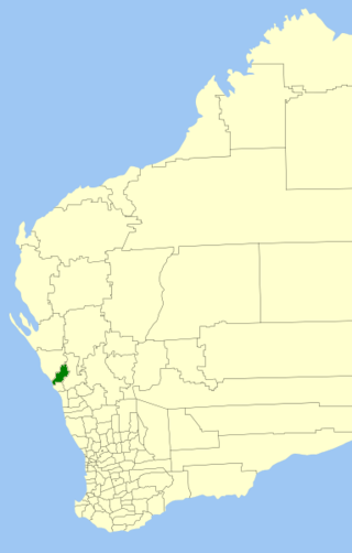
The City of Busselton is a local government area in the South West region of Western Australia, approximately 230 km (140 mi) south of Perth, the state capital. The city covers an area of 1,455 km2 (562 sq mi) and had a population of 40,640 as at the 2021 Census. It contains two large towns, Busselton and Dunsborough, and a number of smaller towns. The city office is located on Southern Drive, Busselton.

Vasse Highway is a Western Australian highway connecting Busselton and the South Western Highway 15 kilometres (9.3 mi) south of Manjimup. It is 151 kilometres (94 mi) long and travels through jarrah and karri hardwood forests for most of its length, with some small agricultural areas and wineries nearby, and forms the main street of the towns of Nannup and Pemberton.
Acton Park is a small town and agricultural district located in the South West of Western Australia inland from Busselton along Jalbarragup Road. It was established as part of the Group Settlement Scheme in the 1920s and the local hall was constructed in 1924. The area was gazetted as a bounded locality in 1987. At the 2021 Australian census the area had a population of 92.

Vasse is a suburb of the city of Busselton in the South West region of Western Australia, 10 kilometres (6 mi) west of Busselton and 240 kilometres (149 mi) southwest of Perth. Its local government area is the City of Busselton. At the 2016 census, Vasse had a population of 2,479.
The Shire of Chapman Valley is a local government area located in the Mid West region of Western Australia, immediately northeast of the City of Geraldton and about 440 kilometres (273 mi) north of Perth, the state capital. The Shire covers an area of 3,965 square kilometres (1,531 sq mi) and its seat of government is the small town of Nabawa.

Brinkin is a northern suburb of Darwin, the capital city of the Northern Territory, Australia. It is located 12 kilometres (7 mi) north of Darwin's central business district, and is home to the Casuarina campus of Charles Darwin University.
Jarrahwood is a small town located in the South West region of Western Australia, near the Vasse Highway between Busselton and Nannup. At the 2021 census, the area had a population of nine.

The Vasse River is a river in the South West of Western Australia.
The Ludlow River is a river in the South West region of Western Australia. It was named after Frank Ludlow, one of the first Western Australian colonists, an arrival on the barque Parmelia in 1829, who explored the locality in 1834.
The Abba River is a river in the South West region of Western Australia.

The City of Greater Geraldton is a local government area in the Mid West region of Western Australia, 424 kilometres (263 mi) north of the state capital, Perth on the Indian Ocean. It covers an area of 12,625.5 square kilometres (4,874.7 sq mi), and its seat of government is the town of Geraldton.
Wilyabrup, also spelt Willyabrup, is a locality in Western Australia's Margaret River wine region, in the local government area of the City of Busselton. The Quinninup Falls are within the locality.
Yoongarillup is a locality in Western Australia's South West region in the local government area of the City of Busselton. At the 2021 census, the area had a population of 79.
Metricup is a locality in the South West region of Western Australia near the town of Cowaramup on the Bussell Highway. It is in the Margaret River wine region and its local government area is the City of Busselton. At the 2021 census, it had a population of 263.
Yalyalup is a suburb of the Western Australian city of Busselton. At the 2021 census, it had a population of 2,950.
Bovell is a semi-rural suburb of the Western Australian city of Busselton. At the 2021 census, it had a population of 475. The area has been earmarked for future urban development. Bovell contains Geographe Primary School, named after the nearby suburb, which was established in 2002.
Kealy is a suburb of the Western Australian city of Busselton. At the 2021 census, it had a population of 1,119.

