Chenail Island

Last updated

Ile du Chenail (Chenail Island)
Pont du Long-Sault.jpg
Long-Sault Bridge from Chenail Island over the Ottawa River
Geography
Location Ottawa River
Coordinates 45°36′52″N74°36′05″W / 45.6144°N 74.6014°W / 45.6144; -74.6014 (Chenail Island) Coordinates: 45°36′52″N74°36′05″W / 45.6144°N 74.6014°W / 45.6144; -74.6014 (Chenail Island)
Administration
Canada
Province Ontario
County Prescott and Russell
Municipality Hawkesbury
Demographics
PopulationUninhabited

Chenail Island (officially in French : Ile du Chenail [1] ) is an uninhabited island in the Ottawa River of Ontario, Canada. [2] It is part of the town of Hawkesbury, Ontario, and across the river from Grenville, Quebec. The only road on the island, the four-lane St. John Street, connects Ontario Highway 34 in Hawkesbury and Quebec Route 344 in Grenville via the Perley Bridge (1931 to 1998) and its replacement, the Long-Sault Bridge. [3] [4]

Contents

History

The channel between the island and Hawkesbury was called the "Chenaille Escarté" (lost channel) by early French-Canadian settlers. [5] An English corruption of the term, "Snye Carty", was later shortened to "The Snye" and came to represent the village. [6] Nearby Hamilton Island was the location of an early gristmill and sawmill built by two Americans, Thomas Mears and David Pattee, [7] around 1815. [5] After having financial trouble, the properties were taken over by the mortgagees, brothers John and Robert Hamilton. The sawmill processed logs that were floated down the river after being cut, with much of the lumber being exported to England. The mill complex, known as Hawkesbury or Hamilton Mills, was expanded many times into the largest sawmill in Canada during the 19th century, employing over 1000 people. [8]

1925 mill fire Fire at the sawmill at the Snye, Chenail Island, 1925.jpg
1925 mill fire

The offices of the mill were on Chenail Island, which was at the time a thriving center of commerce and the original town center of Hawkesbury. [9] [10] A fire destroyed the mill complex in 1925. [5]

1940-era Chenail Island houses, later demolished Chenail Island in winter.jpg
1940-era Chenail Island houses, later demolished

In the early 1960s, the size of the island was reduced when construction of the Carillon Generating Station, a hydroelectric power station that was built approximately 12 mi (19 km) downstream from the island [11] raised the water level by over 9 feet (2.7 m) [12] [13] submerging much of the island and forcing the residents to leave. [11] [14] Plans to build embankments that would have protected some properties were rejected by residents who did not want to live behind them. [10] In addition to large tracts of farmland, approximately 35 commercial and 200 residential parcels in Hawkesbury were expropriated, including all of the parcels (approximately 50) on Chenail Island. [11] [10]

Geography

The island's average elevation is 37 m (121 ft). [15] [ clarification needed ] The entire island is a public park (Confederation Park) [16] of approximately 20 acres (8.1 ha) that was constructed at the time the island was depopulated and largely submerged. [17]

Attractions

Chenail Cultural Center

Chenail Island is the location of Chenail Cultural Centre, a non-profit organization that promotes local French-Canadian culture and the history of the Maison de l'Ile (Island House), the only significant structure on the island. [18] [19] The house, built c.1835, [6] is the oldest building in Hawkesbury and was originally the office of John Hamilton who was later appointed to the Senate in the Canadian Confederation of 1867. [20]

The town government, which owns the building, attempted to restrict the Chenail Cultural Centre to the second floor so that it could use the first floor as a tourist information center. The town later said it did not need the entire first floor, and a dispute led the town to call for eviction. A judge rejected the eviction in November, 2016. [21]

Monument de la Francophonie

The 15th Monument of the Francophonie of Ontario is located on Chenail Island. The monument features a fleur-de-lys, the symbol of the Francophonie, surrounded by a man and woman's hand and encircled by 13 maple leaf benches representing the Canadian provinces and territories. The sculptures, made of stone and at human scale, were dedicated on November 28, 2014. [22] There is also a large Franco-Ontarian flag on a 25-metre (82 ft) flagpole. [23]

Snye/Le Chenail Monument

The Town of Hawkesbury placed a monument on the island in 2009 to honour approximately forty families that once resided on the island before their land was expropriated by the government for the power station. [24] [25]

Related Research Articles

<span class="mw-page-title-main">Ottawa River</span> River in Canada

The Ottawa River is a river in the Canadian provinces of Ontario and Quebec. It is named after the Algonquin word 'to trade', as it was the major trade route of Eastern Canada at the time. For most of its length, it defines the border between these two provinces. It is a major tributary of the St. Lawrence River and the longest river in Quebec.

<span class="mw-page-title-main">Brockville</span> City in Ontario, Canada

Brockville, formerly Elizabethtown, is a city in Eastern Ontario, Canada, in the Thousand Islands region. Although it is the seat of the United Counties of Leeds and Grenville, it is politically independent of the county. It is included with Leeds and Grenville for census purposes only.

<span class="mw-page-title-main">Franco-Ontarians</span> Francophone resident of the Canadian province of Ontario

Franco-Ontarians are Francophone Canadians that reside in the province of Ontario. Most are French Canadians from Ontario. In 2016, the Government of Ontario calculated that there are approximately 622,415 francophones residing in the province. The majority of Franco-Ontarians in the province reside in Eastern Ontario, Northeastern Ontario, and Central Ontario, although small francophone communities may be found in other regions of the province.

<span class="mw-page-title-main">Athens, Ontario</span> Township in Ontario, Canada

Athens is a township in the United Counties of Leeds and Grenville in Eastern Ontario, Canada. It is located approximately 25 kilometres (16 mi) north of the St. Lawrence River, near Brockville, west of Addison, and about 90 kilometres (56 mi) south west of Ottawa. Formerly, it was a part of Yonge township before becoming Rear of Yonge and Escott with Athens as its own census division and finally, Athens township. The township consists of the town of Athens and a few other small communities.

<span class="mw-page-title-main">North Grenville</span> Municipality in Ontario, Canada

North Grenville is a township in eastern Ontario, Canada, in the United Counties of Leeds and Grenville on the Rideau River. It is located just south of Ottawa in Canada's National Capital Region.

<span class="mw-page-title-main">Hawkesbury, Ontario</span> Town in Ontario, Canada

Hawkesbury is a Franco-Ontarian city in Prescott-Russell county in Eastern Ontario, Canada. The vast majority of its 10,550 inhabitants are francophone.

<span class="mw-page-title-main">Eastern Ontario</span> Secondary region in Ontario, Canada

Eastern Ontario is a secondary region of Southern Ontario in the Canadian province of Ontario which lies in a wedge-shaped area between the Ottawa River and St. Lawrence River. It shares water boundaries with Quebec to the north and New York State to the east and south, as well as a small land boundary with the Vaudreuil-Soulanges region of Quebec to the east.

<span class="mw-page-title-main">Kemptville</span> Unincorporated community in Ontario, Canada

Kemptville is a community located in the Municipality of North Grenville in Eastern Ontario, Canada in the northernmost part of the United Counties of Leeds and Grenville. It is located approximately 56 km (35 mi) south of the downtown core of Ottawa and 2.5 to 3 km south of the Rideau River.

<span class="mw-page-title-main">Grenville-sur-la-Rouge</span> Municipality in Quebec, Canada

Grenville-sur-la-Rouge is a municipality in the Argenteuil Regional County Municipality in the Laurentides region of Quebec, Canada. It is a predominantly Francophone community situated along the southern border of Quebec between Montreal and Ottawa.

<span class="mw-page-title-main">South Algonquin</span> Township municipality in Ontario, Canada

South Algonquin is a township municipality in Nipissing District, Ontario, Canada. Located south of Algonquin Provincial Park, it is the sole populated portion of the district that lies south of the traditional dividing line between Northern Ontario and Southern Ontario and is closer connected to Renfrew County as opposed to the core portions of Nipissing District.

<span class="mw-page-title-main">Grenville, Quebec</span> Village municipality in Quebec, Canada

Grenville is a village municipality in the Argenteuil Regional County Municipality of the Laurentides region of Quebec, Canada. It is located opposite Hawkesbury, Ontario, on the Ottawa River.

<span class="mw-page-title-main">Pointe-Calumet</span> Municipality in Quebec, Canada

Pointe-Calumet is a municipality in the Canadian province of Quebec. The municipality is located within the Deux-Montagnes Regional County Municipality in the Laurentides region. It is situated about 30 minutes northwest of Montreal. Its population as of the 2006 Canadian Census is just over 6 000.

<span class="mw-page-title-main">Saint-André-d'Argenteuil</span> Municipality in Quebec, Canada

Saint-André-d'Argenteuil is a municipality in the Laurentides region of Quebec, Canada, part of the Argenteuil Regional County Municipality. It is located along the Ottawa River, just south of Lachute.

<span class="mw-page-title-main">Long-Sault Bridge</span> Bridge in Grenville, Quebec

The Long-Sault Bridge is a bridge connecting Hawkesbury, Ontario and Grenville, Quebec. It crosses the Ottawa River via Chenail Island. It connects Quebec Route 344 and Ontario Highway 34.

<span class="mw-page-title-main">Ottawa River timber trade</span>

The Ottawa River timber trade, also known as the Ottawa Valley timber trade or Ottawa River lumber trade, was the nineteenth century production of wood products by Canada on areas of the Ottawa River and the regions of the Ottawa Valley and Western Quebec destined for British and American markets. It was the major industry of the historical colonies of Upper Canada and Lower Canada and it created an entrepreneur known as a lumber baron. The trade in squared timber and later sawed lumber led to population growth and prosperity to communities in the Ottawa Valley, especially the city of Bytown. The product was chiefly red and white pine.The Ottawa River being conveniently located with access via the St. Lawrence River, was a valuable region due to its great pine forests surpassing any others nearby. The industry lasted until around 1900 as both markets and supplies decreased, it was then reoriented to the production of wood pulp which continued until the late 1990's/early 2000's.

<span class="mw-page-title-main">Perley Bridge</span> Former bridge across the Ottawa River in Canada

The Perley Bridge was a bridge connecting Hawkesbury, Ontario and Grenville, Quebec. It crossed the Ottawa River via Chenail Island. It was named for George Perley, Canadian Member of Parliament representing the Argenteuil district in southern Quebec. He first advocated for a crossing at Hawkesbury in 1909. The bridge was known as the Hawkesbury–Grenville Bridge, or less frequently the Grenville–Hawkesbury Bridge prior to its completion in 1931 when the name Perley was applied. It was replaced by the Long-Sault Bridge in 1998.

The Carillon and Grenville Railway (CAGR) was a 5 ft 6 in broad gauge portage railway in Quebec, running approximately 12 miles (19 km) between the towns of Carillon and Grenville on the north bank of the Ottawa River. It provided a through-route from Ottawa to Montreal via steamships on either side of the Long Sault Rapids. It was one of Canada's earliest railways, opened in 1854, and was the last operational broad gauge railway in Canada when it closed in 1910.

Linda Cardinal is a Franco-Ontarian political scientist. She is a University Professor and a Canada Research Chair in Canadian Francophonie and Public Policies at the University of Ottawa. Cardinal was elected a Fellow of the Royal Society of Canada in 2013 and honoured with the Ordre des Palmes Académiques and Member of the Order of Canada. She was also the first coordinator of the francophone studies program at the University of Ottawa.

<span class="mw-page-title-main">Marcel Desjardins (journalist)</span> Canadian journalist, news editor and director

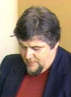
Marcel Desjardins was a Canadian journalist, news editor and director. He was a political correspondent for Le Droit and La Presse, before becoming an editor at Radio-Canada. He later returned to La Presse as the news director, then as the vice-president and assistant editor. He also covered ice hockey and was recognized with the Elmer Ferguson Memorial Award by the Professional Hockey Writers' Association.

References

  1. "Natural Resources Canada". Geographical Names. Retrieved December 25, 2016.
  2. The Canadian Cartographer, Volumes 6–9. Toronto: Department of Geography, York University. 1969. p. 97.
  3. "Long-Sault Bridge". structurae.net. International Database for Civil and Structural Engineering. Retrieved January 15, 2017.
  4. "Ile du Chenail". google maps. Retrieved January 15, 2017.
  5. 1 2 3 "The Town That Timber Built". Ottawa Journal. May 11, 1974. p. 49. Retrieved January 26, 2017 via Newspapers.com. Lock-green.svg
  6. 1 2 Thomas, Cyrus (1896). History of the Counties of Argenteuil, Que., and Prescott, Ont. Montreal. p. 537.
  7. Perkins, Mary Ellen (June 30, 1989). Discover Your Heritage: A Guide to Provincial Plaques in Ontario. Dundurn. p. 224. ISBN   1459713850.
  8. "Hawkesbury". ottawariver.org. Retrieved January 30, 2017.
  9. Mika, Nick (1981). Encyclopedia of Ontario: Places in Ontario Volume 2, Issue 2. Mike Publishing Company.
  10. 1 2 3 "Hawkesbury Residents Oppose Hydro Scheme". Ottawa Journal. June 19, 1960. p. 3. Retrieved January 6, 2017 via Newspapers.com. Lock-green.svg
  11. 1 2 3 "Hawkesbury Flooding Opposed". Ottawa Journal. November 5, 1959. p. 1. Retrieved January 6, 2017 via Newspapers.com. Lock-green.svg
  12. "Canal" (in French). Village de Grenville. Retrieved January 21, 2017.
  13. Vaidyanathan, H.; Cheung, M.S.; Beauchamp, J.C. (1978). "EXTENSION OF LIFE FOR PERLEY BRIDGE". Transportation Research Record. Transportation Research Board. 1. Retrieved November 27, 2016.
  14. "Hawkesbury". The Canadian Encyclopedia . Retrieved August 25, 2019.
  15. "Ile du Chenail". mapcarta.com. Retrieved January 21, 2017.
  16. "Ile du Chenail Hawkesbury, ON Canada". google.com/maps. Retrieved January 21, 2017.
  17. "Carillon Power Project Going Day and Night". Ottawa Journal. November 2, 1961. p. 25. Retrieved January 27, 2017 via Newspapers.com. Lock-green.svg
  18. "Support for Francophone Culture in Eastern Ontario". news.gc. Government of Canada. Retrieved January 21, 2017.
  19. "Chenail Cultural Center". Chenail Cultural Center. Retrieved December 25, 2016.
  20. Johansen, Peter (April 24, 2015). "Daytripping to L'Orignal and Hawkesbury". Ottawa Citizen. Retrieved January 21, 2017.
  21. Ketterling, Theresa (November 14, 2016). "Town can't evict Le Chenail, judge decides". The Review. Retrieved January 21, 2017.
  22. "Les Monuments de la Francophonie de l'Ontario" (in French). Retrieved December 25, 2016.
  23. "Un nouveau Monument de la francophonie à Hawkesbury" (in French). Radio-Canada. November 28, 2014. Retrieved December 25, 2016.
  24. Saomt-Denis, Yves (June 2013). "Le monument de la francophonie et son drapeau" (PDF). Chronicle of Ontario 2013 (in French). Retrieved January 21, 2017.
  25. "The Snye/Le Chenail Monument". Memorial in Ottawa. Retrieved December 25, 2016.

Commons-logo.svg Media related to Chenail Island at Wikimedia Commons