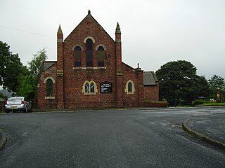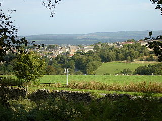
Craghead is a former mining village in County Durham, England. It is located at the bottom of the valley to the south of Stanley, on the main road between Stanley and Durham, and not far from the village of Edmondsley.

East Kyo is a small hamlet in County Durham, England. It is situated a short distance to the west of Stanley, close to Annfield Plain, West Kyo, Oxhill and Harperley. The hamlet of East Kyo consists of two farms and East Kyo House, a former public house.
Killerby is a village in the borough of Darlington and the ceremonial county of County Durham, England. It is situated a few miles to the west of Darlington. At the 2011 Census the population was less than 100. Details are maintained in the parish of Staindrop.

Cornsay is a hamlet and civil parish in County Durham, England. The population of the Civil Parish taken at the 2011 census was 1,128. It is 6 miles (9.7 km) southeast of Consett and 7 miles (11 km) southwest of Durham. It consists of nineteen dwellings, including four farms & is the home of Greenacres nudist club. All formerly belonged to Ushaw College for the training of Catholic priests, hence the organised nomenclature. East and West Farms are now in private hands as homes but the other two are still active, South Farm run by the Suddes family and North Farm by the Tweddle family.

Barmpton is a small village in the borough of Darlington and the ceremonial county of County Durham, England. The population taken at the 2011 Census was less than 100. Details are maintained in the parish of Great Burdon. It is situated a short distance to the north-east of Darlington, on the River Skerne, a tributary of the Tees.

Gilmonby is a village in the Pennines in County Durham, England. it is situated a short distance to the south of Bowes, in the vicinity of Barnard Castle. The population taken at the 2011 Census was less than 100. Information is kept in the Bowes parish details. It is traditionally located in the North Riding of Yorkshire but along with the rest of the former Startforth Rural District it was transferred to County Durham for administrative and ceremonial purposes on 1 April 1974, under the provisions of the Local Government Act 1972.

Wycliffe is a village on the south bank of the River Tees in the North East of England, situated a short distance to the east of Barnard Castle. Wycliffe is in the civil parish of Wycliffe with Thorpe.

Blackwell is a suburb in the borough of Darlington and the ceremonial county of County Durham, England. It is situated towards the edge of the West End of Darlington, beside the River Tees. Blackwell consists of large 1930s style semi-detached and detached houses, and private, newly built homes. Blackwell Grange is an 18th-century country house converted into a hotel.

Brafferton is a village and civil parish in County Durham, England. It is administered as part of the borough of Darlington. The population of Brafferton Parish taken at the 2011 census was 154. It is situated between Darlington and Newton Aycliffe, a short distance from Coatham Mundeville.

Kimblesworth is a relatively small village in County Durham, England. It is situated between Durham and Chester-le-Street. The appropriate civil parish is Kimblesworth and Plawsworth. The population of this parish at the 2011 Census was 1,614.

Castleside is a village in County Durham, England. It is situated a short distance to the south-west of Consett. The village centre is located on the main A68 road which runs between Edinburgh and Darlington and the village crossroads allow easy access to Consett, the North Pennines and Stanhope. To the northeast lies another small village called Moorside.

Close House is a village in County Durham, in England. It is situated a short distance to the north of Shildon, near to Eldon and Coundon Grange. In the 2001 census Close House had a population of 296.

Eastbourne is a former village in the borough of Darlington and the ceremonial county of County Durham, England. It is situated immediately to the east of the town centre of Darlington of which it is now an area.
Great Stainton is a village in the borough of Darlington and ceremonial county of County Durham, England. It is situated to the north of Darlington, and to the west of Stockton-on-Tees. Elstob is a hamlet, just north of Great Stainton, which is part of the Parish of Great Stainton. The population as taken at the Census 2011 was less than 100. Details are now maintained in the parish of Little Stainton.

Headlam is a village in the borough of Darlington and the ceremonial county of County Durham, England. It lies to the west of Darlington. The population taken at the 2011 Census was less than 100. Details are included in the parish of Ingleton. The hamlet has 14 stone houses plus 17th-century Headlam Hall, now a country house hotel. The village is set around a village green with a medieval cattle-pound and an old stone packhorse bridge across the beck. Headlam is classed as Lower Teesdale and has views to the south as far as Richmond and to the Cleveland Hills in the east.

Barrow is a civil parish containing the villages of Great Barrow, Little Barrow and Stamford Bridge. It is situated about 4.5 miles east-north-east of Chester, 6 miles north-west of Tarporley, and 6 miles south of Frodsham.
Croxdale and Hett is a civil parish in County Durham, England. It is situated approximately four miles south of Durham. The population of the civil parish as taken at the 2011 census was 866.

Cymau is a small village situated in the community of Llanfynydd, Flintshire on the edge of the mountains of north-east Wales. Its name is derived from the Welsh word cymau, an old form of the plural for cwm, "valley" or "hollow".

Coddington is a civil parish in the unitary authority of Cheshire West and Chester and the ceremonial county of Cheshire, England.
Chilton Moor is a village in Tyne and Wear, England. The village is located between Houghton le Spring and Fence Houses on the Tyne and Wear/County Durham county boundary.


