Chestnut, Illinois

Last updated

Chestnut, Illinois
USA Illinois location map.svg
Red pog.svg
Chestnut
Location in Illinois
Usa edcp location map.svg
Red pog.svg
Chestnut
Location in the United States
Coordinates: 40°03′13″N89°11′14″W / 40.05361°N 89.18722°W / 40.05361; -89.18722 [1]
CountryUnited States
StateIllinois
County Logan
Township Aetna
Area
[2]
  Total0.12 sq mi (0.32 km2)
  Land0.12 sq mi (0.32 km2)
  Water0.00 sq mi (0.00 km2)
Elevation
[1]
620 ft (190 m)
Population
 (2020)
  Total220
  Density1,788.62/sq mi (688.21/km2)
Time zone UTC-6 (CST)
  Summer (DST) UTC-5 (CDT)
Postal code
62518
Area code 217
FIPS code 17-13230
GNIS feature ID2628546 [1]

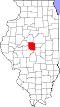
Chestnut is a census-designated place in Aetna Township, Logan County, Illinois. As of the 2010 census, its population was 246. [3] The community is located northwest across the railroad tracks along Illinois Route 54 at Dauphin Street. Its claim to fame, for the sake of town promotion, is that it is the geographic center of the state. [4] [5] A small monument to this effect has been erected in a park near the southwest corner of Melvin Street and East Olive street (in §34 T19N R1W). However, the exact center of Illinois is about eight miles southwest of Chestnut, and on the other side of the town of Mount Pulaski, at 89°18.4'W 40°0.8'N. [ citation needed ]

Contents

History

The town of Chestnut was laid out in 1872 by David Clark in conjunction with the directors of the then newly completed Gilman, Clinton, and Springfield (later the Springfield branch of the Illinois Central railroad). The land was surveyed on April 24 of that year by Thomas G. Gardner, county surveyor. Two years prior, a town had been laid out, platted, and surveyed on the same section by William M. Allen and S. Linn Beidler. A post office had been established there under the name of Allenville in honor of Mr. Allen. On the laying out of Chestnut, the town of Allenville was abandoned. Chestnut was named in honor of one of the directors of the Gilman, Clinton, and Springfield railroad. The Britton Brothers erected the first store, having moved the building from "Yankeetown," a few miles distant; Dement and Clark erected the second store. William H. Daniels soon after started a blacksmith shop, George Lakin a drug store, and I. J. Michener erected an elevator in 1873. Mr. Lakin was postmaster and Mr. Michener was the railroad agent. In 1876, fire consumed the store and stock of Britton Brothers, at a loss of $3,000. In 1877, Dement and Clark's store and stock burned at a loss of $5,000. On Jan. 24, 1905, the general store of Gobleman & Bapst was destroyed by fire at a loss of $10,000. A Methodist church was erected in the town in 1873. An effort to incorporate Chestnut as a village was defeated at a special election in 1898. [6]

Demographics

Historical population
CensusPop.Note
2020 220
U.S. Decennial Census [7]

Per the 2010 US Census, Chestnut had 246 people. Among non-Hispanics this includes 233 White, 1 Native American, 3 Asian, 2 of two or more races, and 7 Hispanic or Latino.

The population was spread out, with 72.0% over the age of 18 and 15.4% who were 65 years of age or older. The median age was 37.5 years. The gender ratio was 47.6% male and 52.4% female. Among 99 occupied households, 88 were owner-occupied and 11 were renter-occupied. [8]

Related Research Articles

<span class="mw-page-title-main">Edgar County, Illinois</span> County in Illinois, United States

Edgar County is a county located in the U.S. state of Illinois. As of the 2020 United States Census, the population was 16,866. Its county seat is Paris.

<span class="mw-page-title-main">Foosland, Illinois</span> Village in Illinois, United States

Foosland is a village in Brown Township, Champaign County, Illinois, United States. The population was 75 at the 2020 census. The village is named after William Foos, who owned 3,500 acres in the area in the 1840s.

<span class="mw-page-title-main">Morrisonville, Illinois</span> Village in Illinois, United States

Morrisonville is a small town in Christian County, Illinois, United States. The population was 997 at the 2020 census.

<span class="mw-page-title-main">Gibson City, Illinois</span> City in Illinois, United States

Gibson City is a city in Ford County, Illinois, United States. The population was 3,475 at the 2020 census.

<span class="mw-page-title-main">Dwight, Illinois</span> Village in Illinois, United States

Dwight is a village located mainly in Livingston County, Illinois, with a small portion in Grundy County. The population was 4,032 at the 2020 census. Dwight contains an original stretch of U.S. Route 66, and from 1892 until 2016 continuously used a railroad station designed in 1891 by Henry Ives Cobb. Interstate 55 bypasses the village to the north and west.

<span class="mw-page-title-main">Gilman, Illinois</span> City in Illinois, United States

Gilman is a city in Douglas Township, Iroquois County, Illinois, United States. The population was 1,738 at the 2020 census.

<span class="mw-page-title-main">Chatsworth, Illinois</span> Town in Illinois, United States

Chatsworth is an incorporated town in Livingston County, Illinois, United States. The population was 1,332 at the 2020 census.

<span class="mw-page-title-main">Forrest, Illinois</span> Village in Illinois, United States

Forrest is a village in Livingston County, Illinois, United States. The population was 1,220 at the 2010 census.

<span class="mw-page-title-main">Odell, Illinois</span> Village in Illinois, United States

Odell is a village in Livingston County, Illinois, United States. The population was 1,046 at the 2010 census.

<span class="mw-page-title-main">Broadwell, Illinois</span> Village in Illinois, United States

Broadwell is a village in Logan County, Illinois, United States. The population was 136 at the 2020 census.

<span class="mw-page-title-main">Elkhart, Illinois</span> Village in Illinois, United States

Elkhart is a village in Logan County, Illinois, United States. The population was 405 at the 2010 census.

<span class="mw-page-title-main">Lincoln, Illinois</span> City in Illinois, United States

Lincoln is a city in Logan County, Illinois, United States. First settled in the 1830s, it is the only town in the U.S. that was named for Abraham Lincoln before he became president; he practiced law there from 1847 to 1859. Lincoln is home to two prisons. It is also the home of the world's largest covered wagon and numerous other historical sites along the Route 66 corridor.

<span class="mw-page-title-main">Steelville, Missouri</span> City in Missouri, United States

Steelville is a city in Crawford County, Missouri, United States. The population was 1,472 at the 2020 census. It is the county seat of Crawford County. Steelville is the hometown of Congressman Albert Reeves and Missouri State Representative Jason Chipman. The town was named after the landowner James Steel.

Beason is an unincorporated census-designated place (CDP) in Oran Township, Logan County, Illinois, United States. The town lies one mile (1.6 km) south of Illinois Route 10. At the 2010 census, Beason had a population of 189. Beason has a post office with ZIP code 62512.

Cornland is an unincorporated community and census-designated place in Logan County, Illinois. As of the 2010 census, its population was 93.

<span class="mw-page-title-main">Harp Township, DeWitt County, Illinois</span> Township in Illinois, United States

Harp Township is one of thirteen townships in DeWitt County, Illinois, USA. As of the 2020 census, its population was 310 and it contained 136 housing units.

<span class="mw-page-title-main">Nixon Township, DeWitt County, Illinois</span> Township in Illinois, United States

Nixon Township is one of thirteen townships in DeWitt County, Illinois, US. As of the 2020 census, its population was 492 and it contained 231 housing units.

<span class="mw-page-title-main">John Dement</span> American politician and militia commander

John Dement was an American politician and militia commander from the U.S. state of Illinois.

Buffalo Hart is an unincorporated community in northern Sangamon County in the U.S. state of Illinois. It is the population center of its own township, Buffalo Hart Township.

The Gilman, Clinton and Springfield Railroad was a railroad of 111 miles (179 km) in length, chartered in 1867, that operated from 1871 until 1877 in the U.S. state of Illinois. It provided service from Springfield, the state capital, to Gilman, a junction point on the main line of the much larger Illinois Central Railroad. After operation for a short period as an independent short line, the Gilman, Clinton and Springfield underwent financial failure and was merged into the Chicago and Springfield Railroad, an affiliate of the Illinois Central.

References

  1. 1 2 3 U.S. Geological Survey Geographic Names Information System: Chestnut, Illinois
  2. "2020 U.S. Gazetteer Files". United States Census Bureau. Retrieved March 15, 2022.
  3. "U.S. Census website". U.S. Census Bureau . Retrieved March 9, 2011.
  4. Illinois.gov Facts Archived June 17, 2007, at the Wayback Machine
  5. Waymarks
  6. Stringer, Lawrence B. (1911). HISTORY OF LOGAN COUNTY, ILLINOIS. Chicago: Pioneer Publishing Company.
  7. "Census of Population and Housing". Census.gov. Retrieved June 4, 2016.
  8. Factfinder, Census.gov