Related Research Articles

Oxfordshire is a historic, ceremonial and non-metropolitan county in South East England. It is a mainly rural county, with its largest settlement being the city of Oxford. The county is a centre of research and development, primarily due to the work of the University of Oxford. Oxfordshire is locally governed by Oxfordshire County Council, together with the lower tier councils of its five non-metropolitan districts: City of Oxford, Cherwell, South Oxfordshire, Vale of White Horse, and West Oxfordshire. The ceremonial county is landlocked and bordered by Northamptonshire to the north-east, Warwickshire to the north-west, Buckinghamshire to the east, Berkshire to the south, Wiltshire to the south-west, and Gloucestershire to the west. The areas of Oxfordshire south of the River Thames were part of the historic county of Berkshire, including the county's highest point, the 261-metre (856 ft) White Horse Hill.
Shipston-on-Stour is a town and civil parish in the Stratford-on-Avon District in Warwickshire, England. It is located on the banks of the River Stour, 9 miles (15 km) south-southeast of Stratford-upon-Avon, 10 miles north-northwest of Chipping Norton, 14 miles (22 km) south of Warwick and 14.5 miles west of Banbury. In the 2021 census, Shipston-on-Stour had a population of 5,849.

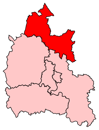
West Oxfordshire is a local government district in northwest Oxfordshire, England, including towns such as Woodstock, Burford, Chipping Norton, Charlbury, Carterton and Witney, where the council is based.

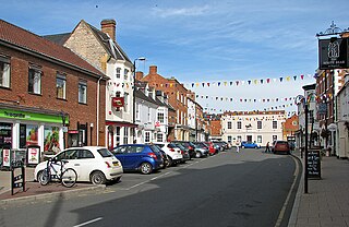
Chipping Norton is a market town and civil parish in the Cotswold Hills in the West Oxfordshire district of Oxfordshire, England, about 12 miles (19 km) south-west of Banbury and 18 miles (29 km) north-west of Oxford. The 2011 Census recorded the civil parish population as 5,719. It was estimated at 6,254 in 2019.
Hook Norton Brewery is a regional brewery in Hook Norton, Oxfordshire, England, several miles outside the Cotswold Hills. Founded in 1849, the brewing plant is a traditional Victorian 'tower' brewery in which all the stages of the brewing process flow logically from floor to floor; mashing at the top, boiling in the middle, fermentation and racking at the bottom. Until 2006, the brewing process was powered by steam. Beer is still delivered in the village by horse-drawn dray.
Banbury, also informally known as Banbury and North Oxfordshire, is a constituency in Oxfordshire created in 1553 and represented in the House of Commons of the UK Parliament since 2015 by Victoria Prentis of the Conservative Party. She currently serves as Attorney General for England and Wales.

Witney is a county constituency in Oxfordshire represented in the House of Commons of the Parliament of the United Kingdom. It elects one Member of Parliament by the first-past-the-post system of election, and was created for the 1983 general election. It has been a safe Conservative Party seat at recent elections. It is currently represented by Robert Courts of the Conservative Party.

Enstone Aerodrome is a small unlicensed civilian airfield in England close to Enstone in Oxfordshire, which is currently used for microlights, light aircraft and motor gliders. The International Civil Aviation Organization (ICAO) designator is EGTN, and its contact radio frequency is 129.880. The Aerodrome Operators are Oxfordshire Sport Flying located close to the Runway 26 Threshold.
Chipping Norton Town Football Club is a football club based in Chipping Norton, Oxfordshire. They are currently members of the Witney & District League Division Three and play at Walterbush Road.

Kingham railway station in Oxfordshire, England, is between the Oxfordshire village of Kingham and the Gloucestershire village of Bledington, to which it is closer. It is also the closest station to the town of Chipping Norton.
Chipping Norton School is a mixed secondary school with academy status located in Chipping Norton, Oxfordshire, United Kingdom. It is attended by 1000 students, with 200 in Sixth Form. It has no specific religious denomination and is a non-boarding, Arts and Science college. The school joined the River Learning Trust, a multi-academy trust on 1 March 2017.

Chipping Norton railway station served the town of Chipping Norton, Oxfordshire, England. The station had two platforms and a signal box.
Chipping Norton Recording Studios was a residential recording studio in Chipping Norton, Oxfordshire, England, which operated from 1971 until October 1999.
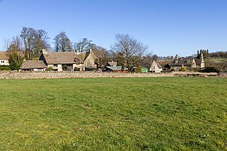
Churchill and Sarsden are civil parishes in West Oxfordshire with a common parish council, about 3 miles (5 km) southwest of Chipping Norton.
Over Norton is a village and civil parish within the West Oxfordshire district, about 1 mile (2 km) north of Chipping Norton, Oxfordshire, England. Over Norton Park is a farm beside the village.

Bliss Tweed Mill is a former mill for the manufacture of tweed. It is located on the edge of Chipping Norton, Oxfordshire, United Kingdom. It became a Grade II* listed building in 1980.

The Theatre Chipping Norton, sometimes The Theatre, Chipping Norton, is a theatre, cinema, gallery and music venue in Chipping Norton, Oxfordshire, England.
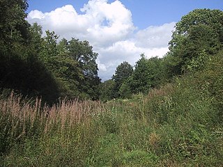
Hook Norton Cutting and Banks is a 6.7-hectare (17-acre) biological and geological Site of Special Scientific Interest south of Hook Norton in Oxfordshire. The site is in three areas, two of which are managed as a nature reserve called Hook Norton Cutting by Berkshire, Buckinghamshire and Oxfordshire Wildlife Trust. and are designated a Geological Conservation Review site.

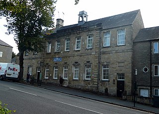
Chipping Norton Town Hall is a municipal building in the Market Place, Chipping Norton, Oxfordshire, England. The building, which is used as an events venue, is a Grade II* listed building.
Chipping Norton Rural District was a rural district in Oxfordshire, England from 1894 to 1974. It surrounded but did not include the town of Chipping Norton.
References
- 1 2 "Chipping Norton Museum of Local History". UK: Oxfordshire Museums Council . Retrieved 1 August 2017.
- ↑ "Chipping Norton Museum of Local History". TripAdvisor . Retrieved 1 August 2017.
- ↑ "Chipping Norton Museum of Local History". Oxfordshire Cotswolds. Retrieved 1 August 2017.