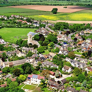
Oxfordshire is a ceremonial county in South East England. The county is bordered by Northamptonshire and Warwickshire to the north, Buckinghamshire to the east, Berkshire to the south, and Wiltshire and Gloucestershire to the west. The city of Oxford is the largest settlement and county town.
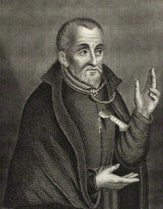
Edmund Campion, SJ was an English Jesuit priest and martyr. While conducting an underground ministry in officially Anglican England, Campion was arrested by priest hunters. Convicted of high treason, he was hanged, drawn and quartered at Tyburn. Campion was beatified by Pope Leo XIII in 1886 and canonised in 1970 by Pope Paul VI as one of the Forty Martyrs of England and Wales. His feast day is celebrated on 1 December.

Baddesley Clinton is a moated manor house, about 8 miles (13 km) north-west of the town of Warwick, in the village of Baddesley Clinton, Warwickshire, England. The house probably originated in the 13th century, when large areas of the Forest of Arden were cleared for farmland. The site is a Scheduled Ancient Monument and the house is a Grade I listed building. The house, park and gardens are owned by the National Trust and open to the public; they lie in a civil parish of the same name.
Ralph Thomas Campion George Sherman Stonor, 7th Baron Camoys, was a British peer and banker who served as Lord Chamberlain of the United Kingdom from 1998 to 2000, and the first Catholic Lord Chamberlain since the Reformation.

Watlington is a small market town and civil parish about 7 miles (11 km) south of Thame in Oxfordshire, near the county's eastern edge and less than 2 miles (3 km) from its border with Buckinghamshire. The parish includes the hamlets of Christmas Common, Greenfield and Howe Hill, all of which are in the Chiltern Hills. The 2011 Census recorded the parish's population as 2,727.

Pishill is a village and former civil parish, now in the parish of Pishill with Stonor, in the South Oxfordshire district, in the county of Oxfordshire, England. It is about 5 miles (8 km) north of Henley-on-Thames, in the Stonor valley in the Chiltern Hills about 430 feet (130 m) above sea level. In 1921 the parish had a population of 147.
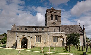
Kirtlington is a village and civil parish in Oxfordshire about 6+1⁄2 miles (10.5 km) west of Bicester. The parish includes the hamlet of Northbrook. The 2011 Census recorded the parish's population as 988.
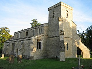
Launton is a village and civil parish on the eastern outskirts of Bicester, Oxfordshire, England. The 2011 Census recorded the parish's population as 1,204.

Christmas Common is a hamlet in Watlington civil parish, Oxfordshire about 7+1⁄2 miles (12 km) south of Thame in Oxfordshire, close to the boundary with Buckinghamshire. The hamlet is 812 feet (247 m) above sea level on an escarpment of the Chiltern Hills. Because of its elevation, Christmas Common has two radio masts that are prominent local landmarks.

Woodcote is a village and civil parish in South Oxfordshire, about 5 miles (8 km) southeast of Wallingford and about 7 miles (11 km) northwest of Reading, Berkshire. It is in the Chiltern Hills, and the highest part of the village is 600 feet (180 m) above sea level. Woodcote lies between the Goring Road and the A4074. It is centred on the village green and Church Farm, with the village hall centred on the crossroads.

Chiselhampton is a village in the civil parish of Stadhampton, on the River Thame, in the South Oxfordshire district, in the county of Oxfordshire, England. It is about 6 miles (10 km) southeast of Oxford. In 1931 the parish named Chislehampton had a population of 136. On 1 April 1932 the parish was abolished and merged with Stadhampton.

Lyford is a small village and civil parish on the River Ock about 4 miles (6 km) north of Wantage. Historically it was part of the ecclesiastical parish of Hanney. Lyford was part of Berkshire until the 1974 boundary changes transferred the Vale of White Horse to Oxfordshire. The 2001 Census recorded the parish's population as 44. Lyford's name refers to a former ford across the river Ock, now replaced with a bridge on the road to Charney Bassett. "Ly" is derived from the Old English lin, meaning "flax". In 1034 it was recorded as Linford.
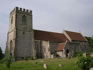
Lewknor is a village and civil parish about 5 miles (8 km) south of Thame in Oxfordshire. The civil parish includes the villages of Postcombe and South Weston. The 2011 Census recorded the parish's population as 663.
William Hartley was an English Roman Catholic priest. He is a Catholic martyr, beatified in 1929.

Pyrton is a small village and large civil parish in Oxfordshire about 1 mile (1.6 km) north of the small town of Watlington and 5 miles (8 km) south of Thame. The 2011 Census recorded the parish's population as 227. The toponym is from the Old English meaning "pear-tree farm".

Stonor is a mostly cultivated and wooded village and former civil parish, now in the parish of Pishill with Stonor, in the South Oxfordshire, district, in the county of Oxfordshire, England. It takes up part of the Stonor valley in the Chiltern Hills which rises to 120 meters above sea level within this south-east part of the civil parish, it is centred 3.8 miles (6.1 km) north of Henley-on-Thames. Stonor House close to the village centre has been the home of the Stonor family for more than eight centuries. The house and park are open to the public at certain times of the year. The house has a 12th-century private chapel built of flint and stone, with an early brick tower. There are also signs of a prehistoric stone circle in the park, which gives the place name its etymology.

Tusmore is a settlement in the civil parish of Hardwick with Tusmore, in the Cherwell district, in Oxfordshire, England, about 5+1⁄2 miles (9 km) north of Bicester. It is the location of the Tusmore country house and estate.

Hethe is a village and civil parish about 4.5 miles (7.2 km) north of Bicester in Oxfordshire, England.
Exlade Street is a hamlet in Checkendon civil parish in Oxfordshire, about 6 miles (9.7 km) northwest of Reading, in the Chiltern Hills. The hamlet is about 445 feet (136 m) above sea level.
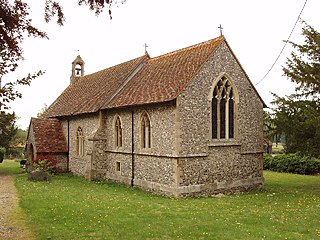
Crowell is a village and civil parish in the South Oxfordshire district, in Oxfordshire, England, about 4 miles (6.4 km) southeast of the market town of Thame and 1 mile (1.6 km) southwest of the village of Chinnor. The 2001 Census recorded the parish's population as 100. Crowell village is a spring line settlement at the source of a stream called the Pleck at the foot of the Chiltern Hills escarpment. The toponym "Crowell" is derived from the Old English for "crow's spring" or "crow's stream".


