Benson, Oxfordshire

Last updated

Benson
Benson church.jpg
St Helen's parish church
Oxfordshire UK location map.svg
Red pog.svg
Benson
Location within Oxfordshire
Area9.84 km2 (3.80 sq mi)
Population4,754 (2011 Census)
  Density 483/km2 (1,250/sq mi)
OS grid reference SU6191
Civil parish
District
Shire county
Region
Country England
Sovereign state United Kingdom
Post town Wallingford
Postcode district OX10
Dialling code 01491
Police Thames Valley
Fire Oxfordshire
Ambulance South Central
UK Parliament
List of places
UK
England
Oxfordshire
51°37′16″N1°06′40″W / 51.621°N 1.111°W / 51.621; -1.111

Benson is a village and civil parish in South Oxfordshire, England. The 2011 Census gave the parish population as 4,754. [2] It lies about a mile and a half (2.4 km) north of Wallingford at the foot of the Chiltern Hills, where a chalk stream, Ewelme Brook, joins the River Thames next to Benson Lock.

Contents

Geography

Benson, on the north and east banks of the Thames, was unaffected by the 1974 boundary changes between Berkshire and Oxfordshire. It rests on river silts and gravel, just above surrounding marshy land named in the nearby settlements of Preston Crowmarsh, Crowmarsh Gifford, and Rokemarsh. The fertile land surrounding Benson meant that farming was the main source of employment until the 20th century.[ citation needed ] The brook through the village is home to trout and to the invasive American signal crayfish.[ citation needed ]

History

Etymology

The place-name Benson is first attested in the Anglo-Saxon Chronicle , which took its present form in the latter half of the ninth century, in the forms Bænesingtun and Benesingtun. Instances where the name is mentioned include the Battle of Bedcanford, which supposedly took place in 571 and led to Britons ceding Benson to someone called Cuthwulf, but the historicity of this event is uncertain. The name is thought to derive from a personal name Benesa, combined with the suffix -ing (here indicating Benesa's possession of the place), and the word tūn (meaning 'estate'). Thus it once meant "farmstead of Benesa". In the period 1140–1315 the name appears as Besinton (and similar forms), and Benston in 1526. [3] The present form of the name, Benson, appears early in the nineteenth century, but Bensington continued in use, at least in formal documents, into the second half of the century.[ citation needed ] The 1866 Working Agreement made by the Great Western Railway for its Wallingford–Watlington line used the older form. [4]

Archaeology

Evidence of human presence has been found dating back to the Mesolithic period – about 10,000 BCE. The village occupies the site of an ancient British town known also to have been occupied in the Roman period, although Benson's written history dates back only to 571 CE [5] Recent excavation for a housing site at the junction of St Helen's Avenue and Church Road revealed evidence of early Neolithic (3500 BCE) and later Bronze Age or early Iron Age (11th – 8th centuries BCE) pits and post holes, with a possible later Bronze Age roundhouse and three early or mid-Saxon (5th – 6th centuries CE) sunken-floored buildings. [6] [7]

Medieval manor

In 779 the estate was, according to the Anglo-Saxon Chronicle. taken from Wessex by Offa of Mercia following the Battle of Bensington. [8] :32–33 It was certainly a royal manor by the 880s. [8] :32 At the time of the 1086 Domesday Book, Benson was "the richest royal manor in Oxfordshire". [9] The manor boundaries ran from the borders of Stadhampton in the north to include Henley in the south-east [10] and were probably set long before the Conquest. [11] Domesday rates that manor at £85 a year, although it comprised only 11.75 hides, while the Bishop of Lincoln's 90 hides at Dorchester were valued at only £30. [9] Benson itself was clearly the most valuable part of the manor. The map shows Benson parish as only about a tenth of the area of Benson manor, but Domesday values it alone at £30, compared with £5 for the neighbouring parish of Berrick. [12]

Parish church

Second World War graves of Polish and Czechoslovak airmen in the extension of St Helen's parish churchyard Benson StHelen Blyskal Odstrcilek.jpg
Second World War graves of Polish and Czechoslovak airmen in the extension of St Helen's parish churchyard

The Church of England parish church of St Helen is partly ancient. John Marius Wilson described it: "variously late pointed Norman and decorated; has a modern tower; contains a Norman font and two [monumental] brasses; and is very good." [13] The church parish includes the hamlets of Fifield and Crowmarsh-Battle or Preston-Crowmarsh. The village is often confused with RAF Benson, which is a well-known RAF station and airfield. The airfield boundary is adjacent to the village, and the aerodrome's construction closed the former "London Road". The RAF buildings are on the opposite side of the airfield to Benson village, adjacent to the village of Ewelme.

The church tower was rebuilt in 1794. It has a single clock-face on the east-facing side, with hours displayed in Roman numerals. The clock face erroneously has the nine o'clock marker marked as "XI", as is the eleven o'clock marker correctly. This mistake gained fame in the Second World War when Germany's English-speaking propaganda broadcaster, William Joyce (Lord Haw Haw) promised an air raid on "an airfield near the village whose clock had two elevens". RAF Benson was bombed soon afterwards.

The bell tower has a ring of eight bells. [14] Six, including the tenor and treble, were cast in 1781 by Thomas Janaway of Chelsea. [15] [14] The current second and third bells were added by Whitechapel Bell Foundry: the second was cast by Charles and George Mears in 1852 and the third by Mears and Stainbank in 1922. [14] In October 2009 White's of Appleton replaced the original oak bell frame of 1794 with a modern steel frame. [14] White's refurbished the bells and fitted new headstocks for the new steel frame. [16]

Social and economic history

13 Castle Square, a mid-18th-century house Tower on the castle - geograph.org.uk - 1614371.jpg
13 Castle Square, a mid-18th-century house
Benson war memorial Benson war memorial.jpg
Benson war memorial
Row of shops in the High Street Arcade along the High Street - geograph.org.uk - 1615282.jpg
Row of shops in the High Street

Benson is one of several key South Oxfordshire sites of the English Civil War, lying between the site of the Battle of Chalgrove Field (18 June 1643) and Wallingford Castle. It was reputedly the last Royalist stronghold to surrender, being close to the Royalist cities of Oxford and Newbury. A building at Benson is still known as the Court House from the time King Charles I held court there on his way to Oxford. [17] A flash lock was installed on the Thames at Benson in 1746. Benson weir collapsed in 1783, necessitating the construction of Benson pound lock in 1788. The lock was rebuilt in 1870.

The road between Henley-on-Thames and Dorchester on Thames became a turnpike in 1736 [18] and in the 18th and early 19th centuries Benson was an important staging post for coaches between London and Oxford via Henley. [19] Its broad open square was surrounded by coaching inns. [19] At its peak the village had four large inns, ten smaller alehouses and a blacksmith. The 1844 opening of the Oxford branch of the GWR rapidly reduced coach traffic: within ten years only three Oxford-London coaches a week were still running through. [20] The Henley–Dorchester road ceased to be a turnpike in 1873. [18]

The decline in coaching, the enclosures and the agricultural depression explain a fall in population from 1253 in 1841 to 1157 by 1861. [21] Failure to extend the Cholsey and Wallingford Railway to Watlington, via a station at Benson on an embankment north of Littleworth Road and close to the junction with Oxford Road, left the village increasingly isolated, as passenger transport between London and Oxford largely followed a railway line that ran nowhere near the once-prominent coaching stop. The village recovered as motor coaches and private cars became more important, leading to a number of roadhouse-type cafes – the early 20th-century equivalents of coaching inns.

Amenities

Benson today is a commuter village, despite its lack of a railway station and distance from the motorways M4 and M40. It has a Church of England primary school in Oxford Road. A separate infant school was built at the top of Westfield Road in 1972 "to relieve congestion at the Oxford Road school", [22] but early in the new millennium, the infant department returned to Oxford Road, allowing the Westfield Road site to be sold for a housing development known as Millar Close. [23] There is also a pre-school.

The village has a doctor's surgery and two public houses: an 18th-century coaching inn, The Crown Inn, [24] and the Three Horseshoes. The pub number is down from five in 1990, those closed having become private homes. There are about a dozen shops, including a supermarket and a dispensing chemist. A garage on the main Oxford road outside the village has an on-site McDonald's with drive-through and a Marks and Spencer food outlet, but the Vauxhall main car dealership there has closed. [25]

The village play area reopened in 2021, dedicated to a local teenager, Faye Elizabeth Grundy. [26] Aircraft noise in the area can be marked, which lowers property values compared with many surrounding villages. [27] The village lies in a well-known frost-pocket, sometimes recording the lowest night-time temperatures in the UK. This climatic quirk may have led to the village playing a part in the development of modern meteorology, with a meteorological observatory being located there in the early 19th century. [28]

In 1993 the River Thames at Benson was one of the primary filming locations for Episode 7 of Series 3 of the BBC sitcom Keeping up Appearances . [29]

See also

Related Research Articles

<span class="mw-page-title-main">Harwell, Oxfordshire</span> Human settlement in England

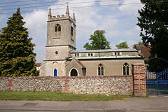
Harwell is a village and civil parish in the Vale of White Horse about 2 miles (3 km) west of Didcot, 6 miles (10 km) east of Wantage and 13 miles (21 km) south of Oxford. The parish measures about 3.5 miles (6 km) north – south, and almost 2 miles (3 km) east – west at its widest point. In 1923 its area was 2,521 acres (1,020 ha). Historically in Berkshire, it has been administered as part of Oxfordshire, England, since the 1974 boundary changes. The parish includes part of Harwell Science and Innovation Campus in the southwest. The 2011 census recorded the parish's population as 2,349.

<span class="mw-page-title-main">South Oxfordshire</span> Non-metropolitan district in England

South Oxfordshire is a local government district in the ceremonial county of Oxfordshire, England. Its council is temporarily based outside the district at Abingdon-on-Thames pending a planned move to Didcot, the district's largest town. The areas located south of the River Thames are within the historic county of Berkshire.

<span class="mw-page-title-main">Eynsham</span> Village in Oxfordshire, England

Eynsham is an English village and civil parish in Oxfordshire, about 5 miles (8 km) north-west of Oxford and east of Witney. The 2011 Census recorded a parish population of 4,648. It was estimated at 5,087 in 2020.

<span class="mw-page-title-main">Culham</span> Human settlement in England

Culham is a village and civil parish in a bend of the River Thames, 1 mile (1.6 km) south of Abingdon in Oxfordshire. The parish includes Culham Science Centre and Europa School UK. The parish is bounded by the Thames to the north, west and south, and by present and former field boundaries to the east. It is low-lying and fairly flat, rising from the Thames floodplain in the south to a north-facing escarpment in the north up to 260 feet (80 m) above sea level. The 2011 Census recorded its population as 453.

<span class="mw-page-title-main">Nettlebed</span> Village in the Chiltern Hills, England

Nettlebed is a village and civil parish in Oxfordshire in the Chiltern Hills about 4+12 miles (7 km) northwest of Henley-on-Thames and 6 miles (10 km) southeast of Wallingford. The parish includes the hamlet of Crocker End, about 12 mile (800 m) east of the village. The 2011 Census recorded a parish population of 727.

<span class="mw-page-title-main">Crowmarsh Gifford</span> Human settlement in England

Crowmarsh Gifford, commonly known as Crowmarsh, is a village in the civil parish of Crowmarsh, in the South Oxfordshire district, in the county of Oxfordshire, England. It is beside the River Thames opposite the market town of Wallingford, the two linked by Wallingford Bridge. Crowmarsh parish also includes the hamlet of Newnham Murren, which is now merged with the village; the hamlet of Mongewell, and the village of North Stoke 2 miles (3.2 km) to the south.

<span class="mw-page-title-main">Berrick Salome</span> Human settlement in England

Berrick Salome is a village and civil parish in South Oxfordshire, England, about 3 miles (5 km) north of Wallingford. Since the 1992 boundary changes, the parish has included the whole of Roke and Rokemarsh and Berrick Prior. The 2011 Census recorded the parish's population as 326. In 1965, Reginald Ernest Moreau (1897–1970), an eminent ornithologist, and a Berrick Salome resident from 1947, realized that he could build up a picture of the village as it had been in the decades before the First World War, based on the recollections of elderly villagers. His study, which was published in 1968 as The Departed Village: Berrick Salome at the Turn of the Century, also included an introduction to local history. This provided much of the information for "A Village History" which appeared in The Berrick and Roke Millennium Book and is the major source for this article.

Wheatley is a village and civil parish in Oxfordshire, about 5 miles (8 km) east of Oxford. The parish includes the hamlet of Littleworth, which is immediately to the west of Wheatley village. The 2011 census recorded the parish population as 3,913.

<span class="mw-page-title-main">Clifton Hampden</span> Human settlement in England

Clifton Hampden is a village and civil parish on the north bank of the River Thames, just over 3 miles (5 km) east of Abingdon in Oxfordshire. Since 1932 the civil parish has included the village of Burcot, 1 mile (1.6 km) east of Clifton Hampden. The 2011 Census recorded the parish population as 662.

<span class="mw-page-title-main">Berinsfield</span> Village in South Oxfordshire, England

Berinsfield is an English village and civil parish in South Oxfordshire, about 7 miles (11 km) southeast of Oxford. The 2011 Census recorded the parish population as 2,806.

<span class="mw-page-title-main">Crowmarsh Rural District</span>

Crowmarsh was a rural district in Oxfordshire, England from 1894 to 1932.

<span class="mw-page-title-main">Bix, Oxfordshire</span> Village in Oxfordshire, England

Bix is a village in the civil parish of Bix and Assendon in South Oxfordshire, about 2.5 miles (4 km) northwest of Henley-on-Thames. The village is about 130 metres (430 ft) above sea level in the Chiltern Hills.

<span class="mw-page-title-main">Yarnton</span> Human settlement in England

Yarnton is a village and civil parish in Oxfordshire about 1 mile (1.6 km) southwest of Kidlington and 4 miles (6 km) northwest of Oxford. The 2011 Census recorded the parish's population as 2,545.

<span class="mw-page-title-main">Chalgrove</span> Human settlement in England

Chalgrove is a village and civil parish in South Oxfordshire about 10 miles (16 km) southeast of Oxford. The parish includes the hamlet of Rofford and the former parish of Warpsgrove with which it merged in 1932. The 2011 Census recorded the parish population as 2,830. Chalgrove is the site of a small Civil War battle in 1643, the Battle of Chalgrove Field. The Parliamentarian John Hampden was wounded in the battle, and died of his wounds six days later.

<span class="mw-page-title-main">Warborough</span> Village in Oxfordshire, England

Warborough is a village and civil parish in South Oxfordshire, about 2.5 miles (4 km) north of Wallingford and about 9 miles (14 km) south of Oxford. The parish also includes the hamlet of Shillingford, south of Warborough beside the River Thames.

<span class="mw-page-title-main">Shillingford</span> Human settlement in England

Shillingford is a hamlet on the north bank of the River Thames in Warborough civil parish in South Oxfordshire, England. It lies on the A4074 between Oxford and Reading, at the junction with the A329.

<span class="mw-page-title-main">North Stoke, Oxfordshire</span> Human settlement in England

North Stoke is a small village beside the River Thames in the civil parish of Crowmarsh, in the South Oxfordshire district, in the county of Oxfordshire, England, 2 miles (3.2 km) south of the market town of Wallingford. Its 'Church of St Mary' is a Grade I listed building. In 1931 the parish had a population of 190. On 1 April 1932 the parish was abolished to form Crowmarsh.

<span class="mw-page-title-main">Rousham</span> Human settlement in England

Rousham is a village and civil parish beside the River Cherwell in Oxfordshire. The village is about 6+12 miles (10.5 km) west of Bicester and about 6 miles (10 km) north of Kidlington. The parish is bounded by the River Cherwell in the east, the A4260 main road between Oxford and Banbury in the west, partly by the B4030 in the north, and by field boundaries with Tackley parish in the south. The 2001 Census recorded the parish's population as 80. Rousham was founded early in the Anglo-Saxon era. Its toponym is derived from Old English meaning Hrothwulf's ham or farm.

<span class="mw-page-title-main">Nuffield, Oxfordshire</span> Human settlement in England

Nuffield is a village and civil parish in the Chiltern Hills in South Oxfordshire, England, just over 4 miles (6 km) east of Wallingford. The 2011 Census recorded the parish population as 939.

<span class="mw-page-title-main">Caversfield</span> Human settlement in England

Caversfield is a village and civil parish about 1+12 miles (2.4 km) north of the centre of Bicester. In 1844 Caversfield became part of Oxfordshire, but until then it was always an exclave of Buckinghamshire. The 2011 Census recorded the parish's population as 1,788.

References

  1. "Benson Parish Council Website". Benson Parish Council. Retrieved 20 July 2021.
  2. "Area: Benson (Parish): Key Figures for 2011 Census: Key Statistics". Neighbourhood Statistics . Office for National Statistics. Archived from the original on 17 November 2015. Retrieved 14 November 2015.
  3. The Cambridge Dictionary of English Place-Names Based on the Collections of the English Place-Name Society, ed. by Victor Watts (Cambridge: Cambridge University Press, 2004), s.v. BENSON; ISBN   9780521168557.
  4. Karau & Turner 1982, inside back cover.
  5. Roe, Derek (1994). "The Palaeolithic Archaeology of the Oxford Region" (PDF). Oxoniensia. 59: 5. Retrieved 9 June 2020. Open Access logo PLoS transparent.svg
  6. Hey, Gill (December 2006). "Neolithic and Early Bronze Age Oxfordshire" (PDF). Oxford Archaeology . Archived from the original (PDF) on 9 June 2020. Retrieved 9 June 2020.
  7. Pine, Jo; Ford, Steve (2003). "Excavation of Neolithic, Late Bronze Age, Early Iron Age and Early Saxon Features at St. Helen's Avenue, Benson, Oxfordshire" (PDF). Oxoniensia . 68: 131–178. Archived from the original (PDF) on 12 July 2020. Retrieved 19 July 2020.
  8. 1 2 Sims-Williams, Patrick (1983). "The Settlement of England in Bede and the Chronicle". Anglo-Saxon England. 12: 1–41. doi:10.1017/S0263675100003331. JSTOR   44510771..
  9. 1 2 Tiller 1999, p. 27.
  10. Tiller 1999, p. 28.
  11. Tiller 1999, p. 29.
  12. Salzman 1939, p. 419.
  13. Wilson 1870–72
  14. 1 2 3 4 "Place: Benson S Helens". Dove's Guide for Church Bell Ringers. Retrieved 2 August 2010.
  15. "Bell Founders". Dove's Guide for Church Bell Ringers. Retrieved 2 August 2010.
  16. Benson. Retrieved 9 June 2020.
  17. p. 213. Retrieved 9 June 2020.
  18. 1 2 Rosevear, Alan (2008–2009). "List of Turnpike Trusts in England". Turnpike Roads in England. Alan Rosevear. Retrieved 28 December 2010.
  19. 1 2 Rowley 1978, p. 149.
  20. Tiller 1999, p. 97.
  21. Table of population. Retrieved 9 June 2020.
  22. Burtt & Clarke 2004, p. 78.
  23. Benson C of E Primary School
  24. Crown Inn Benson
  25. "Find your nearest store – Wallingford Benson BP". Marks & Spencer . Retrieved 19 July 2020.
  26. "Play area re-opened in memory of tragic teenager after £250,000 makeover". Henley Standard. Retrieved 16 August 2021.
  27. Noise assessment. Retrieved 9 June 2020.
  28. Retrieved 9 June 2020.
  29. "Keeping up Appearances". Find That Location.com. 9 February 2014.

Sources