
Wallingford is a historic market town and civil parish on the River Thames in South Oxfordshire, England, 12 miles (19 km) north of Reading, 13 miles (21 km) south of Oxford and 11 miles (18 km) north west of Henley-on-Thames. Although belonging to the historic county of Berkshire, it is within the ceremonial county of Oxfordshire for administrative purposes as a result of the 1972 Local Government Act. The population was 11,600 at the 2011 census.

Benson is a village and civil parish in South Oxfordshire, England. The 2011 Census gave the parish population as 4,754. It lies about a mile and a half north of Wallingford at the foot of the Chiltern Hills, where a chalk stream, Ewelme Brook, joins the River Thames next to Benson Lock.

Ewelme is a village and civil parish in the Chiltern Hills in South Oxfordshire, 2.5 miles (4 km) northeast of the market town of Wallingford. The 2011 census recorded the parish's population as 1,048. To the east of the village is Cow Common and to the west, Benson Airfield, the northeastern corner of which is within the parish boundary. The local geology is chalk overlying gault clay; the drift geology includes some gravel.
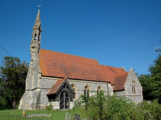
Adwell is a village and civil parish about 3 miles (5 km) south of Thame in South Oxfordshire. The parish covers 443 acres (179 ha),

South Stoke is a village and civil parish on an east bank of the Thames, about 1.5 miles (2.4 km) north of Goring-on-Thames in South Oxfordshire. It includes less than 1 mile (1.6 km) to its north the hamlet and manor house of Littlestoke.

Wallingford Castle is a medieval castle situated in Wallingford in the English county of Oxfordshire, adjacent to the River Thames. Established in the 11th century as a motte-and-bailey design within an Anglo-Saxon burgh, it grew to become what historian Nicholas Brooks has described as "one of the most powerful royal castles of the 12th and 13th centuries". Held for the Empress Matilda during the civil war years of the Anarchy, it survived multiple sieges and was never taken. Over the next two centuries it became a luxurious castle, used by royalty and their immediate family. After being abandoned as a royal residence by Henry VIII, the castle fell into decline. Refortified during the English Civil War, it was eventually slighted, i.e. deliberately destroyed, after being captured by Parliamentary forces after a long siege. The site was subsequently left relatively undeveloped, and the limited remains of the castle walls and the considerable earthworks are now open to the public.
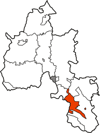
Crowmarsh was a rural district in Oxfordshire, England from 1894 to 1932.
William Seymour Blackstone (1809–1881) was an English MP in the Parliament of the United Kingdom.

Warborough is a village and civil parish in South Oxfordshire, about 2.5 miles (4 km) north of Wallingford and about 9 miles (14 km) south of Oxford. The parish also includes the hamlet of Shillingford, south of Warborough beside the River Thames.

North Stoke is a small village beside the River Thames in the civil parish of Crowmarsh, in the South Oxfordshire district, in the county of Oxfordshire, England, 2 miles (3.2 km) south of the market town of Wallingford. Its 'Church of St Mary' is a Grade I listed building. In 1931 the parish had a population of 190. On 1 April 1932 the parish was abolished to form Crowmarsh.

Crowmarsh is a fairly large, mostly rural civil parish in the South Oxfordshire, district, in the county of Oxfordshire, England, east and southeast of the town of Wallingford on the opposite bank of the River Thames and may also refer to its larger district council ward which extends to Ipsden and Nuffield. In 2011 it had a population of 2830.
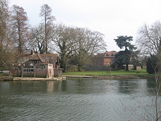
Mongewell is a village in the civil parish of Crowmarsh in the South Oxfordshire district, in Oxfordshire, England, about 1 mile (1.6 km) south of Wallingford. Mongewell is on the east bank of the Thames, linked with the west bank at Winterbrook by Winterbrook Bridge. The earthwork Grim's Ditch, now part of The Ridgeway long-distance footpath, passes through the northern part of it and is a scheduled ancient monument. It has a church called St John the Baptist's Church.
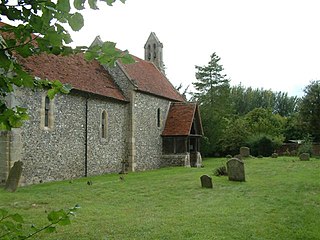
Newnham Murren is a hamlet in the civil parish of Crowmarsh, in the South Oxfordshire district, in the county of Oxfordshire, England. It is in the Thames Valley, about 0.5 miles (800 m) east of the market town of Wallingford. Newnham Murren is now contiguous with the village of Crowmarsh Gifford. It has a church called St Mary's Church.
Langtree is an ancient hundred in the south-east of the county of Oxfordshire established during the Anglo-Saxon era. It was used to organize the local militia, apportion taxes and maintain roads. It was especially important in apprehending criminals and had a hundred court for local trials. Since the end of the nineteenth century its functions have been assumed by other divisions of government. It is currently dormant.
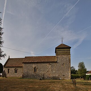
Nuffield is a village and civil parish in the Chiltern Hills in South Oxfordshire, England, just over 4 miles (6 km) east of Wallingford. The 2011 Census recorded the parish population as 939.

Stoke Row is a village and civil parish in the Chiltern Hills, about 5 miles (8 km) west of Henley-on-Thames in South Oxfordshire and about 9 miles (14 km) north of Reading. The 2011 Census recorded the parish population as 651.

St John the Baptist's Church is a closed, redundant Anglican church, partly in ruins, in what has thus reverted to the hamlet of Mongewell, Oxfordshire, England. It is recorded in the National Heritage List for England as a designated Grade II listed building, and is under the care of the Churches Conservation Trust. The ruins stand on the east bank of the River Thames, next to the former Carmel College, to the north of Mongewell Park, 2.5 miles (4 km) south of Wallingford, and near The Ridgeway long-distance path. Local Anglicans are in the parish of North Stoke: St Mary the Virgin.

St Mary's Church is a redundant Anglican church in the hamlet of Newnham Murren, Oxfordshire, England. It is recorded in the National Heritage List for England as a designated Grade II* listed building, and is under the care of the Churches Conservation Trust. The church stands at the end of a farm track, overlooking the River Thames, near The Ridgeway long-distance path.
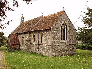
Crowell is a village and civil parish in the South Oxfordshire district, in Oxfordshire, England, about 4 miles (6.4 km) southeast of the market town of Thame and 1 mile (1.6 km) southwest of the village of Chinnor. The 2001 Census recorded the parish's population as 100. Crowell village is a spring line settlement at the source of a stream called the Pleck at the foot of the Chiltern Hills escarpment. The toponym "Crowell" is derived from the Old English for "crow's spring" or "crow's stream".


