
Barnet was a local government district in south Hertfordshire from 1863 to 1965 around the town of Barnet.
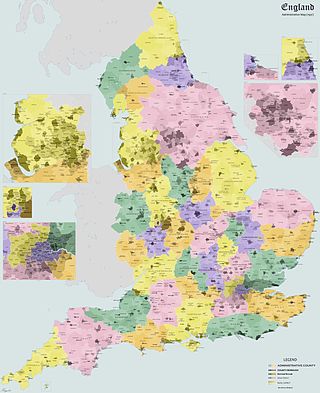
Banbury was a rural district in Oxfordshire, England from 1894 to 1974. It was formed under the Local Government Act 1894 from the bulk of the Banbury rural sanitary district, which had been divided among three counties. The Warwickshire part of the rural sanitary district formed the Farnborough Rural District, whilst the area in Northamptonshire formed the Middleton Cheney Rural District.
Henley was a rural district in Oxfordshire, England from 1894 to 1974.
Bumpstead was a rural district in the administrative county of Essex, England from 1894 to 1934.
Northampton was a rural district in Northamptonshire, England from 1894 to 1974.
Middleton Cheney was a rural district in Northamptonshire, England from 1894 to 1935.
Whitchurch was a rural district in Hampshire, England from 1894 to 1932.
Crowmarsh was a rural district in Oxfordshire, England from 1894 to 1932.
Headington was a rural district in Oxfordshire, England from 1894 to 1932, based on the Headington rural sanitary district. It covered an area to the east of the city of Oxford. The parish of Headington was split out as a separate urban district in 1927.
Goring was a rural district in Oxfordshire, England from 1894 to 1932.
Abingdon was a rural district in the administrative county of Berkshire from 1894 to 1974.
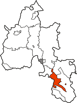
St Helen Without is a civil parish in the Vale of White Horse district in the English county of Oxfordshire. In 1974 it was transferred from Berkshire. It is immediately west of Abingdon and includes the villages of Dry Sandford and Shippon. A large part of the parish is occupied by Dalton Barracks and its associated airfield. According to the 2001 census the parish had a population of 2,623. The parish was created by the Local Government Act 1894, by the division of the parish of Abingdon St. Helen. The part inside Abingdon Municipal Borough became part of Abingdon parish, whilst that part outside became St. Helen Without. It became part of the Abingdon Rural District of Berkshire in 1894, and then part of the Vale of White Horse in Oxfordshire under the Local Government Act 1972.
Faringdon was a rural district in the administrative county of Berkshire from 1894 to 1974.


