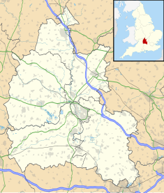
The Cotswolds is a region of central South West England, along a range of rolling hills that rise from the meadows of the upper River Thames to an escarpment above the Severn Valley and the Vale of Evesham. The area is defined by the bedrock of Jurassic limestone that creates a type of grassland habitat that is quarried for the golden-coloured Cotswold stone. It lies across the boundaries of several English counties: mainly Gloucestershire and Oxfordshire, and parts of Wiltshire, Somerset, Worcestershire, and Warwickshire. The highest point is Cleeve Hill at 1,083 ft (330 m), just east of Cheltenham. The predominantly rural landscape contains stone-built villages, towns, stately homes and gardens featuring the local stone.

Oxfordshire is a ceremonial county in South East England. The county is bordered by Northamptonshire and Warwickshire to the north, Buckinghamshire to the east, Berkshire to the south, and Wiltshire and Gloucestershire to the west. The city of Oxford is the largest settlement and county town.

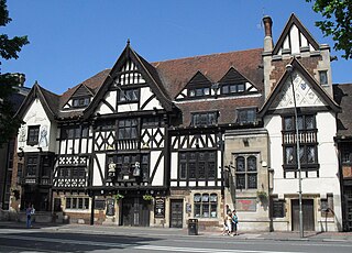
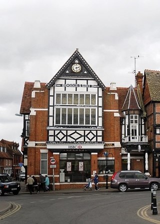
Burford is a town on the River Windrush, in the Cotswold hills, in the West Oxfordshire district of Oxfordshire, England. It is often referred to as the 'gateway' to the Cotswolds. Burford is located 18 miles (29 km) west of Oxford and 22 miles (35 km) southeast of Cheltenham, about 2 miles (3 km) from the Gloucestershire boundary. The toponym derives from the Old English words burh meaning fortified town or hilltown and ford, the crossing of a river. The 2011 Census recorded the population of Burford parish as 1,422.

Chipping Norton is a market town and civil parish in the Cotswold Hills in the West Oxfordshire district of Oxfordshire, England, about 12 miles (19 km) south-west of Banbury and 18 miles (29 km) north-west of Oxford. The 2011 Census recorded the civil parish population as 5,719. It was estimated at 6,254 in 2019.

Northleach is a market town and former civil parish, now in parish Northleach with Eastington, in the Cotswold district, in Gloucestershire, England. The town is in the valley of the River Leach in the Cotswolds, about 10 miles (16 km) northeast of Cirencester and 11 miles (18 km) east-southeast of Cheltenham. The 2011 Census recorded the parish's population as 1,854, the same as Northleach built-up-area.

Bampton, also called Bampton-in-the-Bush, is a settlement and civil parish in the Thames Valley about 4+1⁄2 miles (7 km) southwest of Witney in Oxfordshire. The parish includes the hamlet of Weald. The 2011 Census recorded the parish's population as 2,564. Bampton is variously referred to as both a town and a village. The Domesday Book recorded that it was a market town by 1086. It continued as such until the 1890s. It has both a town hall and a village hall.

Westwell is a small village and civil parish about 2 miles (3 km) southwest of the market town of Burford in Oxfordshire. It is the westernmost village in the county, close to the border with Gloucestershire.
Tholsel was a name traditionally used for a local municipal and administrative building used to collect tolls and taxes and to administer trade and other documents in Irish towns and cities. It was at one stage one of the most important secular buildings in Ireland's town and cities and the level of importance was reflected in the prominence and size of these buildings as well as the expensive materials and architectural techniques used. Some historic tholsels still exist, notably The Tholsel, Kilkenny. Towards the end of the 18th century the term tholsel was typically swapped for Market House with many of the administrative functions of the original tholsel transferring to another dedicated local council or government building such as a court or sessions house.
The King and Queen is a pub in the seaside resort of Brighton, part of the city of Brighton and Hove. The present building, a "striking" architectural "pantomime" by the prolific local firm Clayton & Black, dates from the 1930s, but a pub of this name has stood on the site since 1860—making it one of the first developments beyond the boundaries of the ancient village. This 18th-century pub was, in turn, converted from a former farmhouse. Built using materials characteristic of 16th-century Vernacular architecture, the pub is in the Mock Tudor style and has a wide range of extravagant decorative features inside and outside—contrasting with the simple design of the neighbouring offices at 20–22 Marlborough Place, designed a year later. English Heritage has listed the pub at Grade II for its architectural and historical importance.

The Anglican Church of St John the Baptist in Burford, Oxfordshire, England is a Grade I listed building.
Henley Town Hall is a municipal structure in the Market Place in Henley-on-Thames, Oxfordshire, England. The town hall, which is the headquarters of Henley Town Council, is a Grade II* listed building.
Redesdale Hall, also referred to as Moreton-in-Marsh Town Hall, is a municipal building in the High Street, Moreton-in-Marsh, Gloucestershire, England. The building, which is used as an events venue, is a Grade II listed building.

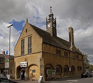
Tetbury Market House, also known as Tetbury Town Hall, is a municipal building in the Market Place, Tetbury, Gloucestershire, England. The building, which was used both as a market house and as a town hall until the late 19th century, is a Grade I listed building.

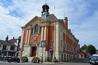
Chipping Norton Town Hall is a municipal building in the Market Place, Chipping Norton, Oxfordshire, England. The building, which is used as an events venue, is a Grade II* listed building.

Wallingford Town Hall is a municipal building in the Market Place in Wallingford, Oxfordshire, England. The building, which is the meeting place of Wallingford Town Council, is a Grade I listed building.

Woodstock Town Hall is a municipal building in the Market Place in Woodstock, Oxfordshire, England. The building, which is used as a community events venue and the headquarters of Woodstock Town Council, is a Grade II listed building.
The Old Town Hall is a municipal building in the Market Place in Wantage, Oxfordshire, England. The building, which was the headquarters of Wantage Urban District Council, was converted into apartments in 2018.

The Moot Hall is a municipal building in Market Cross Place in Aldeburgh, Suffolk, England. The building, which is the meeting place of Aldeburgh Town Council, is a Grade I listed building.

Malmesbury Town Hall is a municipal building in Cross Hayes in Malmesbury, Wiltshire, England. The structure, which is the meeting place of Malmesbury Town Council and the home of the Athelstan Museum, is a Grade II listed building.

The Moot Hall, also known as the Old School House, is a former market hall and school on Church Street in Steeple Bumpstead, Essex, England. The building, which now operates as a library and parish meeting room, is a Grade II* listed building.