
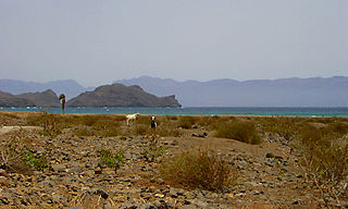
São Nicolau is one of the Barlavento (Windward) islands of Cape Verde. It is located between the islands of Santa Luzia and Sal. Its population is 12,424 (2015), with an area of 343 km². The main towns are Ribeira Brava and Tarrafal de São Nicolau.

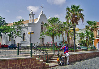
Tarrafal de São Nicolau is a city in the western part of the island of São Nicolau, Cape Verde. With a population of 3,733, it is the most populous settlement of the island. It is the seat of the Tarrafal de São Nicolau Municipality, and the main port of the island. It is situated on the west coast, 9 km southwest of Ribeira Brava.

Estádio Municipal Adérito Sena is a multi-use stadium in Mindelo, Cape Verde. It is currently used mostly for football matches and is the home stadium of FC Derby as well as CS Mindelense, Académica, GD Amarantes and Batuque FC and the lesser club of Corinthians São Vicente. The stadium holds 5,000 people and area is 105x68 m and its ground is artificial grass. The stadium is owned by the municipality of São Vicente and is operated by the São Vicente Regional Football Association (ARFSV). It is a certified stadium by FIFA for international competition as well as friendly matches
Salamansa is a village in the northeastern part of the island of Sao Vicente, Cape Verde. It is situated on the north coast, approximately 5 km northeast of the city centre of Mindelo. In 2010 its population was 1,179. Salamansa is a fishing village with a long sandy beach.
Vicente Dias is a settlement in the western part of the island of Fogo, Cape Verde. It is situated 2 km northwest of Luzia Nunes and 5 km east of the island capital São Filipe.

Lameirão is a village in the northern part of the island of Sao Vicente, Cape Verde. It is situated in the hills east of the island capital Mindelo, approximately 3 km southeast of the city centre and west of Monte Verde.

Ribeira da Vinha is a village in the central part of the island of Sao Vicente, Cape Verde. It is situated in the plain southwest of the island capital Mindelo, approximately 3 km from the city centre.

Matiota is a subdivision of the city of Mindelo in the island of São Vicente, Cape Verde. It is situated 1.2 km northwest of the city centre, along Porto Grande Bay. Adjacent subdivisions include Chã de Alecrim to the east and Fortinho to the south. It includes the beach Praia da Laginha.

Porto Novo is a city in the island of Santo Antão, in Cape Verde. It is the seat of the Porto Novo municipality. At the 2010 census, the town had 9,310 inhabitants, which makes it the most populous settlement of the island.
São Francisco is a subdivision of the city of Praia in the island of Santiago, Cape Verde. Its population was 570 at the 2010 census. It is situated 7 km north of the city centre. 3.5 km to its east is the São Francisco Bay, and 2.5 km to its northeast the village Vale da Custa, part of the municipality of São Domingos.
Ribeira Julião is a village in the central part of the island of Sao Vicente, Cape Verde. In 2010 its population was 611. It is situated in the valley of the stream Ribeira de Julião, south of the island capital Mindelo, 3.5 km from the city centre. An adjacent neighbourhood of Mindelo is named Ribeira de Julião.

Ribeira Bote is a subdivision of the city of Mindelo in the island of São Vicente, Cape Verde. Its population was 3,956 at the 2010 census. It borders the city centre to the northwest and Fonte Cónego to the north. The Hospital Velho and the church Nossa Senhora Auxiliadora are located in Ribeira Bote.
The City center of Mindelo or Morada is the historic center of the Mindelo in the island of São Vicente, Cape Verde. Its population was 1,553 at the 2010 census. It is the place where the island's first settlement was founded in 1793. Many public buildings are situated in the city centre. It lies along the Porto Grande Bay. Adjacent neighbourhoods include Fortinho to the northwest, Alto Miramar to the northeast, Fonte Cônego to the east and Ribeira Bote to the southeast.
Luzia Nunes is a settlement in the southwestern part of the island of Fogo, Cape Verde. It is situated 1.5 km west of Patim, 2 km southeast of Vicente Dias and 7 km southeast of the island capital São Filipe. At the 2010 census its population was 438.

Fortinho or Fortinho/Escola Técnica is a subdivision of the city of Mindelo in the island of São Vicente, Cape Verde. Its population was 92 at the 2010 census. It is situated northwest of the city centre and south of Matiota. It takes its name from the fortress Fortim d'El-Rei.

Alto Miramar is a subdivision of the city of Mindelo in the island of São Vicente, Cape Verde. Its population was 524 at the 2010 census. It is situated directly northeast of the city centre. The main streets of the neighbourhood are Rua Unidade Africana and Rua da Paz.

Fonte Cónego is a subdivision of the city of Mindelo in the island of São Vicente, Cape Verde. Its population was 236 at the 2010 census. It is situated directly east of the city centre. Adjacent neighborhoods include Alto Miramar to the northwest, Alto Santo António to the north, Alto Solarine/Forca to the northeast and Ribeira Bote to the south.

The Universidade de Santiago is a private Cape Verdean university. The main campus is in Assomada, located in the middle of the Island of Santiago. There are two satellite campuses, one in Praia and another one in Tarrafal. It is one of the eight existing universities in Cape Verde; it was established on November 24, 2008. Since its opening in 2008, it has been run by the current rector Gabriel António Monteiro Fernandes, who holds a Ph.D. in Sociology.


