Madera | |
|---|---|
Town | |
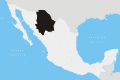
 Madera Location in Mexico  Madera Madera (Chihuahua) | |
| Coordinates: 29°11′24″N108°8′29″W / 29.19000°N 108.14139°W | |
| Country | |
| State | Chihuahua |
| Municipality | Madera |
| Elevation | 2,112 m (6,929 ft) |
| Population (2010) | |
• Total | 15,447 |
Madera, also known as Ciudad Madera, is a town and seat of the municipality of Madera in the mountains of the northwestern Mexican state of Chihuahua. As of 2010, the city of Madera had a population of 15,447, [1] up from 15,267 as of 2005. [2]
Contents
It is a logging town, located in the mountains and the lumber industry is still very important. Madera is Spanish for "wood", and there used to be a large U.S. company with large lumber mills, there is still a section of the city called "barrio americano" where some American-style wooden houses still survive. New manufacturing industries have created new employment for the residents. It is known as the coldest place in Mexico.
It is at 2,112 metres (6,929 ft) above sea level and was founded in 1906.
The town is located 276 kilometres northwest of the state capital, Chihuahua, and 536 km southwest of Ciudad Juárez on the U.S. border.