
Newcastle is a small seaside resort town in County Down, Northern Ireland, which had a population of 8,298 at the 2021 Census. It lies by the Irish Sea at the foot of Slieve Donard, the highest of the Mourne Mountains. Newcastle is known for its sandy beach, forests, and mountains. The town lies within the Newry, Mourne and Down District.

The Mourne Mountains, also called the Mournes or Mountains of Mourne, are a granite mountain range in County Down in the south-east of Northern Ireland. They include the highest mountains in Northern Ireland, the highest of which is Slieve Donard at 850 m (2,790 ft). The Mournes are designated an Area of Outstanding Natural Beauty and it has been proposed to make the area Northern Ireland's first national park. The area is partly owned by the National Trust and sees many visitors every year. The Mourne Wall crosses fifteen of the summits and was built to enclose the catchment basin of the Silent Valley and Ben Crom reservoirs.

The court cairn or court tomb is a megalithic type of chambered cairn or gallery grave. During the period, 3900–3500 BC, more than 390 court cairns were built in Ireland and over 100 in southwest Scotland. The Neolithic monuments are identified by an uncovered courtyard connected to one or more roofed and partitioned burial chambers. Many monuments were built in multiple phases in both Ireland and Scotland and later re-used in the Early Bronze Age.
The Belfast and County Down Railway (BCDR) was an Irish gauge railway in Ireland linking Belfast with County Down. It was built in the 19th century and absorbed into the Ulster Transport Authority in 1948. All but the line between Belfast and Bangor was closed in the 1950s, although some of it has been restored near Downpatrick by a heritage line, the Downpatrick and County Down Railway.

Slieve Croob is a mountain with a height of 534 metres (1,752 ft) in the middle of County Down, Northern Ireland. It is the heart of a mountainous area, the Dromara Hills, north of the Mourne Mountains. It is designated an Area of Outstanding Natural Beauty and is the source of the River Lagan. There is a small road to the summit, where there is an ancient burial cairn and several transmitter stations with radio masts. It has wide views over all of County Down and further afield. The Dromara Hills also includes Slievenisky, Cratlieve, Slievegarran and Slievenaboley.

Slieve Donard is the highest mountain in Northern Ireland, the highest in Ulster and the seventh-highest in Ireland, with a height of 850 metres (2,790 ft). The highest of the Mourne Mountains, it is near the town of Newcastle on the eastern coast of County Down, overlooking the Irish Sea. It is also the highest mountain in the northern half of Ireland.
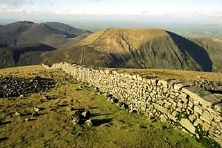
The Mourne Wall was constructed to enclose a catchment area of the Silent Valley Reservoir in the Mourne Mountains, Northern Ireland. The 1.5 m high stone wall, which was built to keep livestock from contaminating water supplies, took almost twenty years to complete. The project was overseen by the Belfast City and District Water Commissioners.
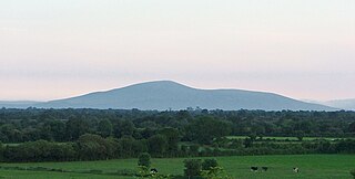
Slievenamon or Slievenaman is a mountain with a height of 721 metres (2,365 ft) in County Tipperary, Ireland. It rises from a plain that includes the towns of Fethard, Clonmel and Carrick-on-Suir. The mountain is steeped in folklore and is associated with Fionn mac Cumhaill. On its summit are the remains of ancient burial cairns, which were seen as portals to the Otherworld. Much of Slievenamon's lower slopes are wooded, and formerly most of the mountain was covered in woodland. A low hill attached to it, Carrigmaclear, was the site of a battle during the Irish Rebellion of 1798.

The Ring of Gullion is a geological formation and area, officially designated as an Area of Outstanding Natural Beauty, (AONB) located in County Armagh, Northern Ireland. The area centres on Slieve Gullion, the highest peak in County Armagh, measures roughly 42 by 18 kilometres and comprises some 150 km2 defined topographically by the hills of an ancient ring dyke. Parts of the area have also been officially listed as Areas of Special Scientific Interest.
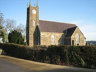
Dromara is a village, townland and civil parish in County Down, Northern Ireland. It lies 10 kilometres (6.2 mi) to the southwest of Ballynahinch on the northern slopes of Slieve Croob, with the River Lagan flowing through it. It is situated in Dromara and the historic barony of Iveagh Lower, Lower Half. In the 2011 Census it had a population of 1,006 people.
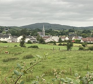
Leitrim, is a small village in County Down, Northern Ireland, approximately 3 miles from Castlewellan, near Dromara, in the parish of Drumgooland. It is set between the Dromara Hills and the Mourne Mountains. It is claimed to be home to the MacCartan clan of Kinelarty.

Slieve Gullion is a mountain in the south of County Armagh, Northern Ireland. The mountain is the heart of the Ring of Gullion and is the highest point in the county, with an elevation of 573 metres (1,880 ft). At the summit is a small lake and two ancient burial cairns, one of which is the highest surviving passage grave in Ireland. Slieve Gullion appears in Irish mythology, where it is associated with the Cailleach and the heroes Fionn mac Cumhaill and Cú Chulainn. It dominates the countryside around it, offering views as far away as Antrim, Dublin Bay and Wicklow on a clear day. Slieve Gullion Forest Park is on its eastern slope.

Clermont Carn, also known as Black Mountain, is a mountain that rises to 510 metres (1,670 ft) in the Cooley Mountains of County Louth, Ireland. It is at the border with Northern Ireland, and is also the location of the Clermont Carn transmission site. The mountain's name refers to an ancient burial cairn on its summit, and to Lord Clermont of Ravensdale.
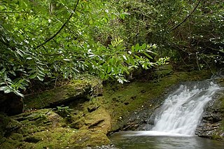
Glen River is a short river in County Down, Northern Ireland. The two-mile (3.2 km) course flows north-east from the foot of Slieve Commedagh and Slieve Donard in the Mourne Mountains into Dundrum Bay at Newcastle, descending 1,500 feet (460 m).
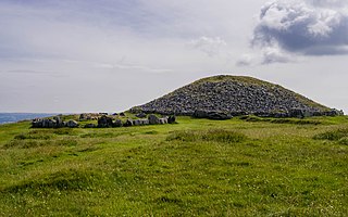
Slieve na Calliagh are a range of hills and ancient burial site near Oldcastle, County Meath, Ireland. The summit is 276 metres (906 ft), the highest point in the county. On the hilltops are about twenty passage tombs, some decorated with rare megalithic art, which were built in the 4th millennium BC. Also called the Loughcrew tombs, it is a protected National Monument and is one of the main passage tomb cemeteries in Ireland, along with Brú na Bóinne, Carrowkeel and Carrowmore.

Slieve Commedagh is a mountain with a height of 767 m (2,516 ft) in County Down, Northern Ireland. It is the second-highest of the Mourne Mountains, after Slieve Donard, and the second-highest mountain in Northern Ireland.

Mullyash Kerbed Cairn is a kerb cairn and National Monument located in County Monaghan, Ireland.

The Denis Rankin Round is a long distance hill running challenge around the Mourne Mountains in County Down, Northern Ireland. The route is a circuit of over 90 kilometres, with a total climb of over 6,500 metres. The Round must be completed within 24 hours to be considered a success.

Millstone Mountain is a hill in the Mourne Mountains in County Down, Northern Ireland. It is the most easterly peak in the Mournes and, along with Thomas Mountain and Crossone, is one of the three subsidiary peaks of Slieve Donard.

Maghera Churches and Round Tower is an ecclesiastical site in Maghera, County Down. It consists of the ruins of a 13th Century church, Maghera Parish Church and the stump of a 10th Century round tower. It is also the site of a monastery founded by St. Donard in the 6th century, and its graveyard confirms evidence that it was an early ecclesiastical site. Together the old church, round tower, and graveyard are a scheduled monument and monument in state care, referred to as "Maghera Church and Round Tower". The church built in 1825 is a functional Church of Ireland church and a listed building.


