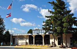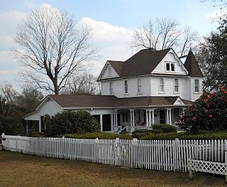
Tishomingo County is a county located in the northeast corner of the U.S. state of Mississippi. As of the 2010 census, the population was 19,593. Its county seat is Iuka.

Claremont is a city on the eastern edge of Los Angeles County, California, United States, 30.3 miles (48.8 km) east of downtown Los Angeles. It is in the Pomona Valley, at the foothills of the San Gabriel Mountains, and has a population, as of the 2015 United States Census estimate, of 36,283 people.

Clark Creek Natural Area is a publicly owned, natural preservation area encompassing 700 acres (280 ha) off Mississippi Highway 24 approximately 20 miles (32 km) west of Woodville, Mississippi. The state park features approximately 50 waterfalls, some with up to 30-foot (9.1 m) drops. The park is used for hiking, bird watching, and geocaching.

Arkabutla Lake is a reservoir on the Coldwater River in the U.S. state of Mississippi. The dam is located on Arkabutla Dam Rd approximately 4 miles (6.4 km) north of the small community of Arkabutla. It is one of four Flood Damage Reduction reservoirs in northern Mississippi, with the others being Sardis, Enid and Grenada Lakes. With an annual visitation exceeding 2 million people, Arkabutla Lake accommodates a wide variety of recreational interest throughout the entire year. The Arkabutla Lake project includes 57,250 acres (231.7 km2) of land and water. The dam is 11,500 ft (3,500 m) long with an average height of 67 ft (20 m). There are 37,700 acres (153 km2) of land at the project which are open to the public for hunting.

Mississippi's 2nd congressional district (MS-2) is the only majority-black district in the U.S. state, covering much of Western Mississippi. The district includes most of Jackson, the riverfront cities of Greenville and Vicksburg and the interior market cities of Clarksdale, Greenwood and Clinton. The district is approximately 275 miles (443 km) long, 180 miles (290 km) wide and borders the Mississippi River; it encompasses much of the Mississippi Delta, and a total of 15 counties and parts of several others.

Minot is an unincorporated community located in northern Sunflower County, Mississippi. Minot is approximately 2 miles (3.2 km) north of Parchman and approximately 1.4 miles (2.3 km) south of Rome along U.S. Route 49W

Perthshire is an unincorporated community located in Bolivar County, Mississippi, United States along Mississippi Highway 1. Perthshire is approximately 5 miles (8.0 km) south of Deeson and approximately 3 miles (4.8 km) north of Gunnison.

McHenry, is an unincorporated community in southern Stone County, Mississippi. It is situated approximately 10 miles (16 km) south of Wiggins and 3 miles (4.8 km) north of Saucier. The community is part of the Gulfport-Biloxi metropolitan area.

Winterville is an unincorporated community located in Washington County, Mississippi, near Mississippi Highway 1. Winterville is approximately 3 miles (4.8 km) north of Greenville, the county seat, and approximately 4 miles (6.4 km) south of Lamont.

Skene is an unincorporated community located in Bolivar County, Mississippi, United States on Mississippi Highway 446. Skene is approximately 3 miles (4.8 km) west of Boyle and approximately 7 miles (11 km) north of Shaw.

Steiner is an unincorporated community located in Sunflower County, Mississippi. Steiner is located on Mississippi Highway 442 and is approximately 2.5 miles (4.0 km) north of Roundaway and approximately 3 miles (4.8 km) south of Linn.

Roundaway is an unincorporated community located in Sunflower County, Mississippi. Steiner is located on Steiner-Boyer Road and is approximately 2.5 miles (4.0 km) south of Steiner and approximately 4 miles (6.4 km) north of Boyer.

Choctaw is an unincorporated community located in Bolivar County, Mississippi, United States. Choctaw is approximately 4 miles (6.4 km) south of Shaw and approximately 12 miles (19 km) east of Stringtown on Mississippi Highway 450.

Hushpuckena is an unincorporated community located in Bolivar County, Mississippi, United States along U.S. Route 61. Hushpuckena is approximately 3 miles (4.8 km) south of Duncan and approximately 4 miles (6.4 km) north of Shelby.

Cottondale is a ghost town located in Sunflower County, Mississippi. Cottondale is located on U.S. Highway 49W and is approximately 2 miles (3.2 km) south of Ruleville and approximately 2.6 miles (4.2 km) north of Doddsville.

Evansville is an unincorporated community in Tunica County, Mississippi, United States. Evansville is approximately 3 miles (4.8 km) south of Tunica and approximately 2 miles (3.2 km) west of White Oak.

White Oak is a census-designated place located on Mississippi Highway 4 in Tunica County, Mississippi. White Oak is approximately 2 miles (3.2 km) east of Evansville and approximately 8 miles (13 km) west of Savage.

Fitzhugh Mounds is an archaeological site in Madison Parish, Louisiana from the Plaquemine\Mississippian period dating to approximately 1200–1541 CE. It is the type site for the Fitzhugh Phase(1350-1500) of the Tensas Basin Plaquemine Mississippian chronology.

Glenville is an unincorporated community located in Panola County, Mississippi. Glenville is approximately 4.3 miles (6.9 km) south-southwest of Tyro and approximately 7.2 miles (11.6 km) southeast of Looxahoma on near Mississippi Highway 310.

The Concord and Claremont Railroad was an American railroad company during the mid-nineteenth century in New Hampshire spanning from Concord to Claremont.


