Coahoma County is a county located in the U.S. state of Mississippi. As of the 2010 census, the population was 26,151. Its county seat is Clarksdale.

Bolivar County is a county located on the western border of the U.S. state of Mississippi. As of the 2010 census, the population was 34,145. Its county seats are Rosedale and Cleveland. The county is named in honor of Simón Bolívar, early 19th-century leader of the liberation of several South American colonies from Spain.

Clarksdale is a city in and the county seat of Coahoma County, Mississippi, United States. It is located along the Sunflower River. Clarksdale is named after John Clark, a settler who founded the city in the mid-19th century when he established a timber mill and business.
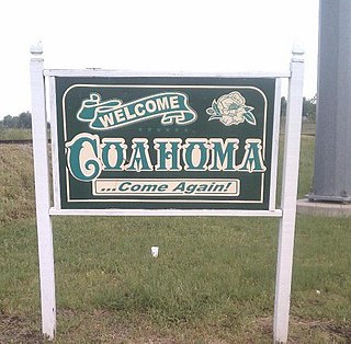
Coahoma is a town in Coahoma County, Mississippi, United States. The population was 377 at the 2010 census.

Friars Point is a town in Coahoma County, Mississippi, United States. The population was 1,200 at the 2010 census, down from 1,480 in 2000.

Jonestown is a town in Coahoma County, Mississippi, United States. The population was 1,298 as of the 2010 census, down from 1,701 in 2000.

Lula is a town in Coahoma County, Mississippi, United States. The population was 298 at the 2010 census, down from 370 in 2000.

Lyon is a town in Coahoma County, Mississippi, United States. The population was 350 at the 2010 census.
The Coahoma County School District (CCSD) is a public school district with its administrative headquarters in Clarksdale, Mississippi (USA).

Coahoma Early College High School (CECHS), formerly Coahoma Agricultural High School (CAHS), is a public secondary school in unincorporated Coahoma County, Mississippi, with a Clarksdale postal address. The school is designated as a part of the Coahoma Agricultural High School District, and operated by Coahoma Community College. Previously it was, as of 2000, one of three independently functioning agricultural high schools in the state of Mississippi. The school has its own facilities, instructional and administrative personnel, and student programs. It shares library facilities with the college.

Rena Lara is an unincorporated community located along Mississippi Highway 1 in southwestern Coahoma County, Mississippi, United States. Rena Lara is located on the former Riverside Division of the Yazoo and Mississippi Valley Railroad. Rena Lara was once home to two general stores, two grocery stores, and the Richardson and May Land & Planting Company.
Bobo is an unincorporated community in Coahoma County, Mississippi, United States. Bobo is located on U.S. routes 61 and 278, southwest of Clarksdale.
Stovall, also known as Prarieville, is an unincorporated community in Coahoma County, Mississippi, United States, along Mississippi Highway 1, 7 miles (11 km) north of Sherard and approximately 6 miles (9.7 km) south of Friars Point.
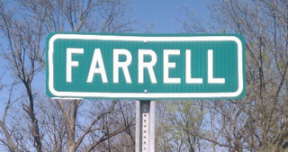
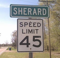
Farrell is an unincorporated community and census-designated place in Coahoma County, Mississippi, United States. As of the 2010 census it had a population of 218. Farrell is located approximately 4 miles (6 km) south of Stovall and 4 miles (6 km) north of Sherard on Mississippi Highway 1. It is about 9 miles (14 km) northwest of Clarksdale, the county seat.
Clover Hill is an unincorporated community located in Coahoma County, Mississippi, United States. Clover Hill is approximately 4 miles (6.4 km) north of Lyon and approximately 4 miles (6.4 km) south of Rudyard. The community is located on the former plantation of J. T. Fargason. Clover Hill once had a depot on the former Yazoo and Mississippi Valley Railroad. A post office operated under the name Clover Hill from 1884 to 1935.
Eagles Nest is an unincorporated community located in Coahoma County, Mississippi, United States. Eagles Nest is approximately 2 miles (3.2 km) south of Jonestown and approximately 11 miles (18 km) west of Belen. Eagles Nest is named for the former plantation of James L. Alcorn, which in turn received its name from an eagle's nest that was built near the site. The community is located on the former Louisville, New Orleans and Texas Railway. A post office operated under the name Eagles Nest from 1887 to 1909.
Roundaway is an unincorporated community located in Coahoma County, Mississippi, United States. Roundaway is approximately 14 miles (23 km) south of Clarksdale and 2 miles (3.2 km) north of Baltzer on New Africa Road. Roundaway is located on the former Yazoo and Mississippi Valley Railroad. A public school was once operated in Roundaway. A post office operated under the name Roundaway from 1905 to 1935.

Hopson is an unincorporated community located in Coahoma County, Mississippi, United States, south of Clarksdale and U.S. Route 61 along U.S. Route 49. Hopson is located on the former Yazoo and Mississippi Valley Railroad. A post office operated under the name Hopson from 1857 to 1867. In 1944 The Hopson Planting Company used International Harvester cotton pickers to harvest cotton, becoming the first farm to mechanically cultivate and produce an entire cotton crop. The former Hopson Plantation Company Store is now operated as a restaurant and music venue.
Mississippi Highway 161 (MS 161) is a state highway designation for three highways in the U.S. state of Mississippi, consisting of old alignments of U.S. Route 61 (US 61). Totaling at 19.872 miles (31.981 km), the three sections are located in Bolivar, Coahoma, and Desoto counties. The Bolivar County section, designated in 2000, travels from Merigold to Mound Bayou and Shelby. In Coahoma County, MS 161 was designated in 2004 and runs through Clarksdale and Lyon. In Desoto County, MS 161 travels through the town of Walls and was created in 1999.
Coahoma County Junior-Senior High School (CCJSHS) is a public junior and senior high school within the city limits of Clarksdale, Mississippi. It is a part of the Coahoma County School District.