
New Haven County is a county in the south central part of the U.S. state of Connecticut. As of the 2020 census, the population was 864,835, making it the third-most populous county in Connecticut. Two of the state's five largest cities, New Haven (3rd) and Waterbury (5th), are part of New Haven County.

Route 34 is a primary state highway in the U.S. state of Connecticut. Route 34 is 21.88 miles (35.21 km) long, and extends from Newtown near I-84 to Route 10 in New Haven. The highways connects the New Haven and Danbury areas via the Lower Naugatuck River Valley. The portion of the route between New Haven and Derby was an early toll road known as the Derby Turnpike. It formerly ran through downtown New Haven on the Oak Street Connector until the early 2020s.

Route 15 is a state highway in the U.S. state of Connecticut that runs 83.53 miles (134.43 km) from a connection with New York's Hutchinson River Parkway in Greenwich, Connecticut, to its northern terminus intersecting with Interstate 84 (I-84) in East Hartford, Connecticut. Route 15 consists of four distinct sections: the Merritt Parkway, the Wilbur Cross Parkway, most of the Berlin Turnpike, and part of the Wilbur Cross Highway. The unified designation was applied to these separate highways in 1948 to provide a continuous through route from New York to Massachusetts. The parkway section of Route 15 is often referred to locally as "The Merritt".

Connecticut Route 80 is a 25.9 mile highway that runs through south-central Connecticut. The route runs from Interstate 91 (I-91) in Quinnipiac Meadows neighborhood of New Haven east to Route 154 in Deep River. Route 80 runs within 5 miles of many town squares- including Downtown New Haven.

Route 40, also known as the Mount Carmel Connector, is a 3.08-mile (4.96 km) freeway connecting Interstate 91 (I-91) and Bailey Road in North Haven, Connecticut to Route 10 in the Mount Carmel neighborhood of Hamden. Route 40 is a four-lane freeway with one intermediate exit leading to/from U.S. Route 5 in North Haven. It crosses over Route 15 but does not have an interchange with it. This is the only place in the state where two freeways cross without an interchange.

Route 17 is a primary north–south state route beginning in New Haven, through Middletown, and ending in Glastonbury, with a length of 36.33 miles (58.47 km).

Interstate 95 (I-95) is the main north–south Interstate Highway on the East Coast of the United States, running in a general east–west compass direction for 111.57 miles (179.55 km) in Connecticut, from the New York state line to the Rhode Island state line. I-95 from Greenwich to East Lyme is part of the Connecticut Turnpike, during which it passes through the major cities of Stamford, Bridgeport, and New Haven. After leaving the turnpike in East Lyme, I-95 is known as the Jewish War Veterans Memorial Highway and passes through New London, Groton, and Mystic, before exiting the state through North Stonington at the Rhode Island border and goes on.

State Road 20 is a 358.154-mile-long (576.393 km) east-to-west route across northern Florida and the Florida Panhandle in the United States.

Route 69 is a primary north–south state highway in the U.S. state of Connecticut connecting the city of New Haven to the city of Bristol in the western part of Greater Hartford, passing through Greater Waterbury along the way. The route extends north of Bristol as a secondary route into the town of Burlington. Route 69 is 35.16 miles (56.58 km) in total length.

Route 63 is a secondary state highway in the U.S. state of Connecticut, from New Haven up to Canaan, running for 52.57 miles (84.60 km). It connects the Greater New Haven area to Northwestern Connecticut via the western suburbs of Waterbury.
The Berlin Turnpike is a 12.17-mile (19.59 km) major thoroughfare carrying U.S. Route 5 and Route 15 in New Haven County and Hartford County in the U.S. state of Connecticut. The road begins one mile south of the Meriden–Berlin town line where Route 15 on the Wilbur Cross Parkway merges with US 5 along North Broad Street in Meriden and terminates at the Wethersfield–Hartford town line. The local name of the street varies as it passes through multiple towns.

Connecticut Route 10 is a state highway that runs from Interstate 95 (I-95) in New Haven Massachusetts state line, where it continues as Massachusetts Route 10, which in turn continues directly to New Hampshire Route 10.

Route 100 is a state highway in Connecticut that connects the town center of East Haven with the Foxon community in the northern part of town.
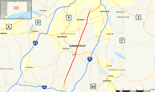
Route 243 is a state highway in Connecticut running for 6.70 miles (10.78 km) from Route 115 at the Ansonia-Derby town line to Route 63 in New Haven. It serves the Westville neighborhood of New Haven and the southern portions of the towns of Woodbridge and Ansonia. The road continues across the Naugatuck River as State Road 853 leading to Route 8.

Route 150 is a state highway in southern Connecticut running for 9.04 miles (14.55 km) from the village of Northford, in the town of North Branford, through the center of Wallingford, to the village of Yalesville in Wallingford.

Route 77 is a state highway in southern Connecticut. It is a state-designated scenic road and runs from the Guilford town green, through North Guilford, into the town center of Durham.

U.S. Route 5 (US 5), a north–south United States Numbered Highway that is generally paralleled by Interstate 91 (I-91), begins at the city of New Haven in Connecticut and heads north through western Massachusetts and eastern Vermont to the international border with Canada. Within Connecticut, US 5 proceeds north from New Haven and passes through Meriden and Hartford toward Springfield, Massachusetts.
Route 146 is a state road that serves as a scenic alternative to US 1 between Branford and Guilford in the U.S. state of Connecticut. Route 146 is 13.00 miles (20.92 km) long, with 8.36 miles (13.45 km) in Branford and 4.64 miles (7.47 km) in Guilford.

U.S. Route 1 (US 1) in the U.S. state of Connecticut is a major east–west U.S. Route along Long Island Sound. It has been replaced by Interstate 95 (I-95) as a through route, which it closely parallels, and now primarily serves as a local business route. Despite its largely east–west orientation, it is part of a north–south route and is mostly signed north–south.

Route 139 is a state highway in southern Connecticut running from Branford to North Branford.

