
Coolah is a town in the central western part of New South Wales, Australia in Warrumbungle Shire. At the 2016 census, Coolah had a population of 1,290. The name Coolah is derived from the Port Jackson Pidgin English word meaning "angry".
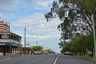
Dunedoo is a village of 747 inhabitants situated within the Warrumbungle Shire of central western New South Wales, Australia. Dunedoo is well known to Australian travellers due to its distinctive name. The name is actually derived from a local Aboriginal word meaning "swan", which are commonly found in the area's lagoons.

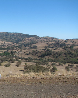
The Liverpool Range is a mountain range and a lava-field province in New South Wales, Australia.

The Warrumbungle Shire is a local government area in the central western region of New South Wales, Australia. The Shire is traversed by the Newell Highway. The Warrumbungle mountain range and Warrumbungles National Park are major tourist attractions for the Shire. Its capital is Coonabarabran, a city in the southwest.
Piambra is rural locality of Warrumbungle Shire Council and a civil parish of Napier County.

The Pandoras Pass, also Brennans Gap and Pandora's Pass is a mountain pass across the Warrumbungle Range, a spur off the Great Dividing Range, located in the Coolah Tops National Park in northwestern New South Wales, Australia.

Napier is a rural locality of Warrumbungle Shire Council and a civil parish of Napier County New South Wales. and is at 31°35′54″S149°46′04″E.
Allison Parish, New South Wales is a rural locality of Warrumbungle Shire Council and a civil parish of Napier County a county of central western New South Wales.
Binnia is a civil parish of Napier County in New South Wales.
Lowe Parish is a civil Parish of Napier County, New South Wales.
Mumbedah is a civil parish, a creek and a hill in central New South Wales.
Morven Parish is a civil parish of County of Napier, a county in the central western part of New South Wales, Australia.
Moorangoorang is a rural locality and a civil parish of County of Napier in the central western part of New South Wales, Australia. The parish has three railway stations, Mooren, Borah and Pimbra.
Bungabah is a civil parish of Napier County in New South Wales.
Narangarie is a civil parish of Napier County, New South Wales.

Toorawandi is a civil parish of Napier County in New South Wales.
Neible Parish, New South Wales is a civil parish of Napier County, a county located in central western New South Wales.

Binnaway Parish is a civil Parish of Napier County, New South Wales, located on the Castlereagh River in central western New South Wales.

Mendooran Parish, New South Wales is a civil parish of Napier County, New South Wales.

Caigan, New South Wales is a bounded rural locality and civil parish of Gowen County, New South Wales.

