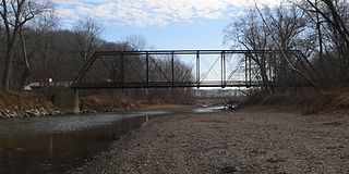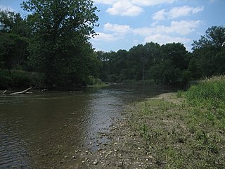
The DuPage River is a 28.3-mile-long (45.5 km) tributary of the Des Plaines River in the U.S. state of Illinois.
The Bourbeuse River is a river located in east-central Missouri, in the Ozarks region, and is one of two major tributaries of the Meramec River, the other being the Big River. The Bourbeuse flows to the northeast from its source near the locale of Dillon just northeast of Rolla in Phelps County, through Maries, Gasconade, Crawford, and Franklin counties, where it discharges into the Meramec River near Moselle. The elevation of the river at its source is approximately 1,140 feet (350 m) above sea level and at its mouth about 463 feet (141 m). The total length of the river is 154 miles (248 km), while the airline distance between source and mouth is 53 miles (85 km). The watershed area is 842.9 square miles (2,183 km2).

Salt Creek is a 43.4-mile-long (69.8 km) stream in northeastern Illinois. It is an important tributary of the Des Plaines River, part of the Illinois River and ultimately the Mississippi River watersheds. It rises in northwest Cook County at Wilke Marsh in Palatine and flows in a meandering course generally southward through DuPage County, returning to central Cook County and emptying into the Des Plaines River in Riverside, Illinois. Most of the creek's watershed is urbanized, densely populated and flood-prone.

La Moine River is a 125-mile-long (201 km) tributary of the Illinois River in western Illinois in the United States. Its watershed covers approximately 2,000 square miles (5,000 km2), and it is the sixth-largest tributary to the Illinois River. It is part of the watershed of the Mississippi River.

The Mackinaw River is a 130-mile-long (210 km) tributary of the Illinois River in the U.S. state of Illinois. Its watershed covers approximately 1,136 square miles (3,000 km2), and contains some of the most productive agricultural land in the United States. The river itself maintains some of the highest quality streams in the state and provides habitat for 60-70 native fish species and 25-30 species of mussels. Its name, also spelled Mackinac, is derived from the Ojibwe word mikinaak meaning "turtle".
The Elm River is a 29-mile-long (47 km) tributary of the Little Wabash River in southeastern Illinois in the United States. Via the Little Wabash, Wabash and Ohio rivers, it is part of the watershed of the Mississippi River.
The Mazon River or Mazon Creek, is a tributary of the Illinois River in the United States. The confluence is near Morris, Illinois.
Macoupin Creek is a 99.7-mile-long (160.5 km) tributary of the Illinois River, which it joins near the village of Hardin, Illinois.
Salt Creek is a major tributary to the Sangamon River, which it joins at the boundary between Mason and Menard County, Illinois. There are at least two other Salt Creeks in Illinois, Salt Creek, and in Effingham County, Illinois.

The Kishwaukee River, locally known as simply The Kish, is a 63.4-mile-long (102.0 km) river in the U.S. state of Illinois. It is a tributary of the Rock River and its name derives from the Potawatomi word for "river of the sycamore".
Piscasaw Creek is a 31.6-mile-long (50.9 km) tributary of the Kishwaukee River in the U.S. states of Wisconsin and Illinois. Rising in Walworth County, Wisconsin, it passes through McHenry County, Illinois before discharging into the Kishwaukee in Boone County, Illinois. Piscasaw Creek's mouth is located near Belvidere, Illinois.

Turtle Creek is a 21.1-mile-long (34.0 km) tributary of the Monongahela River that is located in Allegheny and Westmoreland counties in the U.S. state of Pennsylvania. Situated at its juncture with the Monongahela is Braddock, Pennsylvania, where the Battle of the Monongahela was fought in 1755.
Yellow Creek is a tributary of the Pecatonica River in Stephenson County, in the US state of Illinois. The 50-mile (80 km) stream also flows through a small part of Jo Daviess County. The waters of Yellow Creek were assessed for water quality in 1996, with 28 miles (45 km) being listed as "fair" and 22 miles (35 km) being listed as "good". During the 1832 Black Hawk War, the Battle of Waddams Grove was fought along Yellow Creek.
Indian Creek, also known as Big Indian Creek, is a 51.5-mile-long (82.9 km) tributary of the Fox River in Lee, LaSalle, and DeKalb counties in Illinois.
Killbuck Creek is a 28-mile-long (45 km) tributary of the Kishwaukee River in northern Illinois, United States.
Rush Creek is a 14.9-mile-long (24.0 km) tributary of the Kishwaukee River in northern Illinois.
The North Branch Kishwaukee River is a 17.1-mile-long (27.5 km) tributary of the Kishwaukee River in northern Illinois.

The South Branch Kishwaukee River is a 63.6-mile-long (102.4 km) tributary of the Kishwaukee River in northern Illinois. The South Branch is the main branch of the Kishwaukee River, joining it 10.6 miles (17.1 km) above its confluence with the Rock River. The South Branch flows through DeKalb County; in 2007 flooding along the tributary inundated areas of DeKalb County and Sycamore, Illinois.
Mokeler Creek is a 10.1-mile-long (16.3 km) tributary of Piscasaw Creek, itself a tributary of the Kishwaukee River, in northern Illinois.
Owens Creek is a 15.0-mile-long (24.1 km) stream in the Kishwaukee River watershed in northern Illinois. It is a tributary of the South Branch Kishwaukee River.


