Related Research Articles

Zacapu, is a city and surrounding municipality in the Nahuatzen mountains of Michoacán, Mexico. It is located at 19°49′N101°48′W. The municipality has an area of 455.96 km2 (176.05 sq mi). Geographic features in Zacapu include the Cerro del Tecolote mountain range and Zacapu Lagoon.
Tingambato is a municipality in the Mexican state of Michoacán. Its municipal seat is the city of the same name. The municipality has an area of 188.77 square kilometres and is bordered by the north by the municipalities of Nahuatzén and Erongarícuaro, to the east by Pátzcuaro and Salvador Escalante, to the south by Ziracuaretiro, and to the west by Uruapan. The municipality had a population of 17,630 inhabitants according to the 2015 census. Its municipal seat is the city of the same name.
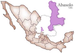
Abasolo is a Mexican city located in the Southwest region of the state of Guanajuato. The municipality has an area of 601.73 square kilometres, and is bordered to the north by Pueblo Nuevo and Valle de Santiago, to the south by the state of Michoacán and Huanímaro, and to the west by Pénjamo and Cuerámaro. The municipality had 79,093 inhabitants according to the 2005 census. The city was estimated to have 28,100 inhabitants in 2020.
Huanímaro is a Mexican city located in Southwest region of the state of Guanajuato. The municipality has an area of 130.57 square kilometres and is bordered to the north and west by Abasolo, to the south by the state of Michoacán, and to the east by Valle de Santiago. The municipality had a population of 19,693 inhabitants according to the 2005 census.
Charo is a municipality located in the Mexican state of Michoacán. The municipality has an area of 322.50 square kilometres and is bordered to the north by Tarímbaro and Álvaro Obregón, to the east by Indaparapeo, to the south by Tzitzio, and to the west and southwest by Morelia. The municipality had a population of 19,417 inhabitants according to the 2005 census. Its municipal seat is the city of the same name.
Tarímbaro is a municipality in the Mexican state of Michoacán. The municipality has an area of 258.57 square kilometres and is bordered to the north by Copándaro, Meson Nuevo and Cuitzeo, to the east by Álvaro Obregón, to the south by Morelia and Charo, and to the west by Chucándiro. The municipality had a population of 51,479 inhabitants according to the 2005 census. Its municipal seat is the city of the same name.
Ario is a municipality in the Mexican state of Michoacán. The municipality has an area of 694.60 square kilometres and is bordered to the north by Salvador Escalante, to the east by Tacámbaro and Turicato, to the south by La Huacana, to the west by Nuevo Urecho, and to the northwest by Taretán. The municipality had a population of 31,647 inhabitants according to the 2005 census. Its municipal seat is the city of Ario de Rosales.
Tiquicheo de Nicolás Romero is a municipality in the Mexican state of Michoacán. The municipality has an area of 1,429.65 square kilometres and is bordered to the north by the municipality of Tzitzio, to the east by Tuzantla and the state of México, to the south by San Lucas, Huetamo and the state of Guerrero, and to the west by Carácuaro and Madero. The municipality had a population of 13,665 inhabitants according to the 2005 census. Its municipal seat is the city of Tiquicheo.
Tuzantla is a municipality in the eastern part of the Mexican state of Michoacán. The municipality has an area of 1,018.49 square kilometres and is bordered to the north by the municipalities of Jungapeo and Hidalgo, to the east by Juárez and Susupuato, to the south by Tiquicheo and the state of Guerrero, and to the west by Tiquicheo and Tzitzio. The municipality had a population of 15,302 inhabitants according to the 2005 census. Its municipal seat is the city of the same name.
Jungapeo is a municipality in the eastern part of the Mexican state of Michoacán. The municipality has an area of 265.98 square kilometres and is bordered to the north by the municipality of Tuxpan, to the east by Juárez and Zitácuaro, to the south by Tuzantla, and to the west by Hildago. The municipality had a population of 18,571 inhabitants according to the 2005 census. Its municipal seat is the city of Jungapeo de Juárez.
Juárez is a municipality in the Mexican state of Michoacán. The municipality has an area of 141.21 square kilometres and is bordered to the north by the municipality of Zitácuaro, to the east and south Susupuato, and to the west by Tuzantla and Jungapeo. The municipality had a population of 12, 016 inhabitants according to the 2005 census. Its municipal seat is the city of Benito Juárez.
Susupuato is a municipality in the Mexican state of Michoacán. The municipality has an area of 273.33 square kilometres and is bordered to the north by the municipality of Juárez, to the east and south by the state of México, and to the west by Tuzantla. The municipality had a population of 7,703 inhabitants according to the 2005 census. Its municipal seat is the city of Susupuato de Guerrero.
Churumuco is a municipality located in the southeastern part of the Mexican state of Michoacán. The municipality has an area of 1,119.44 square kilometres and is bordered to the north by the municipality of La Huacana, to the northeast by Turicato, to the south by the state of Guerrero, to the southwest by Huetamo, and to the west by Arteaga. The municipality had a population of 13,801 inhabitants according to the 2005 census.
Nuevo Urecho is a municipality located in the center of the Mexican state of Michoacán. The municipality has an area of 330.66 square kilometres and is bordered to the north by the municipality of Taretan, to the east by Ario, to the south by La Huacana, and to the west by Gabriel Zamora. The municipality had a population of 7,722 inhabitants according to the 2005 census. Its municipal seat is the city of the same name.
Taretan is a municipality located in the central part of the Mexican state of Michoacán. The municipality has an area of 185.23 square kilometres and is bordered to the north by the municipality of Ziracuaretiro, to the east by Salvador Escalante and Ario, to the south by Gabriel Zamora and Nuevo Urecho, and to the west by Uruapan The municipality had a population of 12,294 inhabitants according to the 2005 census. Its municipal seat is the city of the same name.
Coahuayana is a municipality in the Mexican state of Michoacán, being the westernmost municipality in Michoacán. The municipality has an area of 362.34 square kilometres and is bordered to the north by the municipality of Chinicuila, to the south by Aquila and the Pacific Ocean, and to the west and northwest by the state of Colima. The municipality had a population of 11,632 inhabitants according to the 2005 census. Its municipal seat is the city of the same name.
Peribán is a municipality in the Mexican state of Michoacán. The municipality has an area of 331.87 square kilometres and is bordered to the north by the municipality of Los Reyes, to the east by Uruapan, to the southeast by Tancítaro, to the south by Buenavista, and to the west by the state of Jalisco. The municipality had a population of 20,965 inhabitants according to the 2005 census. Its municipal seat is the city of Peribán de Ramos.
Charapan is a municipality located in the north-western part of the Mexican state of Michoacán. The municipality has an area of 233.16 square kilometres and is bordered to the north by the municipalities of Tangancícuaro and Chilchota, to the east by Paracho, to the south by Uruapan, and to the west by Los Reyes. The municipality had a population of 10,867 inhabitants according to the 2005 census. Its municipal seat is the city of the same name.

Pijijiapan is a town and municipality in the Mexican state of Chiapas, on the coast of the Pacific Ocean about midway between the border with the state of Oaxaca and the international frontier with Guatemala.

Angamacutiro is a municipality in the Mexican state of Michoacán. Located in the far north portion of the state, its municipal seat is the city of Angamacutiro de la Unión. The name Angamacutiro originates from the Uapeani, Pauacume, and Tariácuri native indigenous languages, where it denotes "place on the edge of the canyon" or "lugar al borde de la barranca". This name highlights the region's proximity to a canyon's cliff edge, which is a reflection of its geographic features.
References
- ↑ "2005 Census". INEGI: Instituto Nacional de Estadística, Geografía e Informática. Archived from the original on 2013-04-06. Retrieved 2007-09-19.
19°54′N101°13′W / 19.900°N 101.217°W

| International | |
|---|---|
| National | |
| | This article about a location in the Mexican state of Michoacán is a stub. You can help Wikipedia by expanding it. |