| Contepec | |
|---|---|
| Municipality | |
 Contepec Location in Mexico | |
| Coordinates: 19°57′14″N100°09′49″W / 19.95389°N 100.16361°W Coordinates: 19°57′14″N100°09′49″W / 19.95389°N 100.16361°W [1] | |
| Country | |
| State | |
| Established | 24 July 1857 |
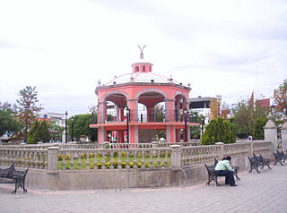
| Seat | Contepec |
| Government [2] | |
| • President | Ruben Rodríguez Jiménez |
| Area [3] | |
| • Total | 381.725 km2 (147.385 sq mi) |
| Elevation [1] (of seat) | 2,497 m (8,192 ft) |
| Population (2010 Census) [3] | |
| • Total | 32,954 |
| • Estimate (2015 Intercensal Survey) [4] | 34,193 |
| • Density | 86/km2 (220/sq mi) |
| • Seat | 4,184 |
| Time zone | Central (UTC-6) |
| • Summer (DST) | Central (UTC-5) |
| Postal codes | 61020–61055 [5] |
| Area code | 447 |
| Website | Official website |
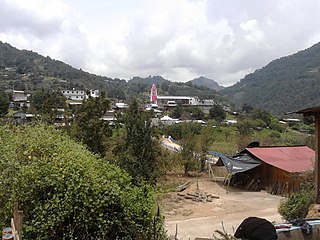
Contepec is a municipality in the Mexican state of Michoacán, located 110 kilometres (68 mi) east of the state capital of Morelia.
Municipalities are the second-level administrative divisions of Mexico, where the first-level administrative division is the state. As of the establishment of two new municipalities in Chiapas in September 2017, there are 2,448 municipalities in Mexico, not including the 16 delegaciones of Mexico City. The internal political organization and their responsibilities are outlined in the 115th article of the 1917 Constitution and detailed in the constitutions of the states to which they belong.

Mexico, officially the United Mexican States, is a country in the southern portion of North America. It is bordered to the north by the United States; to the south and west by the Pacific Ocean; to the southeast by Guatemala, Belize, and the Caribbean Sea; and to the east by the Gulf of Mexico. Covering almost 2,000,000 square kilometres (770,000 sq mi), the nation is the fifth largest country in the Americas by total area and the 13th largest independent state in the world. With an estimated population of over 120 million people, the country is the eleventh most populous state and the most populous Spanish-speaking state in the world, while being the second most populous nation in Latin America after Brazil. Mexico is a federation comprising 31 states and Mexico City, a special federal entity that is also the capital city and its most populous city. Other metropolises in the state include Guadalajara, Monterrey, Puebla, Toluca, Tijuana and León.

Michoacán, formally Michoacán de Ocampo, officially the Free and Sovereign State of Michoacán de Ocampo, is one of the 31 states which, with the Federal District, comprise the 32 Federal Entities of Mexico. The State is divided into 113 municipalities and its capital city is Morelia. The city was named after José María Morelos, one of the main heroes of the Mexican War of Independence.