
Caboolture is a town and suburb in Moreton Bay Region, Queensland, Australia. At the 2016 census, the town of Caboolture had an estimated population of 67,460. It is located on the north side of the Caboolture River, which separates the town from Morayfield and Caboolture South.

Killarney is a rural town and locality in the Southern Downs Region, Queensland, Australia. In the 2016 census, the locality of Killarney had a population of 954 people.

The Northumberland Islands are a scattered island chain off the eastern coast of Queensland, Australia.

The County of Canning is a county in Queensland, Australia. The county consists of almost all of the former Shires of Caboolture, Maroochy and Kilcoy and the former City of Caloundra. Its main urbanised areas are centred on the Sunshine Coast and the areas surrounding Caboolture.

Enoggera Reservoir is an outer suburb of City of Brisbane, Queensland, Australia, which is located 8 kilometres (5 mi) north-west of the CBD and bordering the Moreton Bay Region and The Gap. It contains the neighbourhood of Peewee Bend.
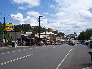
Eumundi is a small town and locality in the Sunshine Coast hinterland in the Sunshine Coast Region, Queensland, Australia, 21 km south-west of Noosa Heads and 118 km north of the state capital, Brisbane. It is located just off the Bruce Highway. Nearby towns are Yandina and Cooroy.

The county of Nares is a cadastral division of Queensland which contains the city of Cairns, Innisfail and most of the Atherton Tableland. It was named after George Nares (1831–1915), a naval officer and commander of HMS Salamander. Cairns is mentioned as being in the county of Nares in the 1911 Britannica. It is bounded by the Daintree River in the north.

Torquay is a coastal suburb in Hervey Bay, Queensland, Australia, located 294 kilometres (183 mi) north of Brisbane. Torquay is one of five beachside suburbs in Hervey Bay that is made up of primarily residential homes with some tourist accommodation in apartment buildings.
The County of Churchill is a county in Queensland, Australia. Like all counties in Queensland, it is a non-functional administrative unit, that is used mainly for the purpose of registering land titles. The county lies between 152°E and 153°E longitude, and is centred on the West Moreton region, extending east to the suburbs of Ipswich. The county was named for Lord Randolph Churchill, who was born in 1849, by the Surveyor-General of New South Wales the following year; the area was officially named and bounded by the Governor in Council on 7 March 1901 under the Land Act 1897.
England Creek is a rural locality split between Somerset Region and City of Brisbane, Queensland, Australia. It lies a short distance south-east of Lake Wivenhoe.
Lansdowne River, a watercourse of the Manning River catchment, is located in the Mid North Coast district of New South Wales, Australia.

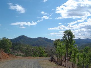
The county of Banks is one of the counties of Queensland, Australia, that existed before 1901. It is located in Far North Queensland, and is named for Sir Joseph Banks, who with Captain James Cook landed in 1770 at a location within the county. Banks includes the towns of Cooktown, Lakeland and Laura.

The County of Aubigny is a county in Queensland, Australia. Like all counties in Queensland, it is a non-functional administrative unit, that is used mainly for the purpose of registering land titles. The county lies between 151°E and 152°E longitude, and it covers the Toowoomba Region and the Dalby part of the Western Downs Region, The county was named by the Surveyor-General of New South Wales in 1850, possibly to honour the Earl of Arundel who had a long association with the name Aubigny. The area was officially named and bounded by the Governor in Council on 7 March 1901 under the Land Act 1897.
The County of Cavendish is a county in Queensland, Australia. Like all counties in Queensland, it is a non-functional administrative unit, that is used mainly for the purpose of registering land titles. The county includes the northern part of the Toowoomba Region and the western part of the Somerset Region. The county was officially named and bounded by the Governor in Council on 7 March 1901 under the Land Act 1897.

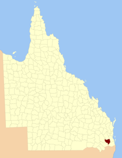
The County of March is a county in Queensland, Australia. The county consists of the Noosa area, plus the eastern parts of the Gympie and Fraser Coast regions.

The county of Solander is a cadastral division of Queensland which contains the towns of Ayton, Daintree, Mossman and Port Douglas. It was originally the southern part of the county of Banks when the counties were named and bounded in 1901.

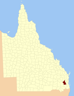
The County of Bowen is a county in Queensland, Australia, located in the Wide Bay–Burnett region to the west of Bundaberg. It was named in honour of Sir George Ferguson Bowen, the first Governor of Queensland. On 7 March 1901, the Governor issued a proclamation legally dividing Queensland into counties under the Land Act 1897. Its schedule described Bowen thus:
Bounded on the east by the county of Cook; on the south by the county of Mackenzie; on the west by [...] the parishes of Mundowran, Boomerang, Binjour, Jonday, Yenda, Wolca, Wombah, Kolonga and Toweran; and on the north by the northern boundaries of the parishes of Toweran, Kolonga and Manduran.
The Shire of Antigua is a former local government area in the Wide Bay–Burnett area of Queensland, Australia, centred on the town of Yengarie. It existed between 1879 and 1917.

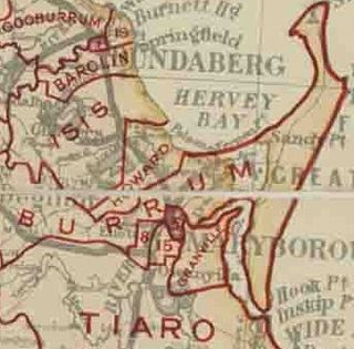
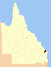
The Shire of Barolin was a local government area located in the Wide Bay–Burnett region of Queensland, Australia. It was the area south of the Burnett River but excluding the urban area of Bundaberg which was initially in Bundaberg Division. It existed from 1879 to 1917.

The Shire of Brassall is a former local government area in the south-east of Queensland, Australia. It existed from 1879 to 1917.