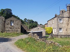
Wharfedale is the valley of the upper parts of the River Wharfe and one of the Yorkshire Dales. It is situated in North Yorkshire, and the cities of Leeds and Bradford in West Yorkshire. It is the upper valley of the River Wharfe. Towns and villages in Wharfedale include Buckden, Kettlewell, Conistone, Grassington, Hebden, Bolton Abbey, Addingham, Ilkley, Burley-in-Wharfedale, Otley, Pool-in-Wharfedale, Arthington, Collingham and Wetherby. Beyond Wetherby, the valley opens out and becomes part of the Vale of York.

Wensleydale is a valley in North Yorkshire, England. It is one of the Yorkshire Dales, which are part of the Pennines. The dale is named after the village of Wensley, formerly the valley's market town. The principal river of the valley is the Ure, which is the source of the alternative name Yoredale. The majority of the dale is within the Yorkshire Dales National Park; the part below East Witton is within the national landscape of Nidderdale.

Arkengarthdale is a dale, or valley, on the east side of the Pennines in North Yorkshire, England. Running roughly north-west to south-east, it is the valley of the Arkle Beck, and is the northernmost of the Yorkshire Dales. It is a subsidiary dale to Swaledale, which it joins at Reeth. The history of the dale, its people, and farming, lead mining, and local crafts is displayed and documented in the Swaledale Museum in Reeth.

Hetton is a small Dales village in the civil parish of Hetton-cum-Bordley, in the North Yorkshire district of North Yorkshire, England, situated 5.75 miles (9.25 km) north of Skipton by the B6265 road. It is the largest settlement in the parish of Hetton-cum-Bordley. The population of the former civil parish of Hetton taken at the 2011 Census was 155.

Askrigg is a small village and civil parish in Wensleydale in the Yorkshire Dales National Park. It was formerly a part of the Richmondshire district of North Yorkshire, England. The village and its parish are located in Upper Wensleydale, 12 miles (19 km) west of Leyburn, and 5 miles (8 km) east of Hawes. It is 31.4 miles (50.5 km) west of the county town of Northallerton.

Aysgarth is a village and civil parish in Wensleydale, in North Yorkshire, England. The village is in the Yorkshire Dales National Park, about 16 miles (26 km) south-west of Richmond and 22.6 miles (36.4 km) west of the county town of Northallerton.

Bainbridge is a village and civil parish in North Yorkshire, England. The population of the civil parish at the 2011 census was 480. The village is situated in the Yorkshire Dales National Park, near the confluence of the River Bain with the River Ure. It is 27+1⁄2 miles west of Northallerton, the county town.
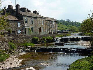
Gayle is a hamlet 0.4-mile (0.64 km) south of Hawes in Wensleydale, North Yorkshire, England. It is noted for the beck that flows through it and the old mill, which featured on the BBC TV programme Restoration.

Stanghow is a village in the civil parish of Lockwood, in the borough of Redcar and Cleveland and the ceremonial county of North Yorkshire, England.

Worton is a hamlet in Wensleydale in the Yorkshire Dales in the Richmondshire district of North Yorkshire, England. It lies 1-mile (1.6 km) east of Bainbridge on the A684 road, 4 miles (6.4 km) west of Aysgarth and 1-mile (1.6 km) south east of Askrigg. The hamlet is just south of the River Ure, the biggest river in Wensleydale. The hamlet is named in the Domesday Book and its name derives from the Old English wyrt-tūn and means the garden.

Thornton Rust is a village and civil parish in North Yorkshire, England. It lies in the Yorkshire Dales about 2 miles (3.2 km) west of Aysgarth, high on the south bank of the River Ure in Wensleydale.

Cray is a hamlet on the B6160 road on a steep hill above Wharfedale in the Yorkshire Dales, North Yorkshire, England. It is near Buckden and the River Wharfe. It is a very popular walking area and is renowned for several waterfalls known collectively as Cray Waterfalls. The name of the settlement derives from the same name for the nearby beck ; Old Welsh Crei, meaning fresh. The settlement was not mentioned in the Domesday Book, first being recorded in 1202 when a meadow was granted as a fine to William de Arches at Creigate.
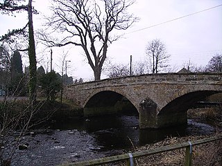
The River Wenning is a tributary of the River Lune, flowing through North Yorkshire and Lancashire. The name derives from the Old English Wann, meaning dark river.
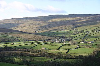
Marsett is one of three settlements in around Semer Water in Raydale, a small side dale off Wensleydale in North Yorkshire, England. Marsett is only a hamlet and lies to the south-west of the lake, at a point where a smaller side dale, Bardale, joins Raydale.

Stalling Busk is one of three settlements around Semer Water in the former Richmondshire district of North Yorkshire in the small dale of Raydale just off from Wensleydale, England. The village lies to the immediate south of the lake, at 1,080 feet (330 m) above sea level. The name of the settlement derives from a combination of Old French (estalon) and Old Norse (buskr), which means the stallion's bush. The village was also known as Stallen Busk, and is commonly referred to by locals as just Busk. Although the village is not mentioned in the Domesday Book, archaeological evidence points to the area being inhabited during the Iron and Bronze ages.

Littondale is a dale in the former Craven District of the non-metropolitan county of North Yorkshire, England. It comprises the main settlements of Hawkswick, Arncliffe, Litton, Foxup and Halton Gill, and farmhouses that date from the 17th century. The main waterway in the dale is the River Skirfare which is fed by many small gills and becks.

Tosside is a small village on the modern border of North Yorkshire and Lancashire in Northern England. It lies within the Forest of Bowland, and is between the villages of Slaidburn in Lancashire and Wigglesworth in North Yorkshire. It lies 11.5 miles north of Clitheroe and 17 miles north-west of Skipton. The village is 870 feet (270 m) above sea level and lies at 54.0001°N / 2.35436°W on the B6478 road.
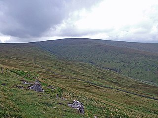
Dodd Fell Hill is a hill in the Yorkshire Dales, in North Yorkshire, England. It is classed as a Marilyn and its summit is at 668 metres (2,192 ft). The flat summit, known as Dodd Fell Hill, is marked by a concrete trig-point. The hill has a lower summit known as Ten End, which is 1.6-kilometre (1 mi) to the north, and slightly lower at 580 metres (1,910 ft) above sea level.

Nappa Hall is a fortified manor house in Wensleydale, North Yorkshire, England, described by English Heritage as "probably the finest and least-spoilt fortified manor house in the north of England". It stands 1-mile (1.6 km) east of Askrigg, overlooking pastures leading down to the River Ure. A single-storey central hall sits between two towers, a four-storey western tower and a two-storey eastern tower. The four-storey tower has a turret, lit by slit vents, for a spiral staircase that climbs to crenellated parapets. The taller tower retains its original windows, but sash windows were inserted in the 18th century in the lower two-storey block which housed the kitchen and service rooms, at the opposite end of the hall. In the 17th century, an extra wing was added. The battlements are served by a single stair consisting of 70 stone steps.

The Richmond to Lancaster Turnpike, was a road that was opened in the second half of the 18th century between Richmond, in the North Riding of Yorkshire and Lancaster in Lancashire, Northern England. The turnpike was built to allow goods to be taken from Yorkshire to the port of Lancaster. It was approved in 1751, but was not wholly completed until 1774.
