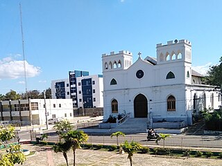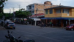
Arauca is a department of Eastern Colombia located in the extreme north of the Orinoco Basin of Colombia, bordering Venezuela. The southern boundary of Arauca is formed by the Casanare and Meta Rivers, separating Arauca from the departments of Casanare and Vichada. To the west, Arauca borders the department of Boyacá. The Caño Limón oil fields located within Arauca account for almost a third of the Colombian oil output. Its capital is the town of Arauca.

Guainía is a department of Eastern Colombia. It is in the east of the country, bordering Venezuela and Brazil. Its capital is Inírida. In 1963 Guainía was split off from Vaupés department. The northern part and the Inírida River are included in the Orinoco basin; the rest is part of the Amazon basin. The Guaviare River is the main area of colonization; many colonos come from the Colombian Andean zone, most of them from Boyacá. They are followed by the llaneros, people from the Eastern plains (Llanos). The population is mainly composed of Amerindians, and the largest ethnic groups are the Puinaves and the curripacos. There are a total of 24 ethnic groups in the department; many of them speak four Indigenous languages besides Spanish and Portuguese.

Meta is a department of Colombia. It is close to the geographic center of the country, to the east of the Andean mountains. A large portion of the department, which is also crossed by the Meta River, is covered by a grassland plain known as the Llanos. Its capital is Villavicencio. The department has a monument placed in the very geographic centre of Colombia, at a place known as Alto de Menegua, a few kilometers from Puerto López.

Sucre is a department in the Caribbean Region of Colombia. The department ranks 27th by area, 10,670 km2 (4,120 sq mi) and it has a population of 904,863, ranking 20th of all the 32 departments of Colombia. Sucre is bordered by the Caribbean on the northwest; by Bolívar Department on the east and by Córdoba Department on the west.

Vichada Department is a department of the Republic of Colombia in South America. Vichada is located in the eastern plains of Colombia, in the Orinoquía Region within the Orinoco river basin bordering the Bolivarian Republic of Venezuela to the north and east. To the north the department also borders with Arauca Department, to the northwest with Casanare Department, to the west with Meta Department, to the southwest narrowly bordering with Guaviare Department and to the south with Guainía Department. The department is the second largest in Colombia and scarcely populated in comparison to other departments.

Villavicencio is a city and municipality in Colombia. The capital of Meta Department, it was founded on April 6, 1840. The municipality had a population of 531,275 in 2018. The city is located at 4°08'N, 73°40'W, 75 km southeast of the Colombian capital city of Bogotá (DC) by the Guatiquía River. It is the most important commercial center in the Llanos Orientales of Colombia.

Dingle, officially the Municipality of Dingle, is a 1st class municipality in the province of Iloilo, Philippines. According to the 2020 census, it has a population of 45,965 people.

Caucasia is a small city and municipality located in the subregion of Bajo Cauca Antioquia department, in Colombia. Bounded on the south by the department of Córdoba, in the east by the municipalities of Antioquia in Nechí and El Bagre, on the north by the municipality of Zaragoza, and west to the town of Cáceres, and is located 270 km from Medellín.

San Fernando de Monte Cristi, also known as Montecristi, is the capital town of Monte Cristi Province in the Dominican Republic. It is located in the northwest region of the country in a coastal area above the border with Haiti.

The Caribbean region of Colombia or Caribbean Colombian is in the north of Colombia and is mainly composed of 8 departments located contiguous to the Caribbean. It's the second most populated region in the country after Andean Region with approximately 11 million residents according to the Colombian Census 2018. The area covers a total land area of 110,000 km2 (42,000 sq mi), including the Archipelago of San Andrés, Providencia and Santa Catalina in the Caribbean Sea.

In South America, Indigenous peoples comprise the Pre-Columbian peoples and their descendants, as contrasted with people of European ancestry and those of African descent. In Spanish, indigenous peoples are referred to as pueblos indígenas, or pueblos nativos. The term aborigen is used in Argentina, and pueblos aborígenes is commonly used in Colombia. The English term Amerindian is often used in the Guianas. Latin Americans of mixed European and Indigenous descent are usually referred to as mestizos (Spanish) and mestiços (Portuguese), while those of mixed African and Indigenous ancestry are referred to as zambos.

La Guajira is a department of Colombia. It occupies most of the Guajira Peninsula in the northeast region of the country, on the Caribbean Sea and bordering Venezuela, at the northernmost tip of South America. The capital city of the department is Riohacha.

Sabanas de San Ángel, Spanish for Savannas of Saint Angel, is a town and municipality of the Colombian Department of Magdalena. Founded around 1607 with the name San Antoñito by the Spanish Colonizers as a pathway town in the route between La Guajira Department and the Magdalena River. On June 24, 1999 the municipality is created with the name of Sabanas de San Angel that segregated from the municipalities of Ariguaní, Pivijay, Chibolo and Plato.

Trinidad is a town and municipality in the Department of Casanare, Colombia.

López de Micay is a town and municipality in the Cauca Department, Colombia. It is located on the Pacific Coast of the Cauca Department in the Naya Region on the foothills of the Colombian Western Cordillera. It is located 84 km from the departmental capital, Popayán.

San Sebastián is a town and municipality in the Cauca Department, Colombia at a distance of 165 km by road from the city of Popayán, capital city of the department of Cauca. The town was founded in 1562 by Pedro Antonio Gómez.

Nilo is a Colombian municipality located in the department of Cundinamarca. It is part of the Alto Magdalena Province and is situated 148 kilometers southwest of Bogotá

The Raizal are a Black Colombian ethnic group from the Archipelago of San Andrés, Providencia and Santa Catalina, off Colombia's Caribbean coast. They are not defined by race but are labeled by the Colombian authorities as one of the Afro-Colombian ethnic groups under the multicultural policy pursued since 1991. They are speakers of the San Andrés-Providencia Creole, one of many English Creoles used in the Caribbean.

The demographics of Colombia consist of statistics regarding Colombians' health, economic status, religious affiliations, ethnicity, population density, and other aspects of the population. Colombia is the second-most populous country in South America after Brazil, and the third-most populous in Latin America, after Brazil and Mexico.
Race and ethnicity in Colombia descend mainly from three racial groups—Europeans, Amerindians, and Africans—that have mixed throughout the last 500 years of the country's history. Some demographers describe Colombia as one of the most ethnically diverse countries in the Western Hemisphere and in the World, with 900 different ethnic groups. Most Colombians identify themselves and others according to ancestry, physical appearance, and sociocultural status. Social relations reflect the importance attached to certain characteristics associated with a given racial group. Although these characteristics no longer accurately differentiate social categories, they still contribute to one's rank in the social hierarchy. A study from Rojas et al. involving 15 departments determined that the average Colombian has a mixture of 47% Amerindian, 42% European, and 11% African. These proportions also vary widely among ethnicities.


