Villavicencio is a city and municipality in Colombia. Capital of Meta Department, it was founded on April 6, 1840. The city had an urban population of approximately 531,275 inhabitants in 2018. The city is located at 4°08'N, 73°40'W, 75 km southeast of the Colombian capital city of Bogotá (DC) by the Guatiquía River. It is the most important commercial center in the Llanos Orientales. It has a warm and humid climate, with average daily temperatures ranging from 21 °C to 30 °C.2 It is affectionately called "Villavo" la bella.
Puerto Cabezas is a Miskito municipality and city in Nicaragua. It is the capital of Miskito nation in the North Caribbean Coast Autonomous Region.
Gómez Plata is a town and municipality in the Colombian department of Antioquia. Part of the subregion of Northern Antioquia.

Heliconia is a town and municipality in Antioquia Department, Colombia.

Condoto is the third most important municipality in the Chocó Department, after Quibdó and Istmina. It is situated in the south of the department and its main economical activity is mining and agriculture. Condoto is also known as the "Platinum Capital of Colombia".

Briceño is a town and municipality in Antioquia Department, Colombia. Part of the subregion of Northern Antioquia.

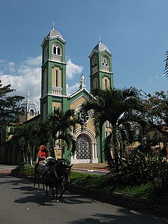
Turbo is a port city in Antioquia Department, Colombia. It is located on the coast of Gulf of Urabá, 340 km north of Medellín. This port city is the capital of the Urabá region of Antioquia. The place where Turbo is today was known as Pisisí, but by 1741 people were already talking about Turbo. By a decree on May 11, 1839, the central government spent one thousand pesos for military service barracks in Turbo. In 1840 the republican president assigned one thousand fanegas of uncultivated lands for the new population. It was established as a municipality in 1847.

Guaranda is a town and municipality located in the Sucre Department, northern Colombia.

Bolívar is a town and municipality in the Santander Department in northeastern Colombia.

Sucre is a town and municipality in the Santander Department in northeastern Colombia.
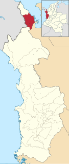
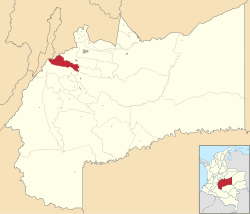
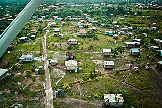
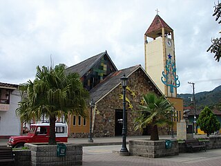
Unguía is a municipality and town in the far north of the Chocó Department, Colombia.

Puerto Guzmán is a town and municipality located in the Putumayo Department, Republic of Colombia.

Cubarral is a town and municipality in the Meta Department, Colombia. The municipality of Guamal borders Cubarral to the north, to the west is bordered by the department of Cundinamarca, to the east by the municipality of San Martín and to the south by the municipality of El Dorado. Furthermore, According to DANE projections from the 2005 census, Cubarral would have a population of approximately 5946 people by 2015.

El Calvario is a town and municipality in the Meta Department, Colombia. It was the epicenter of the 2008 Colombia earthquake.

Lejanías is a town and municipality in the Meta Department, Colombia.
Restrepo is a town and municipality in the Meta Department, Colombia.

López de Micay is a town and municipality in the Cauca Department, Colombia. The Colombian meteorological service IDEAM reports an average annual precipitation of 12,892.4 mm (507.57 in), potentially making it the wettest inhabited place in the world; however, some other sources state a lower average of 10,191 mm (401.2 in), while some other sources state a higher average of approximately 16,000 mm (630 in). It is one of the wettest places on the Earth, with at least some amount of rain falling almost every day, with frequent downpours and torrential rain that causes flash flooding.
La Primavera is a town and municipality located in the Department of Vichada, Colombia.

Florencia is a municipality and capital city of the Department of Caquetá, Colombia. It is the most important city in southwest Colombia because of its population as well as its more than a hundred years of history. It is the boundary between mountains and the Amazon. It lies on the Orteguaza River which flows into the Caqueta River. Its population is 168,346 in 2018.

Villa Altagracia is a municipality (municipio) of the San Cristóbal province in the Dominican Republic. Within the municipality there are three municipal districts : La Cuchilla, Medina and San José del Puerto.