The Arctic Archipelago, also known as the Canadian Arctic Archipelago, groups together all islands lying to the north of the Canadian continental mainland excluding Greenland.

Ubaí is a municipality in the north of the Brazilian state of Minas Gerais. As of 2007 the population was 11,834 in a total area of 821 km². It became a municipality in 1962.
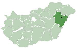
Esztár is a village in Hajdú-Bihar county, in the Northern Great Plain region of eastern Hungary.
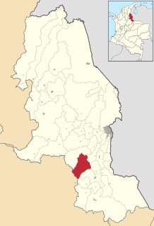
Cucutilla is a Colombian municipality and town located in the department of North Santander.

Málaga is a town and municipality in the Santander Department in northeastern Colombia.
Dongri is a port city in the Mira-Bhayandar municipality of Thane district, situated just north of Gorai, Mumbai. The word 'Dungaree' has its origin from Dongri due this genre of garment monolithically being manufactured from textile sectors within the confines of the city. The modern, colonial history of Dongri dates back to the late early modern era of the early 17th century, at which point merchant mariner and co-founder of the British East India company, George White, established an Anglo trading post and co-dependency in the classical port city of Dongri, as a Maratha protectorate governed by and owing allegiance to Shivaji, under the dominion and fiscal, geographic, and economic jurisdiction of the Maratha dynasty. The Church of Dongri, christened with the title of Our Lady of Bethlehem, bears an erection and consequent consecration date of 1613, indicated by an inscription on the main liturgical portals of the cathedral narthexes

Kabal is a town in Swat District, Khyber-Pakhtunkhwa province of Pakistan located 10 kilometres (6 mi) from Mingora city. The old name of kabal was Chendakhwara. It is the tenth largest city in Khyber Pakhtunkhwa and 82nd largest in Pakistan by population.

The Yenisey Gulf is a large and long estuary through which the lower Yenisey flows into the Kara Sea.

Qərsələ is a village in the Ismailli Rayon of Azerbaijan. The village forms part of the municipality of Birinci Yeniyol.

Paruszewo is a village in the administrative district of Gmina Strzałkowo, within Słupca County, Greater Poland Voivodeship, in west-central Poland. It lies approximately 4 kilometres (2 mi) south-west of Strzałkowo, 6 km (4 mi) west of Słupca, and 61 km (38 mi) east of the regional capital Poznań.
SM UB-18 was a German Type UB II submarine or U-boat in the German Imperial Navy during World War I. The U-boat was ordered on 30 April 1915 and launched on 21 August 1915. She was commissioned into the German Imperial Navy on 11 December 1915 as SM UB-18. The submarine sank 126 ships in 31 patrols for a total of 129,782 gross register tons (GRT) making her the 13th most successful U-boat in both world wars. UB-18 was rammed by the trawler Ben Lawer and sunk in the English Channel at 49°17′N5°47′W on 9 December 1917.

Tancoco is a municipality located in the north zone in the State of Veracruz, about 210 km from state capital Xalapa. It has a surface of 145.59 km2. It is located at 21°17′N97°47′W. On the occasion of the development reached by the camp petroleum of Zacamixtle, the municipal head-board was moved to this place. For Decree of December 26, 1929 it returns to the village of Tancoco, its category of Municipality.

Kochánky is a village and municipality in Mladá Boleslav District in the Central Bohemian Region of the Czech Republic.

Canelinha is a municipality in the state of Santa Catarina in the South region of Brazil. Canelinha is a small town, located 15.2 kilometres (9.4 mi) west of Tijucas and 9.9 kilometres (6.2 mi) by road east of São João Batista. It has an altitude of 17 metres and its population according to the 2010 census is 10,603 inhabitants. It has land area of 151.409 km ². The municipality was established on 23 December 1962.
Uilortussoq Island is an island of Greenland. It is located in Baffin Bay in the Upernavik Archipelago.
Upernavik Island is an island of Greenland. It is located in Baffin Bay in the Upernavik Archipelago. The town of Upernavik is on the island.

Bevin Glacier is a glacier 5 nautical miles (9 km) long, which flows east from the plateau escarpment on the east side of Graham Land into the northwest end of Cabinet Inlet between Attlee Glacier and Anderson Glacier. During December 1947 it was charted by the Falkland Islands Dependencies Survey (FIDS) and photographed from the air by the Ronne Antarctic Research Expedition. It was named by the FIDS for Rt. Hon. Ernest Bevin, M.P., British Minister of Labour and National Service and member of the War Cabinet.
Planet Heights is a series of summits running along an ice-free ridge, extending 24 nautical miles (44 km) in a north-south direction between the southernmost extremity of the LeMay Range and George VI Sound in the east part of Alexander Island, Antarctica. Many landforms and nearby features are named in association with this mountain range; some of these include landforms named after astronomers, satellites, planets and other things related to astrology and astrophysics. The mountain range was first mapped from air photos taken by the Ronne Antarctic Research Expedition (RARE), 1947–48, by Searle of the Falkland Islands Dependencies Survey (FIDS) in 1960. Named by the United Kingdom Antarctic Place-Names Committee (UK-APC) from association with the nearby glaciers named for planets of the solar system. The only planet that is not featured in any of these glaciers is the planet Earth, as there are no glaciers named "Earth Glacier" and this glacier does not exist.
This page is based on this
Wikipedia article Text is available under the
CC BY-SA 4.0 license; additional terms may apply.
Images, videos and audio are available under their respective licenses.