
Kom Ombo is an agricultural town in Egypt famous for the Temple of Kom Ombo. It was originally an Egyptian city called Nubt, meaning City of Gold. Nubt is also known as Nubet or Nubyt. It became a Greek settlement during the Greco-Roman Period. The town's location on the Nile, 50 kilometres (31 mi) north of Aswan (Syene), gave it some control over trade routes from Nubia to the Nile Valley, but its main rise to prominence came with the erection of the Temple of Kom Ombo in the 2nd century BC.

Tanis or San al-Hagar is the Greek name for ancient Egyptian ḏꜥn.t, an important archaeological site in the northeastern Nile Delta of Egypt, and the location of a city of the same name. It is located on the Tanitic branch of the Nile, which has long since silted up.

Pelusium was an important city in the eastern extremes of Egypt's Nile Delta, 30 km (19 mi) to the southeast of the modern Port Said. It became a Roman provincial capital and Metropolitan archbishopric and remained a multiple Catholic titular see and an Eastern Orthodox active archdiocese.

Akhmim is a city in the Sohag Governorate of Upper Egypt. Referred to by the ancient Greeks as Khemmis or Chemmis and Panopolis, it is located on the east bank of the Nile, four miles (6.4 km) to the northeast of Sohag.

Dendera, also spelled Denderah, ancient Iunet 𓉺𓈖𓏏𓊖 “jwn.t”, Tentyris,(Arabic: Ewan-t إيوان-ة ), or Tentyra is a small town and former bishopric in Egypt situated on the west bank of the Nile, about 5 kilometres (3 mi) south of Qena, on the opposite side of the river. It is located approximately 60 kilometres (37 mi) north of Luxor and remains a Latin Catholic titular see. It contains the Dendera Temple complex, one of the best-preserved temple sites from ancient Upper Egypt.

Cynopolis was the Hellenistic toponym for two cities in ancient Egypt. Both Cynopolis superior and Cynopolis inferior were bishoprics in Christian times.

Hu,Huw or Hiw is the modern name of an Egyptian town on the Nile, which in more ancient times was the capital of the 7th Nome of Upper Egypt.

Medinet Habu is an archaeological locality situated near the foot of the Theban Hills on the West Bank of the River Nile opposite the modern city of Luxor, Egypt. Although other structures are located within the area and important discoveries have also been made at these sites, the location is today associated almost synonymously with the largest and best preserved site, the Mortuary Temple of Ramesses III.

Qift is a city in the Qena Governorate of Egypt about 43 km (27 mi) north of Luxor, situated a little south of latitude 26° north, on the east bank of the Nile. In ancient times its proximity to the Red Sea made it an important trading emporium between India, Punt, Arabia Felix and the North. It was important for nearby gold and quartzite mines in the Eastern Desert, and as a starting point for expeditions to Punt by way of the path through the Wadi Hammamat to the Red Sea port at Tjau.

Samannud is a city (markaz) located in Gharbia Governorate, Egypt. Known in classical antiquity as Sebennytos, Samannud is a historic city that has been inhabited since the Ancient Egyptian period. As of 2019, the population of the markaz of Samannud was estimated to be 410,388, with 83,417 people living in urban areas and 326,971 in rural areas.

Armant, also known as Hermonthis, is a town located about 19 km south of Thebes. It was an important Middle Kingdom town, which was enlarged during the Eighteenth Dynasty. It is located today in the Luxor Governorate on the west bank of the Nile.
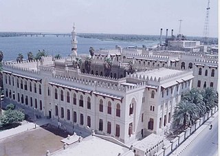
Asyut is the capital of the modern Asyut Governorate in Egypt. It was built close to the ancient city of the same name, which is situated nearby. The modern city is located at 27°11′00″N31°10′00″E, while the ancient city is located at 27°10′00″N31°08′00″E. The city is home to one of the largest Coptic Catholic churches in the country.

Girga, alternatively Digirga or Digurga is a city in the Sohag Governorate of Upper Egypt. It is located on the west bank of the Nile River. It is the metropolitan see of the Coptic Orthodox Church, and is the oldest continuously-inhabited city on the African continent.
Sakha, also known by the ancient name of Xois is a town in Kafr El Sheikh Governorate of Egypt. Located near the center of the Nile Delta, it is a city of great antiquity, identified with the ancient Egyptian city of Ḫꜣsww(t).

Tahta is a city in the Sohag Governorate of Upper Egypt. It is located on the west bank of the Nile in an area known for its agricultural richness. Tahta had a population of 85,528 in the 2017 census. Egyptologists believe that the modern name may derive from the word Ta-ho-ty. Two famous monasteries are located near Tahta, the White Monastery and the Red Monastery. The town has a small but significant Coptic Catholic community. Its most famous resident was the reformist intellectual Rifa'a al-Tahtawi, who was born in Tahta in 1801, and who wrote and translated many books following his trip to Paris in 1826 as the imam and chaplain for the first group of Egyptians whom Mehmet Ali Pasha sent to study in western Europe.

Babylon Fortress is an Ancient Roman fortress on the eastern bank of the Nile Delta, located in the area known today as Old Cairo or Coptic Cairo. The fortress was built circa 300 AD by Emperor Diocletian in order to protect the entrance to an ancient canal, previously rebuilt by Trajan, that linked the Nile with the Red Sea.

Elkab, also spelled El-Kab or El Kab, is an Upper Egyptian site on the east bank of the Nile at the mouth of the Wadi Hillal about 80 kilometres (50 mi) south of Luxor. Elkab was called Nekheb in the Egyptian language, a name that refers to Nekhbet, the goddess depicted as a white vulture. In Greek it was called Eileithyias polis, "city of the goddess Eileithyia".
Herwer was an ancient Egyptian town in the 16th nome in Upper Egypt. It is mentioned in several ancient inscriptions dating from the Old, Middle and New Kingdom. The main deities of the place were Khnum and Heqet, both several times called lord or lady of Herwer. Perhaps in the Middle Kingdom, the place became capital of the 16th Upper Egyptian nome. The local governor Amenemhat of that nome was indeed overseer of the priests of Khnum of Herwer. The place is often mentioned in the tombs of Beni Hasan.
Hypselis or Hypsela, known to the ancient Egyptians as Shashotep, is an ancient Egyptian city and Roman bishopric, which was located near the modern town of Shutb in the Asyut Governorate.
Sumenu or Smenu was an ancient Egyptian town located in Upper Egypt. It housed the most prominent early-Middle Kingdom sanctuary of the crocodile-god Sobek.

