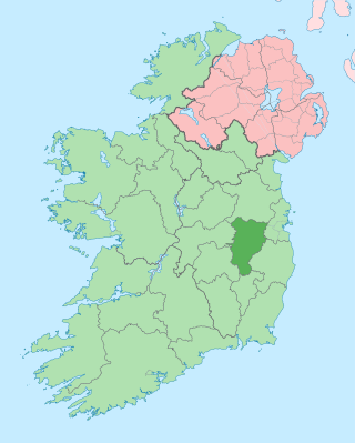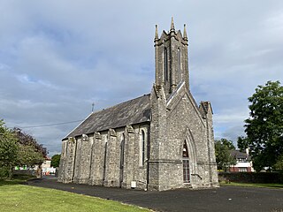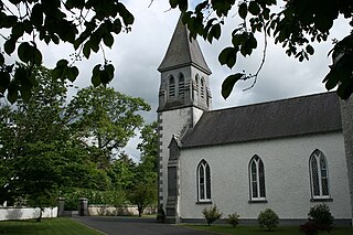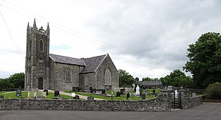
County Kildare is a county in Ireland. It is in the province of Leinster and is part of the Eastern and Midland Region. It is named after the town of Kildare. Kildare County Council is the local authority for the county, which had a population of 246,977 at the 2022 census.

Enniscrone – also spelt Inniscrone and officially named Inishcrone – is a small seaside town in County Sligo, Ireland. Its sandy beach, tourist campsite, and golf course all attract visitors. As of the 2022 census, the town had a population of 1,291 people.

Newbridge, officially known by its Irish name Droichead Nua, is a town in County Kildare, Ireland. While the nearby Great Connell Priory was founded in the 13th century, the town itself formed from the 18th century onwards, and grew rapidly alongside a military barracks which opened in the early 19th century. Taking on the name Newbridge in the 20th century, the town expanded to support the local catchment, and also as a commuter town for Dublin. Doubling in population during the 20 years between 1991 and 2011, its population of 24,366 in 2022 makes it the second largest town in Kildare and the sixteenth-largest in Ireland.

Ballintra is a village in the parish of Drumholm in the south of County Donegal, Ireland, just off the N15 road between Donegal town and Ballyshannon. Ballintra lies on the northern bank of the Blackwater river. The river rises in the hills that lie inland from the town, and flows through a number of small lakes before spilling over a small waterfall in a gorge behind the village.

Clonegal, officially Clonegall, is a village in the southeast of County Carlow, Ireland. It is in a rural setting, close to the border between counties Wexford and Carlow, 5 km (3 mi) from Bunclody, County Wexford and 22 km (14 mi) from Carlow town. It is just over a mile north of where the River Slaney and the River Derry meet. Clonegal has a much smaller "twin" village across the River Derry in County Wexford, Watch House Village.

The Kildare County Board of the Gaelic Athletic Association (GAA), or Kildare GAA, is one of 12 county boards governed by the Leinster provincial council of the GAA in Ireland, and is responsible for the administration of Gaelic games in County Kildare. The Lillie's play in the second tier of county football.

Newcestown is a small village located 35 km from the city of Cork in the western part of County Cork, Ireland. It is a village with a church, a school, a pub and GAA club. Newcestown is part of the Dáil constituency of Cork North-West.

Suncroft is a village in County Kildare, Ireland, south of The Curragh and east of Kildare Town. As of 2016, Suncroft had a population of 746.

Kildangan is a village in County Kildare, Ireland. It is also a townland and civil parish.

Watergrasshill is a village in north east County Cork in Ireland. Watergrasshill is within the Cork North-Central Dáil constituency. Bypassed in 2003, the village is situated on the R639 road and accessible via junction 17 of the M8 motorway. It had a population of 1,840 at the 2022 census.

Haggardstown is a townland and civil parish located in the barony of Upper Dundalk, on the southern outskirts of Dundalk, County Louth, Ireland. The civil parish of Haggardstown lies on the shore of Dundalk Bay, north of the estuary of the River Fane, and includes the village of Blackrock and Dundalk Golf Club.

Knockbride is a civil parish in County Cavan, Ireland. It is located to the north of the town of Bailieborough.

Ravensdale is a village, townland and electoral division located at the foothills of the Cooley Mountains on the Cooley Peninsula in the north of County Louth in Ireland. Bordering with the townland of Doolargy, Ravensdale is approximately 8 km to the north of Dundalk. The dual carriageway between Dublin and Belfast runs nearby, and the R174 connects it with Jenkinstown.

Ballindrait is a townland, village and census town in County Donegal, Ireland. Located near Lifford, the village and townland of Ballindrait is in the civil parish of Clonleigh and the barony of Raphoe North. The Burn Dale flows through the centre of Ballindrait.
Staplestown is a village and townland in north County Kildare, Ireland, located 40 kilometres west of Dublin. The village has a church, a school and is home to St Kevin's GAA. The local national (primary) school is Scoil Naomh Mhuire National School.
Brownstown is a village in County Kildare, Ireland, south of The Curragh and east of Kildare Town. It is situated on the road from Athy to Newbridge closed to the village of Cutbush. Spanning the townlands of Brownstown Lower and Brownstown Great, it is located in the historical barony of Offaly East and the civil parish of Carn. As of the 2016 census, the Central Statistics Office recorded Brownstown as having a population of 883 people.
Maddenstown is a village in County Kildare, Ireland, south of The Curragh and east of Kildare town. It is situated in the barony of Offaly West and the parish of Ballysax.

Tyone is a townland in the historical Barony of Ormond Upper, County Tipperary, Ireland.
Carlanstown is a village and townland in County Meath, Ireland. As of the 2016 census, there were 664 people living in the village.

Rathtoe, also spelled Rathoe, is a village and townland in County Carlow, Ireland. The village is located in the civil parish of Gilbertstown, between Tullow and Ballon, County Carlow. The Burren River flows through the area. Rathtoe is a census town, and had a population of 304 as of the 2016 census.


