Clane

Last updated • 5 min readFrom Wikipedia, The Free Encyclopedia

Clane
Claonadh
Town
IMG Clane1272w.jpg
Clane
Ireland adm location map.svg
Red pog.svg
Clane
Location in Ireland
Coordinates: 53°17′31″N6°41′10″W / 53.29185°N 6.68612°W / 53.29185; -6.68612
Country Ireland
Province Leinster
County County Kildare
Elevation
70 m (230 ft)
Population
 (2022) [1]
  Total
8,152
Time zone UTC±0 (WET)
  Summer (DST) UTC+1 (IST)
Eircode
W91
Telephone area code 045
Irish Grid Reference N872278
Website www.clane.ie

Clane ( /ˈkln/ ; Irish : Claonadh [2] ) is a town in County Kildare, Ireland, 35.4 km (22 mi) from Dublin. With a population of 8,152 in 2022, it is the ninth largest town in Kildare and the 66th largest in Ireland. [1] The town is on the River Liffey. Clane gives its name to the associated townland, civil parish, electoral division and surrounding barony. [3]

Contents

History

Clane is located on the crossroads of the R403 and R407 regional roads.

The town most probably owes its origin to the foundation of Clane Friary in the sixth century, from about 520 A.D., when Ailbe of Emly, Bishop of Ferns, founded an Abbey in Clane and made St. Senchel the Elder its first Abbot. Saint Ultan Tua, who used to put a stone into his mouth to prevent him from speaking during Lent, and his brother Fotharnaise, are said to have been buried in Clane. They were brothers of Maighend, Abbot of Kilmainham, from whom the parish and church of Mainham, near Clane, were probably called. King Mesgegra's Mound claims links to the legendary first-century AD king Mesgegra of Leinster and was later used by Normans.[ citation needed ]

The ruins of the Franciscan monastery founded at Clane by Sir Gerald FitzMaurice, 3rd Lord Ophaly, in 1272 still exist. In 1542, Henry VIII's Commissioner granted the site and precincts of this House of Friars, manor or preaching-house of the preaching Friars of Clane to Robert Eustace, Roger Roche and Ed. Brown for £177. Besides about 70 acres (28  ha ) of land in the neighbourhood – its possessions consisted of a church, cemetery, chapter-house, dormitory, store, kitchen, two chambers, stable and orchard. The dormitory and other buildings probably stood on the north side of the Abbey Church, and have long since completely disappeared.[ citation needed ]

The parish of Clane has the distinction of being the place where the rebellion of 1798 broke out; a battle between the United Irishmen and the Yeomen forces led by Richard Griffith took place on Coiseanna Hill by the modern Woods Centre. The rebels were easily defeated, and the survivors fled to Timahoe with the rest of the North Kildare rebels. [4]

Features and amenities

Clane has two Liffey tributaries, the Butter Stream at the south west, with a small park, and the Gollymochy River at the eastern side.

Sections of The Pale remain as ditches and hedgerows in private fields to the north of Clane. [5]

Clane Friary and Abbey Cemetery lie to the south of the village. The Abbey, on Main Street, was formerly a church, then a ruin, and has since been restored into a community centre and garden of remembrance. The Wogan Mausoleum and churchyard lies at Mainham.[ citation needed ]

The Liffeyside Nature Park is a small wilderness area leading to a paved path by the River Liffey. [6]

Clane General Hospital is a private hospital, founded in 1985, offering surgical and outpatient procedures, including a fertility clinic.

Demographics

Clane is a commuter town for Dublin, which lies 32 km (20 mi) to the east. [7]

As of the 2022 census, Clane had a population of 8,152 people, [1] an increase from 7,280 in the 2016 census. [8] According to the 2011 census, 2,565 people then spoke Irish in Clane (with 880 people speaking it daily). [9] 984 people speak a language other than English or Irish, with Polish the most common foreign language (with 336 speakers).

Transport

A commuter railway station in Sallins, approximately 6 km (4 mi) from Clane, has a service to Dublin. The town is also served by Go-Ahead Ireland, which operates regular bus service between Edenderry and Dublin with the routes 120/a/b/c/d/e/f/x. [10] A rapid town link service, provided by private operator JJ Kavanagh and Sons operates hourly between Clane, Sallins and Naas, and the route 139 served by the same company, operates regularly between Naas and the Institute of Technology, Blanchardstown. [11]

Sport

There are 10 golf courses within 16 km (10 mi) of the town, including the K Club, where the 1995 European Open was held, and which hosted the 2006 Ryder Cup.

Clane Rugby Club has two senior sides and a youth program, with pitches situated on the Ballinagappa Road. [12]

Clane GAA is located on the Prosperous Road, and is one of the most successful senior clubs in Kildare.[ citation needed ] The club last won the Kildare Senior Football Championship in 1997. Clane United is the local soccer club.

Education

Clongowes Wood College Main Building, Clongowes Wood College - Kildare, Ireland.JPG
Clongowes Wood College

Primary schools (national schools) serving the area include Hewetsons N.S. (located near Millicent), Scoil Bhríde G.N.S. (on the Prosperous Road), [13] and Scoil Phádraig B.N.S. (also on the Prosperous Road). [14]

Secondary schools serving the area include Scoil Mhuire Community School and Clongowes Wood College.

According to the 2011 census, 53% of residents of Clane have completed second-level education and 38.4% had gone on to third level. [9]

Religion

Saint Patrick's & Saint Brigid's Church is the Catholic place of worship, part of the Catholic parish of Clane and Rathcoffey. It first opened in 1884, and was renovated after a fire in 2008, which left the church unsafe. [15] The local Church of Ireland church is Church of St Michael and All Angels, Millicent (C of I parish of Clane and Donadea), a 19th-century building noted for its architecture and interior.

In literature

The town of Clane is one of the settings in the early life of Stephen Daedalus, the protagonist in James Joyce's novel, A Portrait of the Artist as a Young Man . (Joyce had been educated at nearby Clongowes Wood College).

People

See also

Bibliography

Related Research Articles

<span class="mw-page-title-main">The Pale</span> Part of Ireland controlled by England in the Late Middle Ages

The Pale or the English Pale was the part of Ireland directly under the control of the English government in the Late Middle Ages. It had been reduced by the late 15th century to an area along the east coast stretching north from Dalkey, south of Dublin, to the garrison town of Dundalk. The inland boundary went to Naas and Leixlip around the Earldom of Kildare, towards Trim and north towards Kells. In this district, many townlands have English or Norman-French names, the latter associated with Anglo-Norman influence in England.
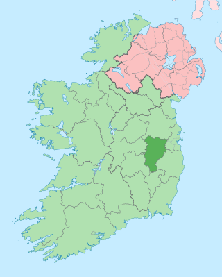
<span class="mw-page-title-main">County Kildare</span> County in Ireland

County Kildare is a county in Ireland. It is in the province of Leinster and is part of the Eastern and Midland Region. It is named after the town of Kildare. Kildare County Council is the local authority for the county, which had a population of 246,977 at the 2022 census.

<span class="mw-page-title-main">Kildare</span> Town in County Kildare, Ireland

Kildare is a town in County Kildare, Ireland. As of 2022, its population was 10,302, making it the 7th largest town in County Kildare. It is home to Kildare Cathedral, historically the site of an important abbey said to have been founded by Saint Brigid of Kildare in the 5th century. The Curragh lies east of the town.
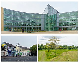
<span class="mw-page-title-main">Blanchardstown</span> Large western suburb of Dublin, Ireland

Blanchardstown is a large outer suburb of Dublin in the modern county of Fingal, Ireland. Located ten kilometres (6 mi) northwest of Dublin city centre, it has developed since the 1960s from a small village to a point where Greater Blanchardstown is the largest urban area in Fingal.
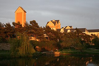
<span class="mw-page-title-main">Naas</span> County town of Kildare, Ireland

Naas is the county town of County Kildare in Ireland. In 2022, it had a population of 26,180, making it the largest town in County Kildare and the fourteenth-largest urban centre in Ireland.
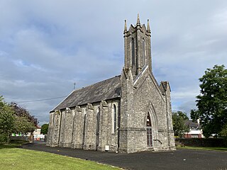
<span class="mw-page-title-main">Newbridge, County Kildare</span> Town in County Kildare, Ireland

Newbridge, officially known by its Irish name Droichead Nua, is a town in County Kildare, Ireland. While the nearby Great Connell Priory was founded in the 13th century, the town itself formed from the 18th century onwards, and grew rapidly alongside a military barracks which opened in the early 19th century. Taking on the name Newbridge in the 20th century, the town expanded to support the local catchment, and also as a commuter town for Dublin. Doubling in population during the 20 years between 1991 and 2011, its population of 24,366 in 2022 makes it the second largest town in Kildare and the sixteenth-largest in Ireland.

Castleknock is an affluent suburb located 8 km (5 mi) west of the centre of Dublin city, Ireland. It is centred on the village of the same name in Fingal.

<span class="mw-page-title-main">Clara, County Offaly</span> Town in County Offaly, Ireland

Clara is a town on the River Brosna in County Offaly, Ireland. It is the 10th largest town in the midlands of Ireland. The town had a population of 3,403 as of the 2022 census.

<span class="mw-page-title-main">Sallins</span> Town in County Kildare, Ireland

Sallins is a town in County Kildare, Ireland, situated 3.5 km north of the town centre of Naas, from which it is separated by the M7 motorway. Sallins is the anglicised name of Na Solláin which means "the willows".

<span class="mw-page-title-main">Straffan</span> Village in County Kildare, Ireland

Straffan is a village in County Kildare, Ireland, situated on the banks of the River Liffey, 25 km upstream of the Irish capital Dublin. As of the 2016 census, the village had a population of 853, a nearly two-fold increase since the 2006 census.

<span class="mw-page-title-main">Kildare GAA</span> County board of the Gaelic Athletic Association in Ireland

The Kildare County Board of the Gaelic Athletic Association (GAA), or Kildare GAA, is one of 12 county boards governed by the Leinster provincial council of the GAA in Ireland, and is responsible for the administration of Gaelic games in County Kildare.

<span class="mw-page-title-main">Ballymore Eustace</span> Town in County Kildare, Leinster, Ireland

Ballymore Eustace is a small town situated in County Kildare in Ireland, although until 1836 it lay within an exclave of County Dublin. It lies close to the border with County Wicklow. The town is in a civil parish of the same name.

County Kildare in the province of Leinster, Ireland, was first defined as a diocese in 1111, shired in 1297 and assumed its present borders in 1836. Its location in the Liffey basin on the main routes from Dublin to the south and west meant it was a valuable possession and important theatre of events throughout Irish history.

<span class="mw-page-title-main">Kilcullen</span> Town in County Kildare, Ireland

Kilcullen, formally Kilcullen Bridge, is a small town on the River Liffey in County Kildare, Ireland. Its population of 3,815 at the 2022 census made it the 13th largest settlement in County Kildare. From 2002 to 2011, it was one of the fastest growing towns in the county, doubling its population from 1,483 to 3,473. It is situated primarily in the Barony of Kilcullen, with a part in the Barony of Naas South, and subsidiary areas include Logstown, Harristown, Carnalway and Brannockstown, Gilltown, Nicholastown, and Castlemartin.

<span class="mw-page-title-main">Caragh</span> Village in County Kildare, Ireland

Caragh or Carragh is a village in County Kildare, Ireland. It is located on the R409 regional road between the River Liffey and the Grand Canal and is located 6.1 km north-west of Naas. The village is also 7.9 km from Clane and 10.6 km from Newbridge.

<span class="mw-page-title-main">Croghan, County Offaly</span> Village in County Offaly, Ireland

Croghan is a village in County Offaly in Ireland. It is situated near Croghan Hill, on an "island" of high ground surrounded by an expanse of raised bog which forms part of the Bog of Allen. The village is in a townland and civil parish of the same name.

Turnings is a townland in County Kildare, Ireland. It is situated on the banks of the Morell River, a tributary of the River Liffey. It is a rural area between Clane and Straffan.

<span class="mw-page-title-main">Leixlip</span> Town in County Kildare, Ireland

Leixlip is a town in north-east County Kildare, Ireland. Its location on the confluence of the River Liffey and the Rye Water has marked it as a frontier town historically: on the border between the ancient kingdoms of Leinster and Brega, as an outpost of The Pale, and on Kildare's border with County Dublin. Leixlip was also a civil parish in the ancient barony of Salt North.
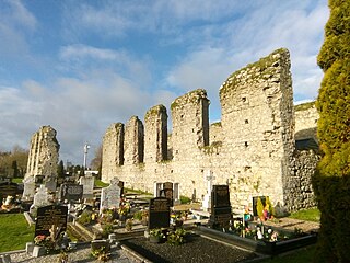
<span class="mw-page-title-main">Clane Friary</span> Friary in Clane, Ireland

Clane Friary, also called Clane Abbey, is a former friary of the Order of Friars Minor Conventual located in Clane, Ireland.

References

  1. 1 2 3 "Census 2022 - F1015 Population". Central Statistics Office Census 2022 Reports. Central Statistics Office Ireland. August 2023. Retrieved 16 September 2023.
  2. "Claonadh/Clane". logainm.ie. Placenames Database of Ireland. Retrieved 5 October 2021.
  3. Details of the Clane Townland, Civil Parish, Barony and Electoral Division
  4. "Seamus Cullen's Personal Web Site". seamuscullen.net. Retrieved 29 November 2016.
  5. "Shop.osi.ie Mapviewer". Archived from the original on 29 August 2012. Retrieved 3 January 2016.
  6. "Liffeyside Nature Park". www.clanecommunity.ie. Clane Community Council. Retrieved 18 April 2020.
  7. "Clane scheme could tempt Dublin commuters". Irish Independent. June 2019. Retrieved 21 September 2023.
  8. "Sapmap Area – Settlements – Clane". Census 2016. CSO. 2016. Retrieved 12 January 2018.
  9. 1 2 "AREA PROFILE FOR TOWN CLANE CO. KILDARE" (PDF).
  10. "120 - Edenderry - Prosperous - Clane - Celbridge - Dublin". www.goaheadireland.ie. Retrieved 19 July 2023.
  11. "Route 139 Naas to Blanchardstown". Transport for Ireland. 22 July 2023. Retrieved 19 July 2023.
  12. "Clane Rugby FC". www.pitchero.com. Retrieved 23 November 2016.
  13. "Scoil Bhríde Girls National School".
  14. "Scoil Phádraig Boys National School".
  15. "Mass Times for Clane, Church of St. Patrick and St. Brigid. Parish of Clane & Rathcoffey, Diocese of Kildare and Leighlin". www.claneparish.com. Retrieved 23 November 2016.
  16. Dungan, Thomas P. John Dongan of Dublin: An Elizabethan Gentleman and His Family, Baltimore, GPC, 1996, esp. pp. 116–123, with mult. ref.
  17. "5 pieces of career advice we learned from Charles Handy". thejournal.ie. Journal Media. 22 May 2012. Retrieved 18 April 2020.
  18. "Who the hell are?". irishtimes.com. Irish Times. 2 June 2006. Retrieved 18 April 2020. Dublin-born Graham Hopkins was brought up in Clane, Co Kildare
  19. "Tenor Josef Locke dies at 82". irishtimes.com. Irish Times. 16 October 1999. Retrieved 18 April 2020. Josef Locke, the Derry-born tenor, died [..] in Clane, Co Kildare, near where he lived in retirement
  20. "Rob Smith". Twitter . 2022. Retrieved 8 June 2022.
  21. "Mark Walsh". Horse Racing Ireland. Retrieved 7 March 2017.
  22. "Rolling Stones arrive in Ireland before Croke Park concert". irishtimes.com. Irish Times. 14 May 2018. Retrieved 18 April 2020. Ronnie Wood owns Sandymount House near Clane in Co Kildare